TopoQuest Logo
Do you find TopoQuest useful?
Help keep TopoQuest running and adding new maps/features by donating!
Bitcoin:  19c7KJd3qBynnjoSw5npx9KScwjBe4ifkT
Litecoin:  LXs6TkuXGGXo1vDsWCkWVdjQX94eUKd6ui
Home View Maps Find Maps Find Places Resources & Links


Wheatfield, Indiana Topographic Map

USGS Map Title: Wheatfield, IN
USGS Map MRC: 41087B1
DRG (GeoTIFF) Download: o41087b1.tif


Neighboring USGS Topographic Map Quads:


  Hebron, IN  
41087C2
 

  Kouts, IN  
41087C1
 

  La Crosse, IN  
41086C8
 

  DeMotte, IN  
41087B2
 

  Wheatfield, IN  
41087B1
 

  San Pierre, IN  
41086B8
 

  Parr, IN  
41087A2
 

  Gifford, IN  
41087A1
 

  Medaryville, IN  
41086A8


Map MRC Location:

N42°
W88°
N42°
W87°
H8 H7 H6 H5 H4 H3 H2 H1
G8 G7 G6 G5 G4 G3 G2 G1
F8 F7 F6 F5 F4 F3 F2 F1
E8 E7 E6 E5 E4 E3 E2 E1
D8 D7 D6 D5 D4 D3 D2 D1
C8 C7 C6 C5 C4 C3 C2 C1
B8 B7 B6 B5 B4 B3 B2 B1
A8 A7 A6 A5 A4 A3 A2 A1
N41°
W88°
N41°
W87°

Wheatfield, IN USGS 1:24K Topographic Map Preview:
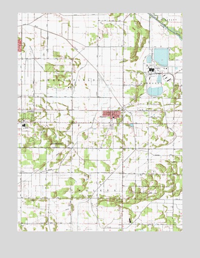
Wheatfield, IN USGS Topographic Map
Click on map above to begin viewing in our Map Viewer.

This topographic map contains these locations and features:
Feature Name Type Latitude Longitude GNIS ID View Map
Calvary Evangelical Free ChurchChurchN41.1945°W87.0459°450100View Map
Davis DitchCanalN41.2136°W87.0250°449817View Map
Delehanty DitchStreamN41.2425°W87.1214°449818View Map
Fisher DitchCanalN41.1875°W87.0120°449819View Map
Heilsher DitchCanalN41.1600°W87.1017°450434View Map
Hickam LateralCanalN41.1853°W87.0684°449820View Map
James DitchCanalN41.2489°W87.0722°449821View Map
Kniman CemeteryCemeteryN41.1437°W87.1119°449822View Map
Marble DitchCanalN41.2139°W87.0761°449824View Map
Myers DitchCanalN41.2270°W87.1020°449825View Map
Schlatzley DitchCanalN41.2214°W87.1167°449830View Map
Schrader DitchCanalN41.1686°W87.0181°449827View Map
StoutsburgPopulated PlaceN41.1914°W87.1139°449829View Map
Town of WheatfieldCivilN41.1911°W87.0526°2397738View Map
Township of WalkerCivilN41.1344°W87.0547°453968View Map
Township of WheatfieldCivilN41.2256°W87.1042°454050View Map
WheatfieldPopulated PlaceN41.1931°W87.0556°445877View Map
Wheatfield Ambulance ServiceBuildingN41.1933°W87.0458°2719304View Map
Wheatfield Fire DepartmentBuildingN41.1921°W87.0545°2625844View Map
Wheatfield Police DepartmentBuildingN41.1911°W87.0522°2758245View Map

Note: Coordinates in the location and feature list above are referenced to NAD83 datum.


Copyright (C) 2008-2025 Ryan Niemi / Sunset Dynamics ... All Rights Reserved