TopoQuest Logo
Do you find TopoQuest useful?
Help keep TopoQuest running and adding new maps/features by donating!
Bitcoin:  19c7KJd3qBynnjoSw5npx9KScwjBe4ifkT
Litecoin:  LXs6TkuXGGXo1vDsWCkWVdjQX94eUKd6ui
Home View Maps Find Maps Find Places Resources & Links


Cannibal Island, California Topographic Map

USGS Map Title: Cannibal Island, CA
USGS Map MRC: 40124F3
DRG (GeoTIFF) Download: o40124f3.tif


Neighboring USGS Topographic Map Quads:


  Eureka, CA  
40124G2


  Cannibal Island, CA  
40124F3
 

  Fields Landing, CA  
40124F2


  Ferndale, CA  
40124E3
 

  Fortuna, CA  
40124E2


Map MRC Location:

N41°
W125°
N41°
W124°
H8 H7 H6 H5 H4 H3 H2 H1
G8 G7 G6 G5 G4 G3 G2 G1
F8 F7 F6 F5 F4 F3 F2 F1
E8 E7 E6 E5 E4 E3 E2 E1
D8 D7 D6 D5 D4 D3 D2 D1
C8 C7 C6 C5 C4 C3 C2 C1
B8 B7 B6 B5 B4 B3 B2 B1
A8 A7 A6 A5 A4 A3 A2 A1
N40°
W125°
N40°
W124°

Cannibal Island, CA USGS 1:24K Topographic Map Preview:
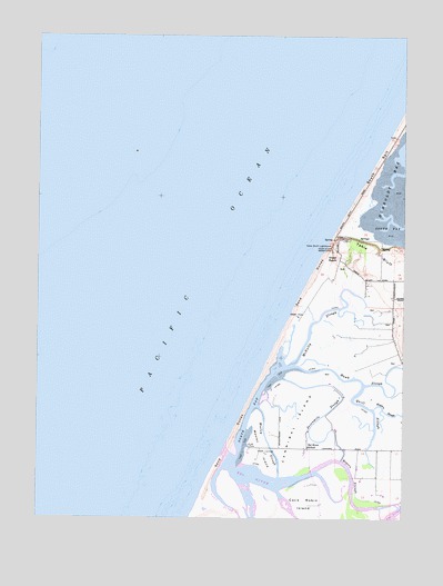
Cannibal Island, CA USGS Topographic Map
Click on map above to begin viewing in our Map Viewer.

This topographic map contains these locations and features:
Feature Name Type Latitude Longitude GNIS ID View Map
Camp Weott (historical)LocaleN40.6276°W124.3034°1665529View Map
Cannibal IslandIslandN40.6496°W124.2873°220543View Map
Clark School (historical)SchoolN40.6871°W124.2548°1665532View Map
Cock Robin IslandIslandN40.6268°W124.2834°221288View Map
Crab ParkParkN40.6432°W124.3048°221777View Map
Eel RiverStreamN40.6415°W124.3123°251974View Map
Eel River SchoolSchoolN40.6432°W124.2837°222996View Map
Hawk SloughGutN40.6590°W124.2578°225033View Map
Heckman Island (historical)IslandN40.6329°W124.3051°1665231View Map
Hogpen SloughGutN40.6523°W124.2523°225430View Map
McNulty SloughGutN40.6746°W124.2831°228443View Map
Mosley IslandIslandN40.6432°W124.2998°229106View Map
Mosley SloughGutN40.6448°W124.2976°229107View Map
North BayBayN40.6510°W124.3042°229600View Map
Ocean RanchLocaleN40.6923°W124.2737°229924View Map
Quill SloughGutN40.6529°W124.2612°231141View Map
Ropers SloughGutN40.6362°W124.2687°231875View Map
Salt RiverStreamN40.6379°W124.3131°232330View Map
Sevenmile SloughGutN40.6521°W124.2770°232826View Map
Table Bluff County ParkParkN40.6971°W124.2726°1702467View Map
Table Bluff LighthouseLocaleN40.6951°W124.2756°235953View Map
Table Bluff ReservationCivilN40.6907°W124.2522°1665550View Map

Note: Coordinates in the location and feature list above are referenced to NAD83 datum.


Copyright (C) 2008-2025 Ryan Niemi / Sunset Dynamics ... All Rights Reserved