TopoQuest Logo
Do you find TopoQuest useful?
Help keep TopoQuest running and adding new maps/features by donating!
Bitcoin:  19c7KJd3qBynnjoSw5npx9KScwjBe4ifkT
Litecoin:  LXs6TkuXGGXo1vDsWCkWVdjQX94eUKd6ui
Home View Maps Find Maps Find Places Resources & Links


Live Oak Ranch, Texas Topographic Map

USGS Map Title: Live Oak Ranch, TX
USGS Map MRC: 30099B5
DRG (GeoTIFF) Download: o30099b5.tif


Neighboring USGS Topographic Map Quads:


  Allen Creek, TX  
30099C6
 

  Mudge Draw, TX  
30099C5
 

  Old Noxville, TX  
30099C4
 

  Y O Ranch, TX  
30099B6
 

  Live Oak Ranch, TX  
30099B5
 

  Contrary Creek, TX  
30099B4
 

  Garven Store, TX  
30099A6
 

  Boneyard Draw, TX  
30099A5
 

  Bee Caves Creek, TX  
30099A4


Map MRC Location:

N31°
W100°
N31°
W99°
H8 H7 H6 H5 H4 H3 H2 H1
G8 G7 G6 G5 G4 G3 G2 G1
F8 F7 F6 F5 F4 F3 F2 F1
E8 E7 E6 E5 E4 E3 E2 E1
D8 D7 D6 D5 D4 D3 D2 D1
C8 C7 C6 C5 C4 C3 C2 C1
B8 B7 B6 B5 B4 B3 B2 B1
A8 A7 A6 A5 A4 A3 A2 A1
N30°
W100°
N30°
W99°

Live Oak Ranch, TX USGS 1:24K Topographic Map Preview:
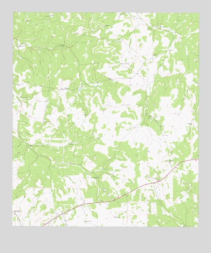
Live Oak Ranch, TX USGS Topographic Map
Click on map above to begin viewing in our Map Viewer.

This topographic map contains these locations and features:
Feature Name Type Latitude Longitude GNIS ID View Map
Audrey WindmillLocaleN30.2202°W99.5517°1329837View Map
Big South WindmillLocaleN30.2480°W99.5995°1330653View Map
Black Bull RanchLocaleN30.1535°W99.5678°1330736View Map
Charley WindmillLocaleN30.1958°W99.5509°1332689View Map
Four Section WindmillLocaleN30.1894°W99.5334°1336106View Map
Game Warden WindmillLocaleN30.1335°W99.6226°1336361View Map
Goat Shed WindmillLocaleN30.1902°W99.5767°1336617View Map
Hog WindmillLocaleN30.2305°W99.5906°1337910View Map
Hyatt WindmillLocaleN30.2299°W99.6214°1338341View Map
Little South WindmillLocaleN30.2455°W99.6173°1340194View Map
Live Oak RanchLocaleN30.2255°W99.5314°1340260View Map
New Double WellsWellN30.2052°W99.5914°1342449View Map
New WellWellN30.2110°W99.5587°1342517View Map
New WindmillLocaleN30.1280°W99.5756°1342534View Map
North WindmillLocaleN30.1305°W99.5556°1342835View Map
Ponda Rosa RanchLocaleN30.1641°W99.5206°1344344View Map
Red WindmillLocaleN30.2402°W99.5320°1344966View Map
Rock Springs WindmillLocaleN30.1733°W99.5862°1345406View Map
Steel Pens WindmillLocaleN30.1858°W99.6045°1347849View Map
Turkey WindmillLocaleN30.2202°W99.5717°1348896View Map
West WindmillLocaleN30.2421°W99.5637°1349832View Map
White Point WindmillLocaleN30.2002°W99.6206°1349977View Map
Wolf Proof RanchLocaleN30.1855°W99.5039°1350484View Map

Note: Coordinates in the location and feature list above are referenced to NAD83 datum.


Copyright (C) 2008-2025 Ryan Niemi / Sunset Dynamics ... All Rights Reserved