TopoQuest Logo
Do you find TopoQuest useful?
Help keep TopoQuest running and adding new maps/features by donating!
Bitcoin:  19c7KJd3qBynnjoSw5npx9KScwjBe4ifkT
Litecoin:  LXs6TkuXGGXo1vDsWCkWVdjQX94eUKd6ui
Home View Maps Find Maps Find Places Resources & Links


Lodge Pole NW, Montana Topographic Map

USGS Map Title: Lodge Pole NW, MT
USGS Map MRC: 48108B6
DRG (GeoTIFF) Download: o48108b6.tif


Neighboring USGS Topographic Map Quads:


  Fort Belknap Agency SE, MT  
48108C7
 

  Wild Horse Butte, MT  
48108C6
 

  Bigby Lake, MT  
48108C5
 

  Lake Seventeen NE, MT  
48108B7
 

  Lodge Pole NW, MT  
48108B6
 

  Lodge Pole NE, MT  
48108B5
 

  Lake Seventeen East, MT  
48108A7
 

  Stiffarm Coulee, MT  
48108A6
 

  Lodge Pole, MT  
48108A5


Map MRC Location:

N49°
W109°
N49°
W108°
H8 H7 H6 H5 H4 H3 H2 H1
G8 G7 G6 G5 G4 G3 G2 G1
F8 F7 F6 F5 F4 F3 F2 F1
E8 E7 E6 E5 E4 E3 E2 E1
D8 D7 D6 D5 D4 D3 D2 D1
C8 C7 C6 C5 C4 C3 C2 C1
B8 B7 B6 B5 B4 B3 B2 B1
A8 A7 A6 A5 A4 A3 A2 A1
N48°
W109°
N48°
W108°

Lodge Pole NW, MT USGS 1:24K Topographic Map Preview:
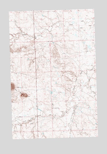
Lodge Pole NW, MT USGS Topographic Map
Click on map above to begin viewing in our Map Viewer.

This topographic map contains these locations and features:
Feature Name Type Latitude Longitude GNIS ID View Map
28N23E23BAA_01 WellWellN48.1747°W108.7252°1633846View Map
28N23E25ADDA01 WellWellN48.1547°W108.6929°826802View Map
28N23E27ADD_01 WellWellN48.1542°W108.7363°826800View Map
28N23E27ADDC01 WellWellN48.1542°W108.7363°826801View Map
28N23E34AAAC01 WellWellN48.1455°W108.7363°826705View Map
28N23E34AAD_01 WellWellN48.1433°W108.7396°826662View Map
28N23E34AAD_02 WellWellN48.1430°W108.7396°826660View Map
28N23E36BAB_01 WellWellN48.1455°W108.7065°826704View Map
28N24E29DBAB01 WellWellN48.1530°W108.6571°826785View Map
28N24E30BBCD01 WellWellN48.1583°W108.6899°826832View Map
28N24E32CCAA01 WellWellN48.1353°W108.6665°826584View Map
29N23E25DBD_01 WellWellN48.2383°W108.6777°1634338View Map
29N23E25DBD_02 WellWellN48.2386°W108.6774°1634345View Map
29N23E34DDCB01 WellWellN48.2211°W108.7185°1634226View Map
Fort Belknap DivisionCivilN48.1994°W108.7060°1940616View Map
Fort Belknap Number 34 DamDamN48.1700°W108.6924°798032View Map
Fort Belknap Number 35 DamDamN48.1533°W108.7090°798039View Map
Fort Belknap ReservationCivilN48.1995°W108.6270°767938View Map
Jim Brown CreekStreamN48.1625°W108.6607°772821View Map
Lodge Pole CreekStreamN48.1869°W108.6407°773541View Map
Three ButtesRangeN48.1761°W108.7499°777599View Map

Note: Coordinates in the location and feature list above are referenced to NAD83 datum.


Copyright (C) 2008-2024 Ryan Niemi / Sunset Dynamics ... All Rights Reserved