TopoQuest Logo
Do you find TopoQuest useful?
Help keep TopoQuest running and adding new maps/features by donating!
Bitcoin:  19c7KJd3qBynnjoSw5npx9KScwjBe4ifkT
Litecoin:  LXs6TkuXGGXo1vDsWCkWVdjQX94eUKd6ui
Home View Maps Find Maps Find Places Resources & Links


Manor, Georgia Topographic Map

USGS Map Title: Manor, GA
USGS Map MRC: 31082A5
DRG (GeoTIFF) Download: o31082a5.tif


Neighboring USGS Topographic Map Quads:


  Cogdell, GA  
31082B6
 

  Pine Valley, GA  
31082B5
 

  Waycross West, GA  
31082B4
 

  Homerville East, GA  
31082A6
 

  Manor, GA  
31082A5
 

  Waycross SW, GA  
31082A4
 

  Midway, GA  
30082H6
 

  Spooner, GA  
30082H5
 

  Cravens Island, GA  
30082H4


Map MRC Location:

N32°
W83°
N32°
W82°
H8 H7 H6 H5 H4 H3 H2 H1
G8 G7 G6 G5 G4 G3 G2 G1
F8 F7 F6 F5 F4 F3 F2 F1
E8 E7 E6 E5 E4 E3 E2 E1
D8 D7 D6 D5 D4 D3 D2 D1
C8 C7 C6 C5 C4 C3 C2 C1
B8 B7 B6 B5 B4 B3 B2 B1
A8 A7 A6 A5 A4 A3 A2 A1
N31°
W83°
N31°
W82°

Manor, GA USGS 1:24K Topographic Map Preview:
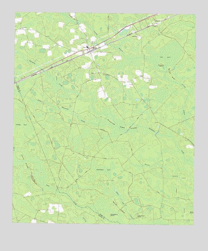
Manor, GA USGS Topographic Map
Click on map above to begin viewing in our Map Viewer.

This topographic map contains these locations and features:
Feature Name Type Latitude Longitude GNIS ID View Map
Big BaySwampN31.0994°W82.5210°311293View Map
Big Bay IslandIslandN31.0891°W82.5171°311297View Map
Booth ChurchChurchN31.0891°W82.5699°311656View Map
Cane Creek IslandsIslandN31.0299°W82.6162°312290View Map
GlenmorePopulated PlaceN31.1238°W82.5299°331817View Map
Hendrix BaySwampN31.0318°W82.5636°315329View Map
Horseshoe IslandIslandN31.0955°W82.5237°315725View Map
Huckleberry IslandIslandN31.0047°W82.5576°315782View Map
Little Scrub IslandIslandN31.0041°W82.5396°317194View Map
Little Suwannee CreekStreamN31.0580°W82.5532°317213View Map
ManorPopulated PlaceN31.1038°W82.5732°317665View Map
Manor ChapelChurchN31.0969°W82.5707°357690View Map
Manor ChurchChurchN31.1041°W82.5740°357691View Map
Manor SchoolSchoolN31.1049°W82.5746°357692View Map
Martha BranchStreamN31.1010°W82.6224°317727View Map
Mount Olive ChurchChurchN31.0885°W82.5601°318727View Map
Otter BaySwampN31.0585°W82.6185°320112View Map
Pine Grove ChurchChurchN31.1183°W82.5282°320562View Map
Providence ChurchChurchN31.1152°W82.6196°321187View Map
Sand HillPopulated PlaceN31.1113°W82.5393°332966View Map
Scrub IslandIslandN31.0110°W82.5512°322664View Map
Suwannee Creek IslandsIslandN31.0613°W82.5474°323792View Map
Victory Methodist ChurchChurchN31.0891°W82.5700°2502158View Map
Ware County Fire Rescue Station 2 ManorBuildingN31.1060°W82.5740°2604784View Map

Note: Coordinates in the location and feature list above are referenced to NAD83 datum.


Copyright (C) 2008-2024 Ryan Niemi / Sunset Dynamics ... All Rights Reserved