TopoQuest Logo
Do you find TopoQuest useful?
Help keep TopoQuest running and adding new maps/features by donating!
Bitcoin:  19c7KJd3qBynnjoSw5npx9KScwjBe4ifkT
Litecoin:  LXs6TkuXGGXo1vDsWCkWVdjQX94eUKd6ui
Home View Maps Find Maps Find Places Resources & Links


Canon Agua Buena, New Mexico Topographic Map

USGS Map Title: Canon Agua Buena, NM
USGS Map MRC: 33106H6
DRG (GeoTIFF) Download: o33106h6.tif


Neighboring USGS Topographic Map Quads:


  Loma De Las Canas, NM  
34106A7
 

  Bustos Well, NM  
34106A6
 

  Sierra Larga South, NM  
34106A5
 

  San Antonio, NM  
33106H7
 

  Canon Agua Buena, NM  
33106H6
 

  Prairie Spring, NM  
33106H5
 

  San Antonio SE, NM  
33106G7
 

  Cerro De La Campana, NM  
33106G6
 

  Cerro De La Campana SE, NM  
33106G5


Map MRC Location:

N34°
W107°
N34°
W106°
H8 H7 H6 H5 H4 H3 H2 H1
G8 G7 G6 G5 G4 G3 G2 G1
F8 F7 F6 F5 F4 F3 F2 F1
E8 E7 E6 E5 E4 E3 E2 E1
D8 D7 D6 D5 D4 D3 D2 D1
C8 C7 C6 C5 C4 C3 C2 C1
B8 B7 B6 B5 B4 B3 B2 B1
A8 A7 A6 A5 A4 A3 A2 A1
N33°
W107°
N33°
W106°

Canon Agua Buena, NM USGS 1:24K Topographic Map Preview:
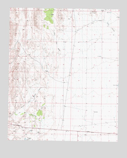
Canon Agua Buena, NM USGS Topographic Map
Click on map above to begin viewing in our Map Viewer.

This topographic map contains these locations and features:
Feature Name Type Latitude Longitude GNIS ID View Map
10040 Water WellWellN33.9406°W106.7061°925726View Map
10049 Water WellWellN33.8806°W106.6642°925507View Map
Anaya Water WellWellN33.9176°W106.7209°925512View Map
Araya WellLocaleN33.9170°W106.7206°885866View Map
Blackington HillsRangeN33.9965°W106.6525°901000View Map
Caņon Agua BuenaValleyN33.9015°W106.7353°901031View Map
CarthagePopulated PlaceN33.8834°W106.6595°938809View Map
Carthage CemeteryCemeteryN33.8842°W106.7258°900528View Map
Carthage Post Office (historical)Post OfficeN33.8767°W106.7297°937989View Map
CC TankReservoirN33.9554°W106.6461°898344View Map
Cerro del ViboroSummitN33.9162°W106.7417°915955View Map
Del Curto RanchLocaleN33.9981°W106.6433°900527View Map
Fernandez RanchLocaleN33.9056°W106.7122°889007View Map
Gonzales WellLocaleN33.9412°W106.7064°889488View Map
Hart Coal MineMineN33.8820°W106.7139°915746View Map
Hart MineMineN33.8820°W106.7136°902258View Map
Law MineMineN33.9920°W106.6264°900463View Map
Muncy RanchLocaleN33.8806°W106.6608°892339View Map
Old CarthagePopulated PlaceN33.8767°W106.7275°896886View Map
Padilla RanchLocaleN33.8928°W106.7159°893007View Map
Ranchito WindmillLocaleN33.9945°W106.7028°898455View Map
Taylor TankReservoirN33.9965°W106.6264°900385View Map
Triple A TankReservoirN33.9282°W106.6265°901030View Map

Note: Coordinates in the location and feature list above are referenced to NAD83 datum.


Copyright (C) 2008-2025 Ryan Niemi / Sunset Dynamics ... All Rights Reserved