TopoQuest Logo
Do you find TopoQuest useful?
Help keep TopoQuest running and adding new maps/features by donating!
Bitcoin:  19c7KJd3qBynnjoSw5npx9KScwjBe4ifkT
Litecoin:  LXs6TkuXGGXo1vDsWCkWVdjQX94eUKd6ui
Home View Maps Find Maps Find Places Resources & Links


McMurray, Washington Topographic Map

USGS Map Title: McMurray, WA
USGS Map MRC: 48122C2
DRG (GeoTIFF) Download: o48122c2.tif


Neighboring USGS Topographic Map Quads:


  Mount Vernon, WA  
48122D3
 

  Sedro-Woolley South, WA  
48122D2
 

  Haystack Mountain, WA  
48122D1
 

  Conway, WA  
48122C3
 

  McMurray, WA  
48122C2
 

  Stimson Hill, WA  
48122C1
 

  Stanwood, WA  
48122B3
 

  Arlington West, WA  
48122B2
 

  Arlington East, WA  
48122B1


Map MRC Location:

N49°
W123°
N49°
W122°
H8 H7 H6 H5 H4 H3 H2 H1
G8 G7 G6 G5 G4 G3 G2 G1
F8 F7 F6 F5 F4 F3 F2 F1
E8 E7 E6 E5 E4 E3 E2 E1
D8 D7 D6 D5 D4 D3 D2 D1
C8 C7 C6 C5 C4 C3 C2 C1
B8 B7 B6 B5 B4 B3 B2 B1
A8 A7 A6 A5 A4 A3 A2 A1
N48°
W123°
N48°
W122°

McMurray, WA USGS 1:24K Topographic Map Preview:
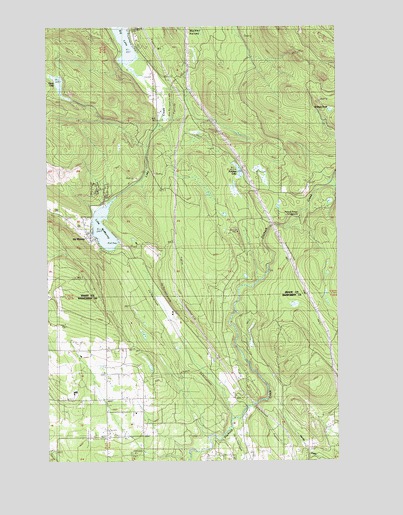
McMurray, WA USGS Topographic Map
Click on map above to begin viewing in our Map Viewer.

This topographic map contains these locations and features:
Feature Name Type Latitude Longitude GNIS ID View Map
Crane CreekStreamN48.3287°W122.1268°1518278View Map
Devils LakeLakeN48.3591°W122.2464°1504460View Map
EhrlichLocaleN48.3540°W122.2332°1514698View Map
Lake CreekStreamN48.3643°W122.2163°1533275View Map
Lake McMurrayLakeN48.3166°W122.2268°1513164View Map
Lake McMurrayPopulated PlaceN48.3142°W122.2319°2413639View Map
Lake McMurray Census Designated PlaceCensusN48.3128°W122.2316°2408543View Map
McMurrayPopulated PlaceN48.3162°W122.2354°1512445View Map
PilchuckPopulated PlaceN48.2659°W122.1663°1512825View Map
Pilchuck Bridge CampgroundLocaleN48.3204°W122.1424°1510522View Map
Pilchuck Creek BridgeBridgeN48.2652°W122.1654°2607969View Map
Rainbow Bridge FarmLocaleN48.2725°W122.2114°2706113View Map
S and S FarmsLocaleN48.2636°W122.2133°2706085View Map
Seabury PondLakeN48.3507°W122.1289°1510524View Map
Skagit County Fire District 15 Lake McMurray Fire DepartmentBuildingN48.3150°W122.2341°2643611View Map
Skagit County Fire District 9 Big Lake Fire Department Station 2 EhrlichBuildingN48.3626°W122.2050°2643594View Map
Summer LakeLakeN48.3332°W122.1682°1510523View Map

Note: Coordinates in the location and feature list above are referenced to NAD83 datum.


Copyright (C) 2008-2025 Ryan Niemi / Sunset Dynamics ... All Rights Reserved