TopoQuest Logo
Do you find TopoQuest useful?
Help keep TopoQuest running and adding new maps/features by donating!
Bitcoin:  19c7KJd3qBynnjoSw5npx9KScwjBe4ifkT
Litecoin:  LXs6TkuXGGXo1vDsWCkWVdjQX94eUKd6ui
Home View Maps Find Maps Find Places Resources & Links


Conway, Washington Topographic Map

USGS Map Title: Conway, WA
USGS Map MRC: 48122C3
DRG (GeoTIFF) Download: o48122c3.tif


Neighboring USGS Topographic Map Quads:


  La Conner, WA  
48122D4
 

  Mount Vernon, WA  
48122D3
 

  Sedro-Woolley South, WA  
48122D2
 

  Utsalady, WA  
48122C4
 

  Conway, WA  
48122C3
 

  McMurray, WA  
48122C2
 

  Juniper Beach, WA  
48122B4
 

  Stanwood, WA  
48122B3
 

  Arlington West, WA  
48122B2


Map MRC Location:

N49°
W123°
N49°
W122°
H8 H7 H6 H5 H4 H3 H2 H1
G8 G7 G6 G5 G4 G3 G2 G1
F8 F7 F6 F5 F4 F3 F2 F1
E8 E7 E6 E5 E4 E3 E2 E1
D8 D7 D6 D5 D4 D3 D2 D1
C8 C7 C6 C5 C4 C3 C2 C1
B8 B7 B6 B5 B4 B3 B2 B1
A8 A7 A6 A5 A4 A3 A2 A1
N48°
W123°
N48°
W122°

Conway, WA USGS 1:24K Topographic Map Preview:
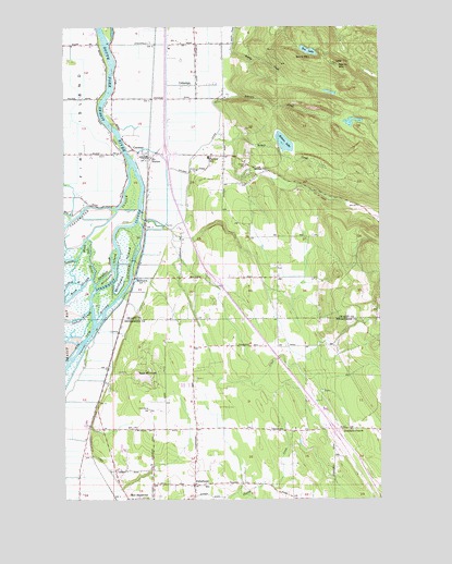
Conway, WA USGS Topographic Map
Click on map above to begin viewing in our Map Viewer.

This topographic map contains these locations and features:
Feature Name Type Latitude Longitude GNIS ID View Map
Aqua FarmLocaleN48.2669°W122.3269°2706104View Map
Barker AirportAirportN48.3748°W122.3388°1513976View Map
Boom SloughStreamN48.3026°W122.3743°1503478View Map
Brandstedt SloughStreamN48.3068°W122.3632°1503531View Map
Bulson CreekStreamN48.3462°W122.3157°1503638View Map
CedardalePopulated PlaceN48.3593°W122.3238°1510863View Map
CedarhomeLocaleN48.2537°W122.3249°1503884View Map
Cedarhome Baptist ChurchChurchN48.2595°W122.3250°2609869View Map
Cedarhome Christian SchoolSchoolN48.2547°W122.3245°1515124View Map
Cedarhome Seventh Day Adventist ChurchChurchN48.2548°W122.3243°2608679View Map
ConwayPopulated PlaceN48.3404°W122.3429°1512112View Map
Conway Census Designated PlaceCensusN48.3357°W122.3444°2407654View Map
Conway DivisionCivilN48.3374°W122.3341°1939485View Map
Conway PitMineN48.3303°W122.2827°2605697View Map
Conway Post OfficePost OfficeN48.3402°W122.3432°2781677View Map
Conway SchoolSchoolN48.3404°W122.3188°1504110View Map
Courting Frogs NurseryBuildingN48.2922°W122.3344°2706106View Map
Devils MountainSummitN48.3651°W122.2682°1513098View Map
Erickson IslandIslandN48.3109°W122.3565°1504765View Map
Fir - Conway Lutheran ChurchChurchN48.3417°W122.3547°2608582View Map
Fir StationLocaleN48.3407°W122.3407°1504886View Map
Fisher CreekStreamN48.3209°W122.3335°1511888View Map
Folkertsma DairyLocaleN48.3397°W122.3656°2703822View Map
Freeborn ChurchChurchN48.2682°W122.2629°1505033View Map
Freedom CreekStreamN48.2518°W122.3082°1531552View Map
Haflinger Haven FarmLocaleN48.2806°W122.2556°2706109View Map
Happy Little FarmLocaleN48.3478°W122.3483°2703845View Map
Harvey Arabian FarmsLocaleN48.2667°W122.3386°2706110View Map
Hidden Meadow RanchLocaleN48.3717°W122.3058°2703843View Map
Hill DitchCanalN48.3457°W122.3163°1511905View Map
Isohis SloughStreamN48.2970°W122.3735°1505762View Map
JC's AirportAirportN48.3250°W122.3140°1534178View Map
Johnson CreekStreamN48.3562°W122.3146°1505841View Map
Lake KetchumLakeN48.2823°W122.3449°1505957View Map
Lake KetchumPopulated PlaceN48.2845°W122.3440°1852945View Map
Lake Ketchum Census Designated PlaceCensusN48.2820°W122.3480°2408539View Map
MilltownPopulated PlaceN48.3084°W122.3479°1511156View Map
Milltown IslandIslandN48.3118°W122.3521°1506718View Map
Morning Glory FarmsLocaleN48.2506°W122.2908°2706112View Map
North County Fire / Emergency Medical Services Station 96 FreebornBuildingN48.2684°W122.2771°2606771View Map
North StanwoodPopulated PlaceN48.2587°W122.3427°1852954View Map
North Stanwood Census Designated PlaceCensusN48.2598°W122.3468°2408949View Map
Northwest Stanwood Census Designated PlaceCensusN48.2624°W122.3501°2585015View Map
Old RiverStreamN48.3057°W122.3640°1507157View Map
River Bend DairyLocaleN48.3506°W122.3544°2703823View Map
Sandy CreekStreamN48.3701°W122.3099°1508107View Map
Scott MountainSummitN48.3662°W122.2807°1512647View Map
Sixteen LakeLakeN48.3442°W122.2888°1508374View Map
Skagit City CemeteryCemeteryN48.3455°W122.3574°2605503View Map
Skagit County Fire District 3 ConwayBuildingN48.3409°W122.3468°2643580View Map
Smith Morrison FarmsLocaleN48.3320°W122.3349°2605538View Map
South Fork Skagit RiverStreamN48.3387°W122.3490°1508543View Map
Steamboat SloughStreamN48.2959°W122.3643°1508708View Map
Sunset AirportAirportN48.2723°W122.3571°1533983View Map
Tazer Valley FarmLocaleN48.2667°W122.3336°2706121View Map
Ten LakeLakeN48.3685°W122.2791°1508938View Map
Tom Moore SloughStreamN48.2915°W122.3679°1509047View Map
Victoria Heights ReservoirReservoirN48.2980°W122.2519°1532691View Map
Victoria Heights Reservoir DamDamN48.2982°W122.2529°1532690View Map
Westheim FarmsLocaleN48.3614°W122.3533°2703826View Map

Note: Coordinates in the location and feature list above are referenced to NAD83 datum.


Copyright (C) 2008-2024 Ryan Niemi / Sunset Dynamics ... All Rights Reserved