TopoQuest Logo
Do you find TopoQuest useful?
Help keep TopoQuest running and adding new maps/features by donating!
Bitcoin:  19c7KJd3qBynnjoSw5npx9KScwjBe4ifkT
Litecoin:  LXs6TkuXGGXo1vDsWCkWVdjQX94eUKd6ui
Home View Maps Find Maps Find Places Resources & Links


Molson, Washington Topographic Map

USGS Map Title: Molson, WA
USGS Map MRC: 48119H2
DRG (GeoTIFF) Download: o48119h2.tif


Neighboring USGS Topographic Map Quads:


  Mount Hull, WA  
48119H3
 

  Molson, WA  
48119H2
 

  Chesaw, WA  
48119H1
 

  Burge Mountain, WA  
48119G3
 

  Havillah, WA  
48119G2
 

  Mount Bonaparte, WA  
48119G1


Map MRC Location:

N49°
W120°
N49°
W119°
H8 H7 H6 H5 H4 H3 H2 H1
G8 G7 G6 G5 G4 G3 G2 G1
F8 F7 F6 F5 F4 F3 F2 F1
E8 E7 E6 E5 E4 E3 E2 E1
D8 D7 D6 D5 D4 D3 D2 D1
C8 C7 C6 C5 C4 C3 C2 C1
B8 B7 B6 B5 B4 B3 B2 B1
A8 A7 A6 A5 A4 A3 A2 A1
N48°
W120°
N48°
W119°

Molson, WA USGS 1:24K Topographic Map Preview:
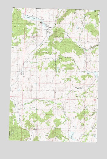
Molson, WA USGS Topographic Map
Click on map above to begin viewing in our Map Viewer.

This topographic map contains these locations and features:
Feature Name Type Latitude Longitude GNIS ID View Map
Alden LakeLakeN49.0000°W119.1348°1515779View Map
Baker LakeLakeN48.8807°W119.1281°1516054View Map
Block HillSummitN48.9960°W119.1625°1516606View Map
Dry CreekStreamN48.9077°W119.2414°1518945View Map
Fields LakeLakeN48.9399°W119.1295°1519511View Map
Haley CanyonValleyN48.8918°W119.2364°1520451View Map
Hee Hee MountainSummitN48.9177°W119.1567°1520672View Map
Hee Hee StonePillarN48.9249°W119.1595°1520673View Map
Kerwin LakeLakeN48.9827°W119.1575°1521632View Map
KiplingLocaleN48.9166°W119.2012°1529906View Map
Knobhill GrangeLocaleN48.8816°W119.1325°1521753View Map
Laura LakeLakeN48.9957°W119.1262°1521935View Map
Lindberg LakeLakeN48.9937°W119.1475°1522133View Map
MolsonPopulated PlaceN48.9810°W119.2006°1523307View Map
Molson HillSummitN48.9724°W119.1848°1523308View Map
Molson LakeLakeN48.9874°W119.2067°1523309View Map
Molson MuseumBuildingN48.9788°W119.2009°1529771View Map
Mud Lake ValleyValleyN48.9266°W119.2489°1523482View Map
Muskrat LakeLakeN48.8806°W119.1602°1523532View Map
Okanogan County Fire District 11 FieldsBuildingN48.9330°W119.1311°2643866View Map
Okanogan County Fire District 11 MolsonBuildingN48.9783°W119.2012°2643865View Map
Old Molson (historical)LocaleN48.9780°W119.2000°1529772View Map
Sanger LakeLakeN48.9407°W119.1402°1525433View Map
Sidley LakeLakeN48.9906°W119.2229°1525734View Map
Teal LakeLakeN48.9432°W119.1831°1526961View Map

Note: Coordinates in the location and feature list above are referenced to NAD83 datum.


Copyright (C) 2008-2025 Ryan Niemi / Sunset Dynamics ... All Rights Reserved