TopoQuest Logo
Do you find TopoQuest useful?
Help keep TopoQuest running and adding new maps/features by donating!
Bitcoin:  19c7KJd3qBynnjoSw5npx9KScwjBe4ifkT
Litecoin:  LXs6TkuXGGXo1vDsWCkWVdjQX94eUKd6ui
Home View Maps Find Maps Find Places Resources & Links


Morgan, Texas Topographic Map

USGS Map Title: Morgan, TX
USGS Map MRC: 32097A5
DRG (GeoTIFF) Download: o32097a5.tif


Neighboring USGS Topographic Map Quads:


  Glen Rose East, TX  
32097B6
 

  Brazos Point, TX  
32097B5
 

  Blum, TX  
32097B4
 

  Walnut Springs East, TX  
32097A6
 

  Morgan, TX  
32097A5
 

  Lakeside Village, TX  
32097A4
 

  Meridian, TX  
31097H6
 

  Pilot Knob, TX  
31097H5
 

  Allen Bend, TX  
31097H4


Map MRC Location:

N33°
W98°
N33°
W97°
H8 H7 H6 H5 H4 H3 H2 H1
G8 G7 G6 G5 G4 G3 G2 G1
F8 F7 F6 F5 F4 F3 F2 F1
E8 E7 E6 E5 E4 E3 E2 E1
D8 D7 D6 D5 D4 D3 D2 D1
C8 C7 C6 C5 C4 C3 C2 C1
B8 B7 B6 B5 B4 B3 B2 B1
A8 A7 A6 A5 A4 A3 A2 A1
N32°
W98°
N32°
W97°

Morgan, TX USGS 1:24K Topographic Map Preview:
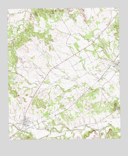
Morgan, TX USGS Topographic Map
Click on map above to begin viewing in our Map Viewer.

This topographic map contains these locations and features:
Feature Name Type Latitude Longitude GNIS ID View Map
Boyd AirportAirportN32.0598°W97.5878°2770629View Map
City of MorganCivilN32.0155°W97.6061°2411160View Map
El Colina Lake Number 5ReservoirN32.0656°W97.6249°1863952View Map
El Colina Lake Number 5 DamDamN32.0651°W97.6236°1863951View Map
El Colina Lake Number 6ReservoirN32.0631°W97.6237°1863954View Map
El Colina Lake Number 6 DamDamN32.0635°W97.6236°1863953View Map
El Colina Lake Number 7ReservoirN32.0733°W97.6212°1863956View Map
El Colina Lake Number 7 DamDamN32.0735°W97.6203°1863955View Map
KopperlPopulated PlaceN32.0699°W97.5039°1339225View Map
Kopperl Post OfficePost OfficeN32.0700°W97.5034°2731707View Map
Kopperl Volunteer Fire DepartmentBuildingN32.0706°W97.5025°2552328View Map
MorganPopulated PlaceN32.0188°W97.6084°1341904View Map
Morgan CemeteryCemeteryN32.0029°W97.6122°1341908View Map
Morgan Post OfficePost OfficeN32.0171°W97.6082°2731704View Map
Morgan Volunteer Fire DepartmentBuildingN32.0145°W97.6077°2552428View Map
Steele CreekStreamN32.0002°W97.5914°1347859View Map
Tuggle BranchStreamN32.1224°W97.6045°1348829View Map

Note: Coordinates in the location and feature list above are referenced to NAD83 datum.


Copyright (C) 2008-2025 Ryan Niemi / Sunset Dynamics ... All Rights Reserved