TopoQuest Logo
Do you find TopoQuest useful?
Help keep TopoQuest running and adding new maps/features by donating!
Bitcoin:  19c7KJd3qBynnjoSw5npx9KScwjBe4ifkT
Litecoin:  LXs6TkuXGGXo1vDsWCkWVdjQX94eUKd6ui
Home View Maps Find Maps Find Places Resources & Links


Walnut Springs East, Texas Topographic Map

USGS Map Title: Walnut Springs East, TX
USGS Map MRC: 32097A6
DRG (GeoTIFF) Download: o32097a6.tif


Neighboring USGS Topographic Map Quads:


  Glen Rose West, TX  
32097B7
 

  Glen Rose East, TX  
32097B6
 

  Brazos Point, TX  
32097B5
 

  Walnut Springs West, TX  
32097A7
 

  Walnut Springs East, TX  
32097A6
 

  Morgan, TX  
32097A5
 

  Iredell, TX  
31097H7
 

  Meridian, TX  
31097H6
 

  Pilot Knob, TX  
31097H5


Map MRC Location:

N33°
W98°
N33°
W97°
H8 H7 H6 H5 H4 H3 H2 H1
G8 G7 G6 G5 G4 G3 G2 G1
F8 F7 F6 F5 F4 F3 F2 F1
E8 E7 E6 E5 E4 E3 E2 E1
D8 D7 D6 D5 D4 D3 D2 D1
C8 C7 C6 C5 C4 C3 C2 C1
B8 B7 B6 B5 B4 B3 B2 B1
A8 A7 A6 A5 A4 A3 A2 A1
N32°
W98°
N32°
W97°

Walnut Springs East, TX USGS 1:24K Topographic Map Preview:
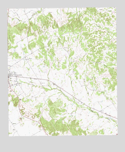
Walnut Springs East, TX USGS Topographic Map
Click on map above to begin viewing in our Map Viewer.

This topographic map contains these locations and features:
Feature Name Type Latitude Longitude GNIS ID View Map
Ball LakeReservoirN32.0635°W97.7070°1863958View Map
Ball Lake DamDamN32.0635°W97.7070°1863957View Map
Bryant's LandingAirportN32.0615°W97.7378°1387708View Map
Campbell LakeReservoirN32.1204°W97.6289°1863960View Map
Campbell Lake DamDamN32.1201°W97.6270°1863959View Map
Corn GapGapN32.0354°W97.7378°1333370View Map
Cox BranchStreamN32.0301°W97.6717°1333573View Map
Diamond Seven Ranch AirportAirportN32.0251°W97.6264°1387216View Map
El Colina Lake Number 2ReservoirN32.0651°W97.7020°1863946View Map
El Colina Lake Number 2 DamDamN32.0651°W97.7020°1863945View Map
El Colina Lake Number 3ReservoirN32.0799°W97.6839°1863948View Map
El Colina Lake Number 3 DamDamN32.0785°W97.6836°1863947View Map
El Colina Lake Number 4ReservoirN32.0604°W97.6766°1863950View Map
El Colina Lake Number 4 DamDamN32.0601°W97.6770°1863949View Map
Farris CreekStreamN32.0257°W97.6564°1335720View Map
Katy ParkParkN32.0549°W97.7489°1338963View Map
Meridian DivisionCivilN32.0126°W97.6277°1938987View Map
Oak Grove CemeteryCemeteryN32.0501°W97.7420°1342964View Map
Russell CemeteryCemeteryN32.0518°W97.7125°1345771View Map
Walnut SpringsPopulated PlaceN32.0576°W97.7495°1349451View Map
Walnut Springs Post OfficePost OfficeN32.0568°W97.7499°2731414View Map
Walnut Springs Volunteer Fire and Emergency Medical ServicesBuildingN32.0586°W97.7484°2552678View Map
Willow Springs ChurchChurchN32.0121°W97.7459°1350218View Map

Note: Coordinates in the location and feature list above are referenced to NAD83 datum.


Copyright (C) 2008-2025 Ryan Niemi / Sunset Dynamics ... All Rights Reserved