TopoQuest Logo
Do you find TopoQuest useful?
Help keep TopoQuest running and adding new maps/features by donating!
Bitcoin:  19c7KJd3qBynnjoSw5npx9KScwjBe4ifkT
Litecoin:  LXs6TkuXGGXo1vDsWCkWVdjQX94eUKd6ui
Home View Maps Find Maps Find Places Resources & Links


Negreet, Louisiana Topographic Map

USGS Map Title: Negreet, LA
USGS Map MRC: 31093D5
DRG (GeoTIFF) Download: o31093d5.tif


Neighboring USGS Topographic Map Quads:


  Beech Bayou, LA  
31093E6
 

  Loring, LA  
31093E5
 

  Many, LA  
31093E4
 

  Salter Creek, LA  
31093D6
 

  Negreet, LA  
31093D5
 

  Florien, LA  
31093D4
 

  Negreet SW, TX  
31093C6
 

  Toro, LA  
31093C5
 

  Hornbeck, LA  
31093C4


Map MRC Location:

N32°
W94°
N32°
W93°
H8 H7 H6 H5 H4 H3 H2 H1
G8 G7 G6 G5 G4 G3 G2 G1
F8 F7 F6 F5 F4 F3 F2 F1
E8 E7 E6 E5 E4 E3 E2 E1
D8 D7 D6 D5 D4 D3 D2 D1
C8 C7 C6 C5 C4 C3 C2 C1
B8 B7 B6 B5 B4 B3 B2 B1
A8 A7 A6 A5 A4 A3 A2 A1
N31°
W94°
N31°
W93°

Negreet, LA USGS 1:24K Topographic Map Preview:
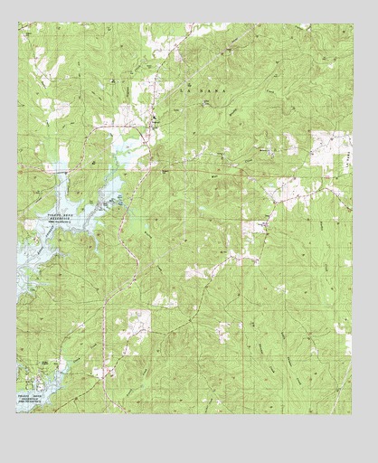
Negreet, LA USGS Topographic Map
Click on map above to begin viewing in our Map Viewer.

This topographic map contains these locations and features:
Feature Name Type Latitude Longitude GNIS ID View Map
Antioch CemeteryCemeteryN31.4355°W93.5321°534508View Map
Antioch ChurchChurchN31.4355°W93.5330°532184View Map
Antioch ChurchChurchN31.4743°W93.5560°541550View Map
Antioch School (historical)SchoolN31.4357°W93.5330°546073View Map
Brushy CreekStreamN31.4591°W93.5868°533469View Map
Caney CreekStreamN31.3896°W93.6049°533743View Map
Carroll CemeteryCemeteryN31.4860°W93.5749°541551View Map
Cedar Grove School (historical)SchoolN31.4002°W93.5163°546087View Map
DessPopulated PlaceN31.4388°W93.5305°543142View Map
Dess Fire Lookout TowerTowerN31.4268°W93.5488°558763View Map
EstoPopulated PlaceN31.3924°W93.6088°543190View Map
Macedonia ChurchChurchN31.4596°W93.5313°541554View Map
NegreetPopulated PlaceN31.4693°W93.5749°543513View Map
Negreet CreekStreamN31.4591°W93.5868°555463View Map
Negreet High SchoolSchoolN31.4698°W93.5744°546150View Map
Negreet Post OfficePost OfficeN31.4668°W93.5760°1630480View Map
Negreet School (historical)SchoolN31.4743°W93.5560°557921View Map
Parish Governing Authority District 2CivilN31.3901°W93.5957°1929910View Map
Peg Leg Fire DepartmentBuildingN31.3885°W93.6125°2673035View Map
Recknor (historical)Populated PlaceN31.4980°W93.6238°546162View Map
Redland CemeteryCemeteryN31.4521°W93.5713°538543View Map
Redland ChurchChurchN31.4582°W93.5485°538544View Map
Roberts CemeteryCemeteryN31.4960°W93.6224°538638View Map
Turner CreekStreamN31.4349°W93.6093°548097View Map
Wall CreekStreamN31.4377°W93.5816°540203View Map
Ward ThreeCivilN31.4668°W93.6046°545196View Map
Winfrey CreekStreamN31.4427°W93.5935°556457View Map
Zion Hill Baptist ChurchChurchN31.4666°W93.5757°556497View Map

Note: Coordinates in the location and feature list above are referenced to NAD83 datum.


Copyright (C) 2008-2024 Ryan Niemi / Sunset Dynamics ... All Rights Reserved