TopoQuest Logo
Do you find TopoQuest useful?
Help keep TopoQuest running and adding new maps/features by donating!
Bitcoin:  19c7KJd3qBynnjoSw5npx9KScwjBe4ifkT
Litecoin:  LXs6TkuXGGXo1vDsWCkWVdjQX94eUKd6ui
Home View Maps Find Maps Find Places Resources & Links


New Castle, Kentucky Topographic Map

USGS Map Title: New Castle, KY
USGS Map MRC: 38085D2
DRG (GeoTIFF) Download: o38085d2.tif


Neighboring USGS Topographic Map Quads:


  Bedford, KY  
38085E3
 

  Campbellsburg, KY  
38085E2
 

  Worthville, KY  
38085E1
 

  Smithfield, KY  
38085D3
 

  New Castle, KY  
38085D2
 

  Franklinton, KY  
38085D1
 

  Ballardsville, KY  
38085C3
 

  Eminence, KY  
38085C2
 

  North Pleasureville, KY  
38085C1


Map MRC Location:

N39°
W86°
N39°
W85°
H8 H7 H6 H5 H4 H3 H2 H1
G8 G7 G6 G5 G4 G3 G2 G1
F8 F7 F6 F5 F4 F3 F2 F1
E8 E7 E6 E5 E4 E3 E2 E1
D8 D7 D6 D5 D4 D3 D2 D1
C8 C7 C6 C5 C4 C3 C2 C1
B8 B7 B6 B5 B4 B3 B2 B1
A8 A7 A6 A5 A4 A3 A2 A1
N38°
W86°
N38°
W85°

New Castle, KY USGS 1:24K Topographic Map Preview:
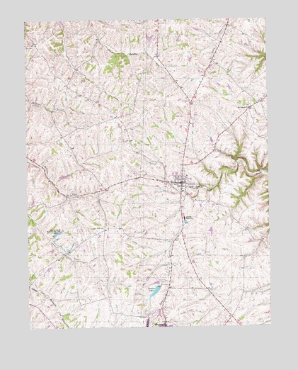
New Castle, KY USGS Topographic Map
Click on map above to begin viewing in our Map Viewer.

This topographic map contains these locations and features:
Feature Name Type Latitude Longitude GNIS ID View Map
Bruce Family Cemetery (historical)CemeteryN38.4721°W85.1446°2568577View Map
Chinn-Elley-Dupuy-Smith CemeteryCemeteryN38.3983°W85.1372°2728660View Map
City of New CastleCivilN38.4334°W85.1689°2404359View Map
Deer Run AirparkAirportN38.4703°W85.1386°517453View Map
Eminence LakeReservoirN38.3896°W85.1846°491763View Map
Henry County Church (historical)ChurchN38.4110°W85.1695°2568604View Map
Henry County Emergency Medical ServicesBuildingN38.4264°W85.1623°2719083View Map
Henry County Poor House (historical)LocaleN38.4908°W85.1479°2568605View Map
Henry County Rod and Gun Club LakeReservoirN38.4133°W85.2350°494062View Map
Henry County Sheriff's OfficeBuildingN38.4336°W85.1695°2767509View Map
Hillsboro Baptist Church (historical)ChurchN38.4800°W85.2233°2568607View Map
Hillsboro School (historical)SchoolN38.4803°W85.2241°2568608View Map
Hughley CemeteryCemeteryN38.4928°W85.1661°2728873View Map
John M Foree AirportAirportN38.4600°W85.1664°517452View Map
Logan CemeteryCemeteryN38.4822°W85.2397°2568622View Map
Mount Gilead ChurchChurchN38.4640°W85.1344°498734View Map
Mount Gilead School (historical)SchoolN38.4656°W85.1303°2568630View Map
New CastlePopulated PlaceN38.4334°W85.1697°499296View Map
New Castle DivisionCivilN38.4599°W85.1618°1937168View Map
New Castle Fire and RescueBuildingN38.4347°W85.1675°2636679View Map
New Castle Police DepartmentBuildingN38.4346°W85.1675°2767639View Map
Russell School (historical)SchoolN38.4039°W85.1354°2568647View Map
Sanford School (historical)SchoolN38.4837°W85.1540°2568650View Map
Simmons BridgeBridgeN38.4338°W85.1766°2568664View Map
Webb CemeteryCemeteryN38.4897°W85.1781°2729126View Map
White Sulphur School (historical)SchoolN38.4315°W85.2344°2568677View Map

Note: Coordinates in the location and feature list above are referenced to NAD83 datum.


Copyright (C) 2008-2024 Ryan Niemi / Sunset Dynamics ... All Rights Reserved