TopoQuest Logo
Do you find TopoQuest useful?
Help keep TopoQuest running and adding new maps/features by donating!
Bitcoin:  19c7KJd3qBynnjoSw5npx9KScwjBe4ifkT
Litecoin:  LXs6TkuXGGXo1vDsWCkWVdjQX94eUKd6ui
Home View Maps Find Maps Find Places Resources & Links


Norden, California Topographic Map

USGS Map Title: Norden, CA
USGS Map MRC: 39120C3
DRG (GeoTIFF) Download: o39120c3.tif


Neighboring USGS Topographic Map Quads:


  Webber Peak, CA  
39120D4
 

  Independence Lake, CA  
39120D3
 

  Hobart Mills, CA  
39120D2
 

  Soda Springs, CA  
39120C4
 

  Norden, CA  
39120C3
 

  Truckee, CA  
39120C2
 

  Royal Gorge, CA  
39120B4
 

  Granite Chief, CA  
39120B3
 

  Tahoe City, CA  
39120B2


Map MRC Location:

N40°
W121°
N40°
W120°
H8 H7 H6 H5 H4 H3 H2 H1
G8 G7 G6 G5 G4 G3 G2 G1
F8 F7 F6 F5 F4 F3 F2 F1
E8 E7 E6 E5 E4 E3 E2 E1
D8 D7 D6 D5 D4 D3 D2 D1
C8 C7 C6 C5 C4 C3 C2 C1
B8 B7 B6 B5 B4 B3 B2 B1
A8 A7 A6 A5 A4 A3 A2 A1
N39°
W121°
N39°
W120°

Norden, CA USGS 1:24K Topographic Map Preview:
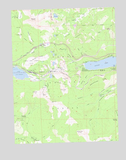
Norden, CA USGS Topographic Map
Click on map above to begin viewing in our Map Viewer.

This topographic map contains these locations and features:
Feature Name Type Latitude Longitude GNIS ID View Map
Anderson PeakSummitN39.2591°W120.2969°256241View Map
Andesite PeakSummitN39.3510°W120.3666°256243View Map
Andesite RidgeRidgeN39.3510°W120.3666°256244View Map
Andover (historical)Populated PlaceN39.3019°W120.2574°1693432View Map
Azalea LakeLakeN39.3348°W120.3286°256389View Map
Billy Mack CanyonValleyN39.3191°W120.2935°257064View Map
Billy Mack FlatFlatN39.3366°W120.3102°257065View Map
Boreal RidgeRidgeN39.3302°W120.3449°257362View Map
Boreal Ridge Ski AreaLocaleN39.3316°W120.3510°1662459View Map
Castle PassGapN39.3582°W120.3652°258061View Map
Castle PeakSummitN39.3655°W120.3491°258063View Map
Castle ValleyValleyN39.3410°W120.3449°258069View Map
Cedar CreekStreamN39.2546°W120.3702°258114View Map
China CoveBayN39.3196°W120.2530°258298View Map
Circle E RanchLocaleN39.3746°W120.2685°258379View Map
Crater LakeLakeN39.3248°W120.3562°258887View Map
Crows NestSummitN39.2971°W120.3502°258948View Map
Deer Park Recreation SiteLocaleN39.3380°W120.3358°1662522View Map
DonnerPopulated PlaceN39.3163°W120.3321°1693433View Map
Donner Ever Valley 319 DamDamN39.3599°W120.2994°1663827View Map
Donner LakeLakeN39.3227°W120.2652°1654915View Map
Donner Lake VillagePopulated PlaceN39.3252°W120.2858°1682876View Map
Donner PassGapN39.3191°W120.3285°259475View Map
Donner PeakSummitN39.3088°W120.3121°259476View Map
Donner RidgeRidgeN39.3505°W120.2883°259477View Map
Donner Summit BridgeBridgeN39.3196°W120.3191°259478View Map
Donner Summit Recreation SiteLocaleN39.3455°W120.3385°1662521View Map
Donner Summit Ski AreaLocaleN39.3235°W120.3299°1662460View Map
Donner WoodsPopulated PlaceN39.3180°W120.2905°1682878View Map
EderPopulated PlaceN39.2996°W120.2924°1658472View Map
Emigrant CanyonValleyN39.2946°W120.2721°259904View Map
Euer SaddleGapN39.3430°W120.3399°252113View Map
Flora LakeLakeN39.3322°W120.3261°260212View Map
Frog LakeLakeN39.3682°W120.3227°260426View Map
Frog Lake CliffCliffN39.3674°W120.3274°260429View Map
GelattPopulated PlaceN39.3210°W120.2913°1693425View Map
Gelatt Post Office (historical)Post OfficeN39.3210°W120.2913°1940097View Map
George R. Stewart PeakSummitN39.3238°W120.3196°274661View Map
Horse RangeSlopeN39.3496°W120.3094°261501View Map
Horseshoe BendBendN39.2932°W120.2705°261523View Map
Lake AngelaReservoirN39.3241°W120.3264°256256View Map
Lake Angela 89-002 DamDamN39.3223°W120.3270°1663560View Map
Lake MaryReservoirN39.3120°W120.3300°263250View Map
Lake Mary 311-003 DamDamN39.3112°W120.3318°1663822View Map
Lake Van NordenReservoirN39.3148°W120.3731°268671View Map
LakeviewPopulated PlaceN39.3282°W120.2635°1682907View Map
Lakeview CanyonValleyN39.3163°W120.2852°262301View Map
Lytton LakeLakeN39.3256°W120.3399°263091View Map
McGlashan PointSummitN39.3182°W120.3202°274670View Map
Mount DisneySummitN39.2946°W120.3408°259390View Map
Mount JudahSummitN39.2985°W120.3155°262032View Map
Mount LincolnSummitN39.2877°W120.3280°262489View Map
Mount StephensSummitN39.3199°W120.3230°1655065View Map
Negro CanyonValleyN39.3266°W120.2877°264030View Map
NordenPopulated PlaceN39.3180°W120.3560°1659242View Map
Norden Post OfficePost OfficeN39.3174°W120.3499°1682932View Map
Old Stanford Wood CampLocaleN39.2707°W120.2524°264337View Map
Onion CreekStreamN39.2541°W120.3721°264363View Map
Onion Creek CampgroundLocaleN39.2746°W120.3633°264367View Map
Onion Creek Experimental ForestForestN39.2821°W120.3494°1662526View Map
Peter Grubb HutBuildingN39.3677°W120.3671°264664View Map
Round ValleyBasinN39.3702°W120.3641°265622View Map
Schallenberger RidgeRidgeN39.3071°W120.2716°265906View Map
South Fork Cold CreekStreamN39.2896°W120.2733°267441View Map
Southside HighlandsPopulated PlaceN39.3157°W120.2705°1701096View Map
Stanford (historical)Populated PlaceN39.2927°W120.2677°1701097View Map
Sugar BowlBasinN39.3016°W120.3338°267832View Map
Sugar Bowl Ski AreaLocaleN39.3043°W120.3358°1662525View Map
Summit LakeLakeN39.3498°W120.3239°267929View Map
Summit ValleyValleyN39.3132°W120.3591°267951View Map
Tahoe Donner Ski AreaLocaleN39.3524°W120.2716°1662461View Map
The CedarsPopulated PlaceN39.2530°W120.3533°1659979View Map
Truckee Fire Protection District Station 93 Donner LakeBuildingN39.3254°W120.2842°2621796View Map
Uhlen ValleyValleyN39.3235°W120.3713°268571View Map
Upper Alder Creek Picnic AreaLocaleN39.3519°W120.2710°1682985View Map
Upper Castle CreekStreamN39.3224°W120.3716°268602View Map
Weeks TractPopulated PlaceN39.3188°W120.2991°1682993View Map
West End Beach ParkParkN39.3227°W120.2899°1682994View Map
West LakesLakeN39.3422°W120.3417°1693426View Map

Note: Coordinates in the location and feature list above are referenced to NAD83 datum.


Copyright (C) 2008-2024 Ryan Niemi / Sunset Dynamics ... All Rights Reserved