TopoQuest Logo
Do you find TopoQuest useful?
Help keep TopoQuest running and adding new maps/features by donating!
Bitcoin:  19c7KJd3qBynnjoSw5npx9KScwjBe4ifkT
Litecoin:  LXs6TkuXGGXo1vDsWCkWVdjQX94eUKd6ui
Home View Maps Find Maps Find Places Resources & Links


Richville, Alabama Topographic Map

USGS Map Title: Richville, AL
USGS Map MRC: 32086G3
DRG (GeoTIFF) Download: o32086g3.tif


Neighboring USGS Topographic Map Quads:


  Mitchell Dam NW, AL  
32086H4
 

  Flag Mountain, AL  
32086H3
 

  Rockford, AL  
32086H2
 

  Mitchell Dam, AL  
32086G4
 

  Richville, AL  
32086G3
 

  Rockford SW, AL  
32086G2
 

  Marbury, AL  
32086F4
 

  Holtville, AL  
32086F3
 

  Dexter, AL  
32086F2


Map MRC Location:

N33°
W87°
N33°
W86°
H8 H7 H6 H5 H4 H3 H2 H1
G8 G7 G6 G5 G4 G3 G2 G1
F8 F7 F6 F5 F4 F3 F2 F1
E8 E7 E6 E5 E4 E3 E2 E1
D8 D7 D6 D5 D4 D3 D2 D1
C8 C7 C6 C5 C4 C3 C2 C1
B8 B7 B6 B5 B4 B3 B2 B1
A8 A7 A6 A5 A4 A3 A2 A1
N32°
W87°
N32°
W86°

Richville, AL USGS 1:24K Topographic Map Preview:
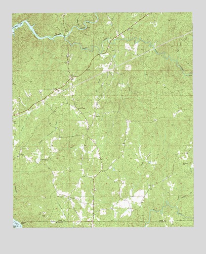
Richville, AL USGS Topographic Map
Click on map above to begin viewing in our Map Viewer.

This topographic map contains these locations and features:
Feature Name Type Latitude Longitude GNIS ID View Map
Browning PondReservoirN32.7839°W86.3053°135666View Map
BryantLocaleN32.8385°W86.3705°135667View Map
Church of ChristChurchN32.7535°W86.3205°116124View Map
Gin CreekStreamN32.8412°W86.3116°118986View Map
Grooves LakeReservoirN32.7601°W86.3416°131005View Map
Grooves Lake DamDamN32.7601°W86.3416°131004View Map
Hamilton BranchStreamN32.7651°W86.2608°119629View Map
Hollybranch CemeteryCemeteryN32.8315°W86.2686°135691View Map
Kellys CrossroadsPopulated PlaceN32.8373°W86.3344°156550View Map
Little Pinchoulee CreekStreamN32.7893°W86.3569°121839View Map
Murchison CemeteryCemeteryN32.7868°W86.2577°123591View Map
New Union Baptist ChurchChurchN32.8654°W86.2947°153765View Map
New Union CemeteryCemeteryN32.8651°W86.2939°135713View Map
Penton-Anderson ProspectMineN32.8098°W86.2689°157676View Map
Proctor CreekStreamN32.8415°W86.3116°125297View Map
Proctor Creek CemeteryCemeteryN32.7951°W86.3694°163408View Map
Proctor Creek ChurchChurchN32.7973°W86.3686°125299View Map
Providence Baptist ChurchChurchN32.7935°W86.3703°158138View Map
Red Mouth CreekStreamN32.8471°W86.2616°158062View Map
RichvillePopulated PlaceN32.8151°W86.3183°156965View Map
Richville Junior High School (historical)SchoolN32.8079°W86.3233°148945View Map
Richville Volunteer Fire DepartmentBuildingN32.8149°W86.3185°2691397View Map
Rocky BranchStreamN32.8657°W86.3266°125827View Map
Sardis Baptist ChurchChurchN32.8498°W86.3364°158081View Map
Sardis CemeteryCemeteryN32.8465°W86.3366°126402View Map
SchleyPopulated PlaceN32.7932°W86.3700°157022View Map
Shelton LakeReservoirN32.7635°W86.2983°131011View Map
Shelton Lake DamDamN32.7635°W86.2983°131010View Map
Sinai ChurchChurchN32.8112°W86.3733°163411View Map
Speed CreekStreamN32.7618°W86.2619°127174View Map
Swamp CreekStreamN32.8610°W86.3386°153617View Map
Swamp Creek CemeteryCemeteryN32.8196°W86.3172°135738View Map
Swamp Creek Primitive Baptist ChurchChurchN32.8193°W86.3172°158092View Map
Thompsons Old Ferry (historical)CrossingN32.7507°W86.3714°137336View Map
Titus ChurchChurchN32.7604°W86.3194°137337View Map
Travelers RestPopulated PlaceN32.8196°W86.3305°157168View Map
Union ChurchChurchN32.7685°W86.3419°164138View Map
Wayside Baptist ChurchChurchN32.7743°W86.2805°158101View Map
Wayside CemeteryCemeteryN32.7748°W86.2811°135747View Map
WelonaPopulated PlaceN32.7668°W86.3361°157232View Map
Williams ProspectMineN32.8171°W86.2597°157681View Map

Note: Coordinates in the location and feature list above are referenced to NAD83 datum.


Copyright (C) 2008-2024 Ryan Niemi / Sunset Dynamics ... All Rights Reserved