TopoQuest Logo
Do you find TopoQuest useful?
Help keep TopoQuest running and adding new maps/features by donating!
Bitcoin:  19c7KJd3qBynnjoSw5npx9KScwjBe4ifkT
Litecoin:  LXs6TkuXGGXo1vDsWCkWVdjQX94eUKd6ui
Home View Maps Find Maps Find Places Resources & Links


Ripley, California Topographic Map

USGS Map Title: Ripley, CA
USGS Map MRC: 33114E6
DRG (GeoTIFF) Download: o33114e6.tif


Neighboring USGS Topographic Map Quads:


  McCoy Peak, CA  
33114F7
 

  McCoy Wash, CA  
33114F6
 

  Blythe NE, CA  
33114F5
 

  Roosevelt Mine, CA  
33114E7
 

  Ripley, CA  
33114E6
 

  Blythe, CA  
33114E5
 

  Thumb Peak, CA  
33114D7
 

  Palo Verde, CA  
33114D6
 

  Mule Wash, AZ  
33114D5


Map MRC Location:

N34°
W115°
N34°
W114°
H8 H7 H6 H5 H4 H3 H2 H1
G8 G7 G6 G5 G4 G3 G2 G1
F8 F7 F6 F5 F4 F3 F2 F1
E8 E7 E6 E5 E4 E3 E2 E1
D8 D7 D6 D5 D4 D3 D2 D1
C8 C7 C6 C5 C4 C3 C2 C1
B8 B7 B6 B5 B4 B3 B2 B1
A8 A7 A6 A5 A4 A3 A2 A1
N33°
W115°
N33°
W114°

Ripley, CA USGS 1:24K Topographic Map Preview:
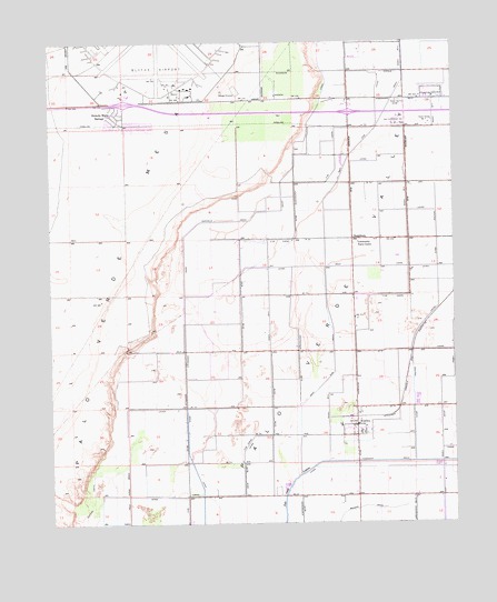
Ripley, CA USGS Topographic Map
Click on map above to begin viewing in our Map Viewer.

This topographic map contains these locations and features:
Feature Name Type Latitude Longitude GNIS ID View Map
Blythe AirportAirportN33.6147°W114.7133°1653274View Map
Blythe Army Air Field (historical)MilitaryN33.6189°W114.7167°1987610View Map
Blythe DivisionCivilN33.5627°W114.6335°1935242View Map
C-03 CanalCanalN33.5956°W114.6613°239927View Map
C-05 CanalCanalN33.5303°W114.6650°239934View Map
Central DrainCanalN33.5331°W114.6383°240416View Map
Clayton HeliportAirportN33.6039°W114.6458°1653271View Map
Community Farm CenterLocaleN33.5728°W114.6550°1654601View Map
Mesa VerdePopulated PlaceN33.6059°W114.7311°1661106View Map
Mesa Verde Census Designated PlaceCensusN33.5957°W114.7316°2583079View Map
NeighborsLocaleN33.5736°W114.6566°246462View Map
Palo Verde DrainCanalN33.5106°W114.7272°247176View Map
Rannells DrainCanalN33.5784°W114.6955°247981View Map
RipleyPopulated PlaceN33.5253°W114.6561°248224View Map
Ripley Census Designated PlaceCensusN33.5238°W114.6530°2583122View Map
Ripley Post OfficePost OfficeN33.5245°W114.6566°1868113View Map
Riverside County Fire Department Station 44 RipleyBuildingN33.5263°W114.6555°2664986View Map
Riverside County Fire Department Station 45 Blythe Air BaseBuildingN33.6100°W114.7150°2664931View Map
Township DrainCanalN33.5159°W114.6475°250568View Map
West CanalCanalN33.5664°W114.6505°251323View Map
West Side DrainCanalN33.6034°W114.6480°251377View Map

Note: Coordinates in the location and feature list above are referenced to NAD83 datum.


Copyright (C) 2008-2025 Ryan Niemi / Sunset Dynamics ... All Rights Reserved