TopoQuest Logo
Do you find TopoQuest useful?
Help keep TopoQuest running and adding new maps/features by donating!
Bitcoin:  19c7KJd3qBynnjoSw5npx9KScwjBe4ifkT
Litecoin:  LXs6TkuXGGXo1vDsWCkWVdjQX94eUKd6ui
Home View Maps Find Maps Find Places Resources & Links


Roberta, Oklahoma Topographic Map

USGS Map Title: Roberta, OK
USGS Map MRC: 33096H3
DRG (GeoTIFF) Download: o33096h3.tif


Neighboring USGS Topographic Map Quads:


  Durant North, OK  
34096A4
 

  Caddo South, OK  
34096A3
 

  Bokchito, OK  
34096A2
 

  Durant South, OK  
33096H4
 

  Roberta, OK  
33096H3
 

  Blue, OK  
33096H2
 

  Achille, OK  
33096G4
 

  Kemp, OK  
33096G3
 

  Yuba, OK  
33096G2


Map MRC Location:

N34°
W97°
N34°
W96°
H8 H7 H6 H5 H4 H3 H2 H1
G8 G7 G6 G5 G4 G3 G2 G1
F8 F7 F6 F5 F4 F3 F2 F1
E8 E7 E6 E5 E4 E3 E2 E1
D8 D7 D6 D5 D4 D3 D2 D1
C8 C7 C6 C5 C4 C3 C2 C1
B8 B7 B6 B5 B4 B3 B2 B1
A8 A7 A6 A5 A4 A3 A2 A1
N33°
W97°
N33°
W96°

Roberta, OK USGS 1:24K Topographic Map Preview:
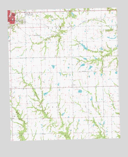
Roberta, OK USGS Topographic Map
Click on map above to begin viewing in our Map Viewer.

This topographic map contains these locations and features:
Feature Name Type Latitude Longitude GNIS ID View Map
AllisonPopulated PlaceN33.8959°W96.3717°1100169View Map
Anderson LakeReservoirN33.9209°W96.2947°1757894View Map
Anderson Lake DamDamN33.9218°W96.2936°1757893View Map
Boatner LakeReservoirN33.8759°W96.2935°1755748View Map
Boatner Lake DamDamN33.8751°W96.2936°1755747View Map
Bryan CountyCivilN33.9623°W96.2597°1101794View Map
Bushnell ChurchChurchN33.9265°W96.3650°1090740View Map
Callaway LakeReservoirN33.9586°W96.2730°1755740View Map
Callaway Lake DamDamN33.9584°W96.2686°1757905View Map
Callaway Lake DamDamN33.9584°W96.2719°1755739View Map
Calvary Temple Assembly of GodChurchN33.9979°W96.3742°1782875View Map
Casteel LakeReservoirN33.9379°W96.2531°1757892View Map
Casteel Lake DamDamN33.9384°W96.2553°1757891View Map
Conditt LakeReservoirN33.8884°W96.2669°1755746View Map
Conditt Lake DamDamN33.8884°W96.2669°1755745View Map
DurantPopulated PlaceN33.9940°W96.3708°1092307View Map
Farrell LakeReservoirN33.9378°W96.2775°1757890View Map
Farrell Lake DamDamN33.9368°W96.2786°1757889View Map
George Washington SchoolSchoolN33.9904°W96.3697°1777898View Map
Grace Baptist ChurchChurchN33.9898°W96.3708°1782890View Map
H L D M Farms Incorporated LakeReservoirN33.9484°W96.2886°1755742View Map
H L D M Farms Incorporated Lake DamDamN33.9484°W96.2886°1755741View Map
Isom 3 LakeReservoirN33.9437°W96.2821°1757896View Map
Isom 3 Lake DamDamN33.9451°W96.2803°1757895View Map
Isom I LakeReservoirN33.9460°W96.2908°1757898View Map
Isom I Lake DamDamN33.9468°W96.2903°1757897View Map
Isom LakeReservoirN33.9384°W96.2703°1751547View Map
Isom Lake DamDamN33.9384°W96.2703°1751546View Map
Lee ChapelChurchN33.9962°W96.3528°1094554View Map
Lee HeightsPopulated PlaceN33.9959°W96.3489°1777896View Map
Martingly Lake Number 1ReservoirN33.9468°W96.3219°1755724View Map
Mattingly Lake Number 1 DamDamN33.9468°W96.3219°1755723View Map
Mattingly Lake Number 2ReservoirN33.9218°W96.3053°1755726View Map
Mattingly Lake Number 2 DamDamN33.9218°W96.3053°1755725View Map
North Branch J-N CreekStreamN33.9590°W96.2569°1095921View Map
Oknoname 013004 DamDamN33.9501°W96.2903°1757903View Map
Oknoname 013007 DamDamN33.9951°W96.2986°1757909View Map
Oknoname 013007 ReservoirReservoirN33.9952°W96.3011°1757910View Map
Oknoname 013019 DamDamN33.9634°W96.2903°1756074View Map
Oknoname 013019 ReservoirReservoirN33.9629°W96.2882°1756075View Map
Oknoname 013022 DamDamN33.9434°W96.2919°1757901View Map
Oknoname 013022 ReservoirReservoirN33.9434°W96.2919°1757902View Map
Oknoname 031004 ReservoirReservoirN33.9519°W96.2880°1757904View Map
Old AllisonPopulated PlaceN33.8815°W96.3372°1100691View Map
Philadelphia Volunteer Fire DepartmentBuildingN33.9741°W96.2509°2656980View Map
Pioneer CemeteryCemeteryN33.9984°W96.3691°1777897View Map
PirtlePopulated PlaceN33.9890°W96.2678°1100746View Map
Pirtle ChurchChurchN33.9823°W96.2689°1777895View Map
Pirtle SchoolLocaleN33.9826°W96.2680°1096693View Map
RobertaPopulated PlaceN33.9265°W96.3025°1097255View Map
Roberta Volunteer Fire DepartmentBuildingN33.9253°W96.3029°2657515View Map
Roberts Lake Number 1ReservoirN33.9054°W96.3149°1757878View Map
Roberts Lake Number 1 DamDamN33.9051°W96.3153°1757877View Map
Roberts Lake Number 2ReservoirN33.8994°W96.3149°1755730View Map
Roberts Lake Number 2 DamDamN33.9001°W96.3136°1755729View Map
Shepard LakeReservoirN33.9280°W96.3192°1757886View Map
Shepard LakeReservoirN33.8968°W96.2919°1756079View Map
Shepard Lake DamDamN33.9268°W96.3186°1757885View Map
Shepard Lake DamDamN33.8968°W96.2919°1756078View Map
Township of CaleraCivilN33.8918°W96.3253°1824709View Map
Township of SpeairsCivilN33.9820°W96.3128°1824702View Map
United Pentecostal ChurchChurchN33.9957°W96.3742°1782897View Map

Note: Coordinates in the location and feature list above are referenced to NAD83 datum.


Copyright (C) 2008-2025 Ryan Niemi / Sunset Dynamics ... All Rights Reserved