TopoQuest Logo
Do you find TopoQuest useful?
Help keep TopoQuest running and adding new maps/features by donating!
Bitcoin:  19c7KJd3qBynnjoSw5npx9KScwjBe4ifkT
Litecoin:  LXs6TkuXGGXo1vDsWCkWVdjQX94eUKd6ui
Home View Maps Find Maps Find Places Resources & Links


Durant North, Oklahoma Topographic Map

USGS Map Title: Durant North, OK
USGS Map MRC: 34096A4
DRG (GeoTIFF) Download: o34096a4.tif


Neighboring USGS Topographic Map Quads:


  Milburn, OK  
34096B5
 

  Caddo NW, OK  
34096B4
 

  Caddo North, OK  
34096B3
 

  Little City, OK  
34096A5
 

  Durant North, OK  
34096A4
 

  Caddo South, OK  
34096A3
 

  Platter, OK  
33096H5
 

  Durant South, OK  
33096H4
 

  Roberta, OK  
33096H3


Map MRC Location:

N35°
W97°
N35°
W96°
H8 H7 H6 H5 H4 H3 H2 H1
G8 G7 G6 G5 G4 G3 G2 G1
F8 F7 F6 F5 F4 F3 F2 F1
E8 E7 E6 E5 E4 E3 E2 E1
D8 D7 D6 D5 D4 D3 D2 D1
C8 C7 C6 C5 C4 C3 C2 C1
B8 B7 B6 B5 B4 B3 B2 B1
A8 A7 A6 A5 A4 A3 A2 A1
N34°
W97°
N34°
W96°

Durant North, OK USGS 1:24K Topographic Map Preview:
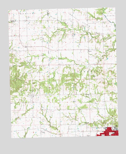
Durant North, OK USGS Topographic Map
Click on map above to begin viewing in our Map Viewer.

This topographic map contains these locations and features:
Feature Name Type Latitude Longitude GNIS ID View Map
Abundant Life TempleChurchN34.0070°W96.3908°1782870View Map
Bible Missionary ChurchChurchN34.0054°W96.4161°1782872View Map
BrownPopulated PlaceN34.0890°W96.4803°1100238View Map
CobbPopulated PlaceN34.0848°W96.4078°1091526View Map
Cox Chapel CemeteryCemeteryN34.0584°W96.4039°1091792View Map
Durant Fire and Rescue Station 2BuildingN34.0197°W96.3870°2657167View Map
Durant High SchoolSchoolN34.0285°W96.3813°1803959View Map
Durant Intermediate Elementary SchoolSchoolN34.0079°W96.3895°2712915View Map
Durant Middle SchoolSchoolN34.0021°W96.3813°1803960View Map
Durant Police DepartmentBuildingN34.0205°W96.3869°2757653View Map
Fairview Baptist ChurchChurchN34.0051°W96.3872°2570567View Map
Fairview Baptist Church Day Care (historical)SchoolN34.0051°W96.3872°1782880View Map
Faith Missionary Baptist ChurchChurchN34.0054°W96.4080°1782881View Map
Folsom Highway ChurchChurchN34.0409°W96.4080°1092921View Map
Keffer CemeteryCemeteryN34.0737°W96.4792°1094310View Map
KHIB-FM (Durant)TowerN34.0084°W96.3753°1102793View Map
KierseyPopulated PlaceN34.0057°W96.4655°1094371View Map
KLBC-FM (Durant)TowerN34.0020°W96.4222°1102794View Map
KSEO-AM (Durant)TowerN34.0020°W96.4222°1102760View Map
Mc Laughlin Farm AirportAirportN34.0894°W96.4212°1102445View Map
Medical Center of Southeastern OklahomaHospitalN34.0074°W96.3936°2695724View Map
Medical Center of Southeastern Oklahoma HeliportAirportN34.0076°W96.3917°1102444View Map
Mount Zion ChurchChurchN34.0057°W96.4205°1095624View Map
Northwest Church of ChristChurchN34.0087°W96.3914°1782891View Map
Northwest Heights Elementary SchoolSchoolN34.0046°W96.3940°1803961View Map
Oklahoma State Highway Patrol Troop EBuildingN34.0213°W96.3870°2757960View Map
Oknoname 013008 DamDamN34.0501°W96.3786°1756052View Map
Oknoname 013008 ReservoirReservoirN34.0497°W96.3794°1756053View Map
Pentecostal Church of GodChurchN34.0012°W96.3817°1782893View Map
Pentecostal Holiness ChurchChurchN34.0062°W96.3905°1782894View Map
Saint Williams Catholic ChurchChurchN34.0048°W96.3805°1782896View Map
SiloPopulated PlaceN34.0415°W96.4742°1098038View Map
Silo Community Volunteer Fire DepartmentBuildingN34.0399°W96.4761°2657480View Map
Silo Elementary SchoolSchoolN34.0385°W96.4764°1790631View Map
Silo High SchoolSchoolN34.0392°W96.4766°2712865View Map
Silo Junior High SchoolSchoolN34.0393°W96.4774°1790321View Map
Southeastern Oklahoma State UniversitySchoolN34.0058°W96.3793°1098306View Map
Town of SiloCivilN34.0359°W96.4747°2413283View Map
Victory LifeChurchN34.0054°W96.4097°1782898View Map
Victory Life AcademySchoolN34.0057°W96.4114°2713013View Map

Note: Coordinates in the location and feature list above are referenced to NAD83 datum.


Copyright (C) 2008-2025 Ryan Niemi / Sunset Dynamics ... All Rights Reserved