TopoQuest Logo
Do you find TopoQuest useful?
Help keep TopoQuest running and adding new maps/features by donating!
Bitcoin:  19c7KJd3qBynnjoSw5npx9KScwjBe4ifkT
Litecoin:  LXs6TkuXGGXo1vDsWCkWVdjQX94eUKd6ui
Home View Maps Find Maps Find Places Resources & Links


Rock Bluff, Nebraska Topographic Map

USGS Map Title: Rock Bluff, NE
USGS Map MRC: 40095H7
DRG (GeoTIFF) Download: o40095h7.tif


Neighboring USGS Topographic Map Quads:


  Plattsmouth, NE  
41095A8
 

  Pacific Junction, IA  
41095A7
 

  Glenwood, IA  
41095A6
 

  Murray, NE  
40095H8
 

  Rock Bluff, NE  
40095H7
 

  Tabor, IA  
40095H6
 

  Nehawka, NE  
40095G8
 

  McPaul, IA  
40095G7
 

  Tabor SW, IA  
40095G6


Map MRC Location:

N41°
W96°
N41°
W95°
H8 H7 H6 H5 H4 H3 H2 H1
G8 G7 G6 G5 G4 G3 G2 G1
F8 F7 F6 F5 F4 F3 F2 F1
E8 E7 E6 E5 E4 E3 E2 E1
D8 D7 D6 D5 D4 D3 D2 D1
C8 C7 C6 C5 C4 C3 C2 C1
B8 B7 B6 B5 B4 B3 B2 B1
A8 A7 A6 A5 A4 A3 A2 A1
N40°
W96°
N40°
W95°

Rock Bluff, NE USGS 1:24K Topographic Map Preview:
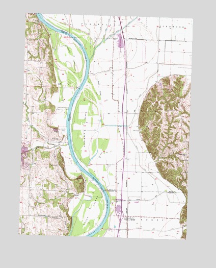
Rock Bluff, NE USGS Topographic Map
Click on map above to begin viewing in our Map Viewer.

This topographic map contains these locations and features:
Feature Name Type Latitude Longitude GNIS ID View Map
Alps Post Office (historical)Post OfficeN40.9514°W95.8147°1968390View Map
BartlettPopulated PlaceN40.8850°W95.7950°454373View Map
BartlettLocaleN40.8861°W95.7947°1949848View Map
Bartlett AccessLocaleN40.8875°W95.8081°1949828View Map
Bartlett Census Designated PlaceCensusN40.8853°W95.7947°2583478View Map
Bartlett Hills Lake DamDamN40.9617°W95.7753°463532View Map
Bartlett Post Office (historical)Post OfficeN40.8850°W95.7950°1949847View Map
Bartlett State Wildlife Management AreaParkN40.8917°W95.8011°463765View Map
Beaver Lake DamDamN40.9232°W95.8700°1766963View Map
Burr OakPopulated PlaceN40.9358°W95.7878°464482View Map
East Rock Bluff Election PrecinctCivilN40.9116°W95.8587°1928839View Map
EgyptLocaleN40.9069°W95.8044°465995View Map
Goose IslandIslandN40.8897°W95.8222°829578View Map
HaneysLocaleN40.9667°W95.8089°465996View Map
Haynie (historical)LocaleN40.9444°W95.8378°1968374View Map
Haynie Post Office (historical)Post OfficeN40.9444°W95.8378°1968375View Map
Honey SloughGutN40.9683°W95.8167°457622View Map
Interchange 24CrossingN40.8875°W95.7992°1949956View Map
Kanosha (historical)Populated PlaceN40.8861°W95.8558°1897817View Map
Kanosha Post Office (historical)Post OfficeN40.8861°W95.8558°1897818View Map
Keg CreekStreamN40.9750°W95.8267°458023View Map
Keg Creek LakeReservoirN40.9854°W95.8039°1968356View Map
Keg Lake Wildlife Management AreaParkN40.9897°W95.8047°1968355View Map
Kenosha CreekStreamN40.8783°W95.8364°830477View Map
Kenosha School (historical)SchoolN40.8864°W95.8558°830478View Map
King HillSummitN40.9075°W95.8297°830509View Map
King Hill QuarryMineN40.9047°W95.8269°836059View Map
Lake Wahaboncey (historical)LakeN40.9011°W95.7603°465288View Map
Mills Fremont DitchCanalN40.8967°W95.7842°459116View Map
Mud CreekStreamN40.9269°W95.8403°833751View Map
Noddleman IslandIslandN40.9375°W95.8283°459542View Map
Osage Post Office (historical)Post OfficeN40.8861°W95.8072°1949829View Map
Pony CreekStreamN40.9858°W95.8164°460357View Map
Queen HillCliffN40.9339°W95.8483°832422View Map
Rock BluffCliffN40.9294°W95.8503°832627View Map
Rock Bluff (historical)Populated PlaceN40.9289°W95.8539°1897804View Map
Rock Bluff CemeteryCemeteryN40.9150°W95.8472°832628View Map
Rock Bluff Post Office (historical)Post OfficeN40.9289°W95.8539°1897803View Map
Rock Bluff School (historical)SchoolN40.9292°W95.8531°1897805View Map
Rock CreekStreamN40.9255°W95.8489°2728271View Map
Sargents SpurRidgeN40.9872°W95.8000°461429View Map
Tobacco IslandIslandN40.9769°W95.8400°834125View Map
Township of LyonsCivilN40.9448°W95.7806°468315View Map
Van Eaton CemeteryCemeteryN40.9389°W95.7919°1968449View Map
Walnut Grove SchoolSchoolN40.9231°W95.7525°462647View Map
Waubonsie CreekStreamN40.8778°W95.8156°462746View Map
Waubonsie Creek DitchCanalN40.8794°W95.7808°462747View Map

Note: Coordinates in the location and feature list above are referenced to NAD83 datum.


Copyright (C) 2008-2024 Ryan Niemi / Sunset Dynamics ... All Rights Reserved