TopoQuest Logo
Do you find TopoQuest useful?
Help keep TopoQuest running and adding new maps/features by donating!
Bitcoin:  19c7KJd3qBynnjoSw5npx9KScwjBe4ifkT
Litecoin:  LXs6TkuXGGXo1vDsWCkWVdjQX94eUKd6ui
Home View Maps Find Maps Find Places Resources & Links


Rock City, New York Topographic Map

USGS Map Title: Rock City, NY
USGS Map MRC: 41073H7
DRG (GeoTIFF) Download: o41073h7.tif


Neighboring USGS Topographic Map Quads:


  Saugerties, NY  
42073A8
 

  Clermont, NY  
42073A7
 

  Ancram, NY  
42073A6
 

  Kingston East, NY  
41073H8
 

  Rock City, NY  
41073H7
 

  Pine Plains, NY  
41073H6
 

  Hyde Park, NY  
41073G8
 

  Salt Point, NY  
41073G7
 

  Millbrook, NY  
41073G6


Map MRC Location:

N42°
W74°
N42°
W73°
H8 H7 H6 H5 H4 H3 H2 H1
G8 G7 G6 G5 G4 G3 G2 G1
F8 F7 F6 F5 F4 F3 F2 F1
E8 E7 E6 E5 E4 E3 E2 E1
D8 D7 D6 D5 D4 D3 D2 D1
C8 C7 C6 C5 C4 C3 C2 C1
B8 B7 B6 B5 B4 B3 B2 B1
A8 A7 A6 A5 A4 A3 A2 A1
N41°
W74°
N41°
W73°

Rock City, NY USGS 1:24K Topographic Map Preview:
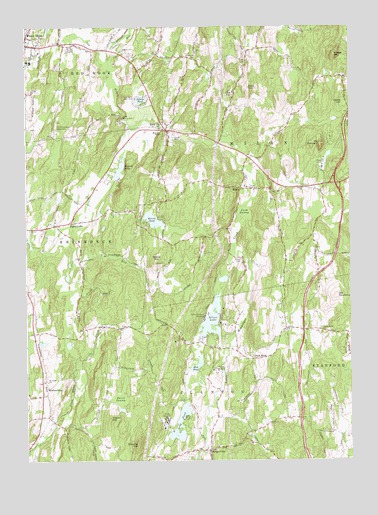
Rock City, NY USGS Topographic Map
Click on map above to begin viewing in our Map Viewer.

This topographic map contains these locations and features:
Feature Name Type Latitude Longitude GNIS ID View Map
Boice HillSummitN41.9323°W73.8249°944397View Map
Briggs MountainSummitN41.9918°W73.7554°944741View Map
Briggs School (historical)SchoolN41.9856°W73.7522°2492559View Map
Bulls HeadPopulated PlaceN41.9048°W73.7879°972279View Map
Bulls Head ChurchChurchN41.9126°W73.7607°945168View Map
Camp BoiberikLocaleN41.8870°W73.8215°945552View Map
Camp BriarLocaleN41.9015°W73.8010°945554View Map
Camp EtonLocaleN41.9815°W73.7965°945579View Map
Camp HaboninLocaleN41.9537°W73.7899°945589View Map
Camp Kanawha MinawhaLocaleN41.9162°W73.8062°945608View Map
Camp Rising SunLocaleN41.9734°W73.8376°945649View Map
Case School (historical)SchoolN41.9350°W73.7617°2492545View Map
Chimney Hill FarmLocaleN41.8767°W73.8281°2517383View Map
Clinton Alliance ChurchChurchN41.8819°W73.8038°2597678View Map
Clinton Town HallBuildingN41.8838°W73.8046°2598690View Map
Coles HillSummitN41.9781°W73.7521°947122View Map
Davis SwampSwampN41.8929°W73.8387°948074View Map
Doty HillSummitN41.9826°W73.7890°948596View Map
EighmyvillePopulated PlaceN41.9437°W73.8574°949433View Map
Homestead FarmLocaleN41.9814°W73.8494°2517390View Map
Interlake Recreational Vehicle Park CampgroundLocaleN41.9045°W73.8118°2598669View Map
Lakes KillStreamN41.9929°W73.8437°954960View Map
Long PondLakeN41.8855°W73.8156°955906View Map
Lush SwampSwampN41.9456°W73.7910°956151View Map
Marks CampLocaleN41.9606°W73.7599°956539View Map
Memorial Lutheran ChurchChurchN41.9699°W73.8230°2597679View Map
MilanPopulated PlaceN41.9534°W73.7921°957170View Map
Milan CemeteryCemeteryN41.9329°W73.7920°970355View Map
Milan Fire Department Station 2BuildingN41.9687°W73.8077°2718531View Map
Mount ConcertSummitN41.9662°W73.7612°947252View Map
Mountain View Mobile EstatesPopulated PlaceN41.9786°W73.8706°2460784View Map
Mud PondLakeN41.9023°W73.8091°958055View Map
Northern Dutchess Bible ChurchChurchN41.9928°W73.8694°2461081View Map
Northern Dutchess Christian SchoolSchoolN41.9928°W73.8694°2456026View Map
Northern Dutchess Mobile Home ParkPopulated PlaceN41.9817°W73.8697°2460785View Map
Old Rhinebeck AirportAirportN41.9700°W73.8629°978259View Map
Old RoundtopSummitN41.9223°W73.7549°959313View Map
Quaker Burial Ground - Thorpe CemeteryCemeteryN41.9625°W73.7878°2776881View Map
Red Hook Golf ClubLocaleN41.9795°W73.8326°974832View Map
Red Hook Methodist Burial GroundCemeteryN41.9970°W73.8721°2776810View Map
Rock CityPopulated PlaceN41.9704°W73.8210°962693View Map
Rock City CemeteryCemeteryN41.9706°W73.8225°2776813View Map
Round PondLakeN41.9444°W73.8262°962989View Map
Rowe Burial GroundCemeteryN41.9542°W73.7672°2776822View Map
Rowe United Methodist ChurchChurchN41.9534°W73.7679°963052View Map
Saint Paul's Lutheran CemeteryCemeteryN41.8982°W73.8672°2776823View Map
Saint Paul's Lutheran ChurchChurchN41.8981°W73.8674°964112View Map
School Number 2 (historical)SchoolN41.8925°W73.8450°2492580View Map
Schultz HillSummitN41.8798°W73.8324°964625View Map
SchultzvillePopulated PlaceN41.8776°W73.8040°1989088View Map
Sepasco LakeLakeN41.9593°W73.8384°964845View Map
Shooks PondLakeN41.9788°W73.8304°965148View Map
Shookville CemeteryCemeteryN41.9915°W73.8090°965150View Map
Silver LakeLakeN41.9157°W73.8032°965256View Map
Sky Park AirportAirportN41.9846°W73.8360°978254View Map
Teats CemeteryCemeteryN41.9908°W73.7910°967117View Map
Town of MilanCivilN41.9746°W73.7755°979218View Map
Town of Milan Wilcox Memorial Town HallBuildingN41.9551°W73.7655°2598671View Map
Traver HillSummitN41.8873°W73.8426°967763View Map
West Clinton Fire Department Station 2BuildingN41.8782°W73.8074°2718444View Map
White School (historical)SchoolN41.9622°W73.7853°2492542View Map
White School (historical)SchoolN41.9125°W73.8533°2492575View Map
Willow Glen School (historical)SchoolN41.9983°W73.7839°2492538View Map
WurtemburgPopulated PlaceN41.8959°W73.8671°973297View Map
Yeoman Burial GroundCemeteryN41.9509°W73.7537°2776818View Map

Note: Coordinates in the location and feature list above are referenced to NAD83 datum.


Copyright (C) 2008-2024 Ryan Niemi / Sunset Dynamics ... All Rights Reserved