TopoQuest Logo
Do you find TopoQuest useful?
Help keep TopoQuest running and adding new maps/features by donating!
Bitcoin:  19c7KJd3qBynnjoSw5npx9KScwjBe4ifkT
Litecoin:  LXs6TkuXGGXo1vDsWCkWVdjQX94eUKd6ui
Home View Maps Find Maps Find Places Resources & Links


Ancram, New York Topographic Map

USGS Map Title: Ancram, NY
USGS Map MRC: 42073A6
DRG (GeoTIFF) Download: o42073a6.tif


Neighboring USGS Topographic Map Quads:


  Hudson South, NY  
42073B7
 

  Claverack, NY  
42073B6
 

  Hillsdale, NY  
42073B5
 

  Clermont, NY  
42073A7
 

  Ancram, NY  
42073A6
 

  Copake, NY  
42073A5
 

  Rock City, NY  
41073H7
 

  Pine Plains, NY  
41073H6
 

  Millerton, NY  
41073H5


Map MRC Location:

N43°
W74°
N43°
W73°
H8 H7 H6 H5 H4 H3 H2 H1
G8 G7 G6 G5 G4 G3 G2 G1
F8 F7 F6 F5 F4 F3 F2 F1
E8 E7 E6 E5 E4 E3 E2 E1
D8 D7 D6 D5 D4 D3 D2 D1
C8 C7 C6 C5 C4 C3 C2 C1
B8 B7 B6 B5 B4 B3 B2 B1
A8 A7 A6 A5 A4 A3 A2 A1
N42°
W74°
N42°
W73°

Ancram, NY USGS 1:24K Topographic Map Preview:
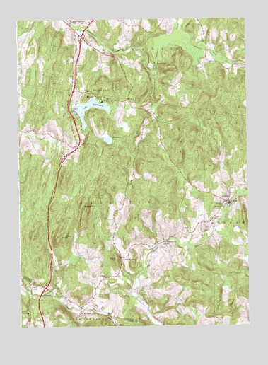
Ancram, NY USGS Topographic Map
Click on map above to begin viewing in our Map Viewer.

This topographic map contains these locations and features:
Feature Name Type Latitude Longitude GNIS ID View Map
AncramPopulated PlaceN42.0506°W73.6362°942454View Map
Ancram CemeteryCemeteryN42.0437°W73.6440°942455View Map
Ancram Post OfficePost OfficeN42.0504°W73.6379°2617792View Map
Ancram Volunteer Fire CompanyBuildingN42.0501°W73.6367°2734748View Map
Chrysler Pond OutletStreamN42.1154°W73.6651°946650View Map
Fall KillStreamN42.0126°W73.7365°949881View Map
Gallatin ChurchChurchN42.0198°W73.7035°950850View Map
GallatinvillePopulated PlaceN42.0345°W73.6707°950851View Map
Green HillSummitN42.0490°W73.7135°951682View Map
Ham BrookStreamN42.0054°W73.7026°952082View Map
Jackson CornersPopulated PlaceN42.0168°W73.7449°953880View Map
Lake TaghkanicLakeN42.0906°W73.7073°966998View Map
Lake Taghkanic State ParkParkN42.0937°W73.7076°954944View Map
Milan Fire Department Station 1BuildingN42.0168°W73.7418°2718728View Map
Mount RossPopulated PlaceN42.0051°W73.7151°957899View Map
New ForgePopulated PlaceN42.1062°W73.6746°972835View Map
Pond Lily PondReservoirN42.0768°W73.7009°960897View Map
Roeliff Jansen Kill State Multiple Use AreaParkN42.0072°W73.7367°2453467View Map
Saint John's Lutheran ChurchChurchN42.0495°W73.6393°963643View Map
School Number 10 (historical)SchoolN42.0484°W73.6398°974928View Map
School Number 4 (historical)SchoolN42.0745°W73.7146°975310View Map
Shekomeko CreekStreamN42.0129°W73.6907°965006View Map
Signal RockSummitN42.0490°W73.7135°965225View Map
SilvernailsPopulated PlaceN42.0148°W73.6832°965289View Map
Silvernails FieldAirportN42.0027°W73.6708°2717027View Map
Snake HillSummitN42.0273°W73.6973°965557View Map
Snydam CreekStreamN42.1026°W73.6773°965588View Map
Spaulding FurnacePopulated PlaceN42.0279°W73.6948°973102View Map
Taghkanic Volunteer Fire Company 1 West Taghkanic Station 1BuildingN42.1238°W73.7218°2734724View Map
Tiffany HillSummitN42.0365°W73.7254°967517View Map
Town of GallatinCivilN42.0511°W73.7103°978984View Map
Union CemeteryCemeteryN42.0493°W73.6384°968147View Map
West TaghkanicPopulated PlaceN42.1240°W73.7207°970881View Map

Note: Coordinates in the location and feature list above are referenced to NAD83 datum.


Copyright (C) 2008-2024 Ryan Niemi / Sunset Dynamics ... All Rights Reserved