TopoQuest Logo
Do you find TopoQuest useful?
Help keep TopoQuest running and adding new maps/features by donating!
Bitcoin:  19c7KJd3qBynnjoSw5npx9KScwjBe4ifkT
Litecoin:  LXs6TkuXGGXo1vDsWCkWVdjQX94eUKd6ui
Home View Maps Find Maps Find Places Resources & Links


Sacaton, Arizona Topographic Map

USGS Map Title: Sacaton, AZ
USGS Map MRC: 33111A6
DRG (GeoTIFF) Download: o33111a6.tif


Neighboring USGS Topographic Map Quads:


  Gila Butte, AZ  
33111B7
 

  Chandler Heights, AZ  
33111B6
 

  Sacaton NE, AZ  
33111B5
 

  Gila Butte SE, AZ  
33111A7
 

  Sacaton, AZ  
33111A6
 

  Blackwater, AZ  
33111A5
 

  Casa Grande West, AZ  
32111H7
 

  Casa Grande East, AZ  
32111H6
 

  Coolidge, AZ  
32111H5


Map MRC Location:

N34°
W112°
N34°
W111°
H8 H7 H6 H5 H4 H3 H2 H1
G8 G7 G6 G5 G4 G3 G2 G1
F8 F7 F6 F5 F4 F3 F2 F1
E8 E7 E6 E5 E4 E3 E2 E1
D8 D7 D6 D5 D4 D3 D2 D1
C8 C7 C6 C5 C4 C3 C2 C1
B8 B7 B6 B5 B4 B3 B2 B1
A8 A7 A6 A5 A4 A3 A2 A1
N33°
W112°
N33°
W111°

Sacaton, AZ USGS 1:24K Topographic Map Preview:
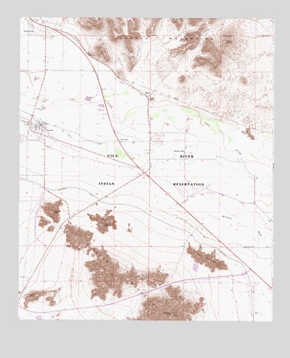
Sacaton, AZ USGS Topographic Map
Click on map above to begin viewing in our Map Viewer.

This topographic map contains these locations and features:
Feature Name Type Latitude Longitude GNIS ID View Map
Agency PeakSummitN33.0445°W111.7329°503View Map
Casa Blanca CanalCanalN33.0776°W111.7271°2500View Map
CottonwoodPopulated PlaceN33.0739°W111.7007°24386View Map
District 2CivilN33.0422°W111.6615°2418909View Map
East Sacaton CemeteryCemeteryN33.0714°W111.7357°10625View Map
Fivemile PeakSummitN33.0103°W111.7418°4649View Map
Gila River Indian Community Fire Department Station 423 SacatonBuildingN33.0794°W111.7415°2672360View Map
Granite KnobSummitN33.0789°W111.6374°5243View Map
Hayden PeakSummitN33.0395°W111.7082°5648View Map
Little Gila CanalCanalN33.0764°W111.7251°23732View Map
McClellan WashStreamN33.0514°W111.6662°7810View Map
OlbergPopulated PlaceN33.0923°W111.6862°24543View Map
Olberg Trading PostBuildingN33.0931°W111.6879°23760View Map
Pima Central SchoolSchoolN33.0809°W111.7399°9436View Map
SacatonPopulated PlaceN33.0767°W111.7393°10623View Map
Sacaton Ball Field ParkParkN33.0734°W111.7410°23794View Map
Sacaton Community ChurchChurchN33.0828°W111.7399°23795View Map
Sacaton FairgroundsParkN33.0759°W111.7437°23796View Map
Sacaton FlatsPopulated PlaceN33.0701°W111.6685°24593View Map
Sacaton Flats Community CenterBuildingN33.0664°W111.6696°23797View Map
Sacaton Flats Village Census Designated PlaceCensusN33.0559°W111.6590°2612143View Map
Sacaton PeakSummitN33.0031°W111.6746°10628View Map
Sacaton Post OfficePost OfficeN33.0815°W111.7442°2669644View Map
South SantanPopulated PlaceN33.1176°W111.7462°24624View Map
Southside CanalCanalN33.0181°W111.6371°24276View Map
Thin MountainSummitN33.0251°W111.6574°12388View Map
Upper Santan CemeteryCemeteryN33.1234°W111.7408°10694View Map
Upper Santan Village Census Designated PlaceCensusN33.1153°W111.7419°2612148View Map
Yellow PeakSummitN33.1153°W111.6482°14068View Map

Note: Coordinates in the location and feature list above are referenced to NAD83 datum.


Copyright (C) 2008-2025 Ryan Niemi / Sunset Dynamics ... All Rights Reserved