TopoQuest Logo
Do you find TopoQuest useful?
Help keep TopoQuest running and adding new maps/features by donating!
Bitcoin:  19c7KJd3qBynnjoSw5npx9KScwjBe4ifkT
Litecoin:  LXs6TkuXGGXo1vDsWCkWVdjQX94eUKd6ui
Home View Maps Find Maps Find Places Resources & Links


Savage Point, Tennessee Topographic Map

USGS Map Title: Savage Point, TN
USGS Map MRC: 35085D4
DRG (GeoTIFF) Download: o35085d4.tif


Neighboring USGS Topographic Map Quads:


  Curtistown, TN  
35085E5
 

  Smartt Mountain, TN  
35085E4
 

  Brockdell, TN  
35085E3
 

  Collins, TN  
35085D5
 

  Savage Point, TN  
35085D4
 

  Mount Airy, TN  
35085D3
 

  Palmer, TN  
35085C5
 

  Daus, TN  
35085C4
 

  Henson Gap, TN  
35085C3


Map MRC Location:

N36°
W86°
N36°
W85°
H8 H7 H6 H5 H4 H3 H2 H1
G8 G7 G6 G5 G4 G3 G2 G1
F8 F7 F6 F5 F4 F3 F2 F1
E8 E7 E6 E5 E4 E3 E2 E1
D8 D7 D6 D5 D4 D3 D2 D1
C8 C7 C6 C5 C4 C3 C2 C1
B8 B7 B6 B5 B4 B3 B2 B1
A8 A7 A6 A5 A4 A3 A2 A1
N35°
W86°
N35°
W85°

Savage Point, TN USGS 1:24K Topographic Map Preview:
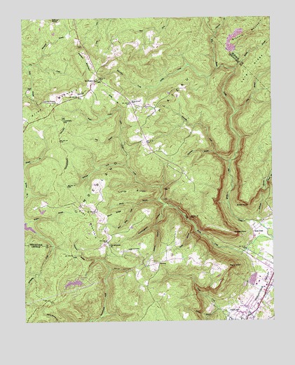
Savage Point, TN USGS Topographic Map
Click on map above to begin viewing in our Map Viewer.

This topographic map contains these locations and features:
Feature Name Type Latitude Longitude GNIS ID View Map
Anderson BranchStreamN35.4234°W85.4289°1275683View Map
Bearwallow CreekStreamN35.4717°W85.4352°1276666View Map
Boyd CreekStreamN35.4628°W85.4511°1278111View Map
Brush CreekPopulated PlaceN35.4115°W85.3847°1314751View Map
CaglePopulated PlaceN35.4751°W85.4611°1314780View Map
Cagle School (historical)SchoolN35.4731°W85.4577°1317842View Map
Cagle Volunteer Fire DepartmentBuildingN35.4732°W85.4580°2654869View Map
Commissioner District 2CivilN35.4765°W85.4175°2463970View Map
Commissioner District 4CivilN35.3912°W85.3865°2464084View Map
Commissioner District 9CivilN35.4422°W85.4838°2772127View Map
Cunningham HollowValleyN35.4229°W85.4295°1281872View Map
Deerhead DamDamN35.3917°W85.4700°1301793View Map
Deerhead LakeReservoirN35.3917°W85.4700°1301794View Map
Dunlap Division (historical)CensusN35.3756°W85.4105°1648945View Map
Ferguson BranchStreamN35.3967°W85.4569°1284202View Map
Flat MountainSummitN35.4165°W85.4652°1284408View Map
Flat Mountain ChurchChurchN35.4073°W85.4566°1284411View Map
Flatrock BranchStreamN35.4937°W85.4016°1284440View Map
FredoniaPopulated PlaceN35.3992°W85.4322°1315077View Map
Fredonia School (historical)SchoolN35.3992°W85.4333°1643947View Map
Fredonia Volunteer Fire DepartmentBuildingN35.3992°W85.4327°2654628View Map
Hester BranchStreamN35.4126°W85.4136°1287516View Map
Hurricane BranchStreamN35.4448°W85.4041°1288779View Map
Kelley CreekStreamN35.4790°W85.4016°1290005View Map
Kelly BranchStreamN35.4009°W85.4641°1290023View Map
King BranchStreamN35.4809°W85.4972°1290189View Map
King CemeteryCemeteryN35.4709°W85.4964°1290197View Map
Lands Chapel CemeteryCemeteryN35.4048°W85.4472°1290589View Map
Lands Chapel School (historical)SchoolN35.4042°W85.4477°1643950View Map
Lockhart HillSummitN35.4584°W85.4797°1291777View Map
Long BranchStreamN35.4612°W85.3927°1291900View Map
Long RidgeRidgeN35.4842°W85.3775°1269763View Map
Long RidgeRidgeN35.4287°W85.4452°1292000View Map
Mansfield BranchStreamN35.4817°W85.4925°1292595View Map
Maple BranchStreamN35.4256°W85.4314°1292610View Map
McGlothen CemeteryCemeteryN35.4653°W85.4452°1293057View Map
Mount Pleasant ChurchChurchN35.4751°W85.4619°1294759View Map
Nichols BranchStreamN35.4790°W85.3927°1295720View Map
Nichols MountainSummitN35.4981°W85.3775°1295732View Map
Pine BranchStreamN35.4512°W85.4511°1297514View Map
Price HollowValleyN35.3966°W85.4573°1298513View Map
Rankin BranchStreamN35.3801°W85.4022°1298914View Map
Reynolds CreekStreamN35.4406°W85.3964°1299259View Map
Rickett BranchStreamN35.4273°W85.4902°1275408View Map
Roberson ForkStreamN35.4395°W85.4475°1299604View Map
Rocky BranchStreamN35.4631°W85.4514°1299852View Map
Savage PointCapeN35.4112°W85.3950°1300819View Map
Sequatchie County Ambulance ServiceBuildingN35.3914°W85.3768°2654488View Map
Sequatchie County High SchoolSchoolN35.3801°W85.3869°1301069View Map
Sequatchie County Junior High SchoolSchoolN35.3790°W85.3886°1308382View Map
Sequatchie County Middle SchoolSchoolN35.3784°W85.3889°1308383View Map
Sequatchie County Sheriff's DepartmentBuildingN35.3810°W85.3910°2765994View Map
Sequatchie Fire TowerBuildingN35.4836°W85.4663°2654884View Map
Sequatchie-Bledsoe Vocational CenterSchoolN35.3790°W85.3861°1308384View Map
Short RidgeRidgeN35.4184°W85.4533°1270217View Map
Short Ridge CreekStreamN35.4228°W85.4444°1270220View Map
Signal PointCapeN35.3973°W85.3975°1270259View Map
Smith PointCapeN35.4237°W85.3877°1270701View Map
Wheeler's Apple OrchardLocaleN35.4119°W85.4233°2678199View Map
Wolfpen MountainSummitN35.4781°W85.4652°1275000View Map
Yellow Springs ChurchChurchN35.4567°W85.4372°1275291View Map

Note: Coordinates in the location and feature list above are referenced to NAD83 datum.


Copyright (C) 2008-2024 Ryan Niemi / Sunset Dynamics ... All Rights Reserved