TopoQuest Logo
Do you find TopoQuest useful?
Help keep TopoQuest running and adding new maps/features by donating!
Bitcoin:  19c7KJd3qBynnjoSw5npx9KScwjBe4ifkT
Litecoin:  LXs6TkuXGGXo1vDsWCkWVdjQX94eUKd6ui
Home View Maps Find Maps Find Places Resources & Links


Smartt Mountain, Tennessee Topographic Map

USGS Map Title: Smartt Mountain, TN
USGS Map MRC: 35085E4
DRG (GeoTIFF) Download: o35085e4.tif


Neighboring USGS Topographic Map Quads:


  Welchland, TN  
35085F5
 

  Spencer, TN  
35085F4
 

  Sampson, TN  
35085F3
 

  Curtistown, TN  
35085E5
 

  Smartt Mountain, TN  
35085E4
 

  Brockdell, TN  
35085E3
 

  Collins, TN  
35085D5
 

  Savage Point, TN  
35085D4
 

  Mount Airy, TN  
35085D3


Map MRC Location:

N36°
W86°
N36°
W85°
H8 H7 H6 H5 H4 H3 H2 H1
G8 G7 G6 G5 G4 G3 G2 G1
F8 F7 F6 F5 F4 F3 F2 F1
E8 E7 E6 E5 E4 E3 E2 E1
D8 D7 D6 D5 D4 D3 D2 D1
C8 C7 C6 C5 C4 C3 C2 C1
B8 B7 B6 B5 B4 B3 B2 B1
A8 A7 A6 A5 A4 A3 A2 A1
N35°
W86°
N35°
W85°

Smartt Mountain, TN USGS 1:24K Topographic Map Preview:
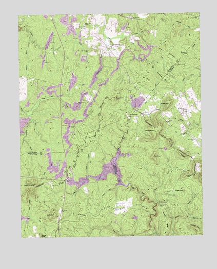
Smartt Mountain, TN USGS Topographic Map
Click on map above to begin viewing in our Map Viewer.

This topographic map contains these locations and features:
Feature Name Type Latitude Longitude GNIS ID View Map
Baltimore BranchStreamN35.5665°W85.4919°1276254View Map
Bellview ChurchChurchN35.6176°W85.4578°1276970View Map
Bird ForkStreamN35.5001°W85.4252°1277505View Map
Bird ForkStreamN35.5245°W85.4630°1649613View Map
Black MountainSummitN35.5126°W85.4769°1277584View Map
Blair CreekStreamN35.5187°W85.4080°1277642View Map
Bob CreekStreamN35.5603°W85.3830°1277859View Map
Bonner KnobSummitN35.5001°W85.4864°1277956View Map
Bouldin BranchStreamN35.6120°W85.4402°1278031View Map
Buck KnobSummitN35.5956°W85.3914°1278826View Map
Clark HollowValleyN35.5109°W85.4938°1280608View Map
Dumpling MountainSummitN35.5887°W85.3986°1283132View Map
Glady ForkStreamN35.5356°W85.4344°1285484View Map
Grape KnobSummitN35.5251°W85.3877°1285857View Map
Green Sea BranchStreamN35.5706°W85.4953°1286123View Map
Hills MountainSummitN35.5734°W85.4436°1287841View Map
HitchcoxPopulated PlaceN35.5687°W85.4141°1311061View Map
Hitchcox CemeteryCemeteryN35.5676°W85.4200°1287908View Map
Hitchcox MountainSummitN35.5590°W85.4075°1287909View Map
Jakes MountainSummitN35.5292°W85.4928°1289267View Map
Jane RidgeRidgeN35.5526°W85.3972°1289295View Map
Jordan Rock HousePillarN35.5181°W85.4066°1289845View Map
Laurel ForkStreamN35.5295°W85.4314°1290743View Map
Long ForkStreamN35.5006°W85.4069°1291937View Map
Longrock BranchStreamN35.6115°W85.4916°1292023View Map
Olio (historical)Populated PlaceN35.5487°W85.4722°1312083View Map
Piney Volunteer Fire Department Station 1BuildingN35.5629°W85.4710°2654861View Map
Piney Volunteer Fire Department Station 2BuildingN35.6235°W85.4545°2654678View Map
Pink KnobSummitN35.5445°W85.4083°1297669View Map
Rattlesnake BranchStreamN35.5101°W85.3839°1298942View Map
Robin RidgeRidgeN35.5456°W85.3886°1299679View Map
Russell RidgeRidgeN35.5084°W85.4000°1300343View Map
Smartt MountainSummitN35.5776°W85.4341°1270549View Map
Smartt Mountain MineMineN35.5956°W85.4325°1651615View Map
Smiths CoveValleyN35.6123°W85.4241°1270711View Map
Spring BranchStreamN35.5337°W85.4522°1271047View Map
Studer LakeReservoirN35.5434°W85.4783°1301908View Map
Studer Lake DamDamN35.5434°W85.4783°1301909View Map
Sutherland RidgeRidgeN35.5359°W85.3791°1271900View Map
The NarrowsRidgeN35.6031°W85.3989°1272417View Map
Vance MountainSummitN35.5337°W85.3861°1273367View Map
Walling CemeteryCemeteryN35.6076°W85.4361°1273699View Map
Whiteoak SwampsSwampN35.5175°W85.4342°1274445View Map
Wright MountainSummitN35.5751°W85.3966°1275184View Map

Note: Coordinates in the location and feature list above are referenced to NAD83 datum.


Copyright (C) 2008-2024 Ryan Niemi / Sunset Dynamics ... All Rights Reserved