TopoQuest Logo
Do you find TopoQuest useful?
Help keep TopoQuest running and adding new maps/features by donating!
Bitcoin:  19c7KJd3qBynnjoSw5npx9KScwjBe4ifkT
Litecoin:  LXs6TkuXGGXo1vDsWCkWVdjQX94eUKd6ui
Home View Maps Find Maps Find Places Resources & Links


Cape Blanco, Oregon Topographic Map

USGS Map Title: Cape Blanco, OR
USGS Map MRC: 42124G5
DRG (GeoTIFF) Download: o42124g5.tif


Neighboring USGS Topographic Map Quads:


  Floras Lake, OR  
42124H5
 

  Langlois, OR  
42124H4


  Cape Blanco, OR  
42124G5
 

  Sixes, OR  
42124G4


  Port Orford, OR  
42124F4


Map MRC Location:

N43°
W125°
N43°
W124°
H8 H7 H6 H5 H4 H3 H2 H1
G8 G7 G6 G5 G4 G3 G2 G1
F8 F7 F6 F5 F4 F3 F2 F1
E8 E7 E6 E5 E4 E3 E2 E1
D8 D7 D6 D5 D4 D3 D2 D1
C8 C7 C6 C5 C4 C3 C2 C1
B8 B7 B6 B5 B4 B3 B2 B1
A8 A7 A6 A5 A4 A3 A2 A1
N42°
W125°
N42°
W124°

Cape Blanco, OR USGS 1:24K Topographic Map Preview:
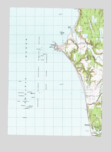
Cape Blanco, OR USGS Topographic Map
Click on map above to begin viewing in our Map Viewer.

This topographic map contains these locations and features:
Feature Name Type Latitude Longitude GNIS ID View Map
Arch RockIslandN42.7793°W124.5979°1117032View Map
Barrel RockPillarN42.8293°W124.5790°1160724View Map
Best RockIslandN42.7912°W124.5968°1117557View Map
Black RockIslandN42.8232°W124.5843°1117770View Map
Blanco ReefBarN42.8290°W124.5862°1117803View Map
Buffington Memorial ParkCemeteryN42.7512°W124.5026°1132533View Map
Cape BlancoCapeN42.8376°W124.5640°1118592View Map
Cape Blanco LighthouseBuildingN42.8366°W124.5633°1160722View Map
Cape Blanco LighthouseBuildingN42.8366°W124.5633°2661189View Map
Cape Blanco MineMineN42.8234°W124.5401°1132534View Map
Cape Blanco State AirportAirportN42.8575°W124.5197°1158828View Map
Cape Blanco State ParkParkN42.8359°W124.5429°1851917View Map
Cape Blanco State Park Boat RampLocaleN42.8448°W124.5374°2668282View Map
Castle RockIslandN42.8571°W124.5479°1118662View Map
Conical White RockIslandN42.7826°W124.6007°1119201View Map
Elk RiverStreamN42.7932°W124.5257°1141795View Map
Flat Black RockIslandN42.7784°W124.6029°1120824View Map
Flat RockIslandN42.7832°W124.6104°1120828View Map
Floras Lake State ParkParkN42.8693°W124.5243°1124663View Map
Garrison LakeLakeN42.7539°W124.5088°1142585View Map
Gull RockIslandN42.8501°W124.5573°1121483View Map
Historic Patrick Hughes HouseBuildingN42.8423°W124.5388°2661190View Map
Hughes Family CemeteryCemeteryN42.8416°W124.5427°1160727View Map
Large Brown RockIslandN42.7923°W124.6012°1122961View Map
Long Brown RockIslandN42.7915°W124.6059°1123401View Map
Mill CreekStreamN42.7554°W124.5007°1134923View Map
Needle RockPillarN42.8332°W124.5665°1160723View Map
Northwest RockIslandN42.8026°W124.6132°1124850View Map
Orford ReefBarN42.7851°W124.6148°1125040View Map
Paradise Point State ParkParkN42.7609°W124.5165°1160726View Map
Port Orford Water Treatment PlantLocaleN42.7513°W124.5017°2660781View Map
Pyramid RockIslandN42.8340°W124.5846°1125718View Map
Seaforth Post Office (historical)Post OfficeN42.8018°W124.5021°1164668View Map
Seal RockIslandN42.7871°W124.5959°1126712View Map
Sixes BeachBeachN42.8512°W124.5457°1132532View Map
Sixes RiverStreamN42.8537°W124.5440°1149567View Map
Southeast Black RockIslandN42.7673°W124.6065°1127360View Map
Split RockPillarN42.8293°W124.5840°1160725View Map
Square White RockIslandN42.7882°W124.6048°1127472View Map
Squaw BluffCliffN42.8262°W124.5179°1160720View Map
Steamboat RockIslandN42.7748°W124.6046°1127558View Map
Tituna SpitBarN42.7984°W124.5276°1135964View Map
Tseriadum State ParkParkN42.7611°W124.5153°2070798View Map
West Conical RockIslandN42.7776°W124.6009°1128818View Map

Note: Coordinates in the location and feature list above are referenced to NAD83 datum.


Copyright (C) 2008-2024 Ryan Niemi / Sunset Dynamics ... All Rights Reserved