TopoQuest Logo
Do you find TopoQuest useful?
Help keep TopoQuest running and adding new maps/features by donating!
Bitcoin:  19c7KJd3qBynnjoSw5npx9KScwjBe4ifkT
Litecoin:  LXs6TkuXGGXo1vDsWCkWVdjQX94eUKd6ui
Home View Maps Find Maps Find Places Resources & Links


Langlois, Oregon Topographic Map

USGS Map Title: Langlois, OR
USGS Map MRC: 42124H4
DRG (GeoTIFF) Download: o42124h4.tif


Neighboring USGS Topographic Map Quads:


  Bandon, OR  
43124A4
 

  Bill Peak, OR  
43124A3
 

  Floras Lake, OR  
42124H5
 

  Langlois, OR  
42124H4
 

  Calf Ranch Mountain, OR  
42124H3
 

  Cape Blanco, OR  
42124G5
 

  Sixes, OR  
42124G4
 

  Mount Butler, OR  
42124G3


Map MRC Location:

N43°
W125°
N43°
W124°
H8 H7 H6 H5 H4 H3 H2 H1
G8 G7 G6 G5 G4 G3 G2 G1
F8 F7 F6 F5 F4 F3 F2 F1
E8 E7 E6 E5 E4 E3 E2 E1
D8 D7 D6 D5 D4 D3 D2 D1
C8 C7 C6 C5 C4 C3 C2 C1
B8 B7 B6 B5 B4 B3 B2 B1
A8 A7 A6 A5 A4 A3 A2 A1
N42°
W125°
N42°
W124°

Langlois, OR USGS 1:24K Topographic Map Preview:
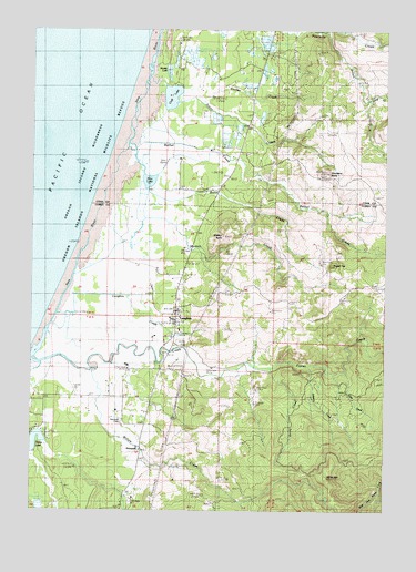
Langlois, OR USGS Topographic Map
Click on map above to begin viewing in our Map Viewer.

This topographic map contains these locations and features:
Feature Name Type Latitude Longitude GNIS ID View Map
Bethel CreekStreamN42.9701°W124.4671°1117564View Map
Blanco SchoolSchoolN42.9217°W124.4486°2416610View Map
Boulder CreekStreamN42.8901°W124.4998°1154687View Map
Butte CreekStreamN42.9526°W124.4615°1118386View Map
Clear CreekStreamN42.9118°W124.3901°1134891View Map
Conner CreekStreamN42.9823°W124.4440°1119205View Map
Croft LakeLakeN42.9827°W124.4522°1119554View Map
Davis CreekStreamN42.9798°W124.4509°1119707View Map
DenmarkPopulated PlaceN42.8907°W124.4626°1119858View Map
Denmark CemeteryCemeteryN42.8981°W124.4691°1135193View Map
Denmark Post Office (historical)Post OfficeN42.8907°W124.4626°1165145View Map
Floras CreekStreamN42.9132°W124.4973°1120843View Map
Jenny CreekStreamN42.9957°W124.4165°1132438View Map
Jim CreekStreamN42.9151°W124.4707°1132434View Map
Joe Cox CreekStreamN42.9123°W124.4304°1132437View Map
Johnson CreekStreamN42.9129°W124.4034°1134892View Map
Lakeport (historical)Populated PlaceN42.9040°W124.4971°1132435View Map
Lakeport Post Office (historical)Post OfficeN42.9040°W124.4971°1165508View Map
LangloisPopulated PlaceN42.9234°W124.4509°1122952View Map
Langlois Census Designated PlaceCensusN42.9259°W124.4532°2611739View Map
Langlois CreekStreamN42.9254°W124.4912°1122953View Map
Langlois Library DistrictBuildingN42.9213°W124.4510°2661293View Map
Langlois Post OfficePost OfficeN42.9264°W124.4508°1165516View Map
Langlois Rural Fire Protection DistrictBuildingN42.9256°W124.4485°2576890View Map
Langlois Water DistrictLocaleN42.9186°W124.4470°2660755View Map
Mill CreekStreamN42.9526°W124.4554°1132439View Map
Millard School (historical)SchoolN42.9332°W124.3890°1124179View Map
Morton ButteSummitN42.9462°W124.4338°1124377View Map
Morton CreekStreamN42.9362°W124.4862°1124378View Map
Muddy LakeLakeN42.9889°W124.4532°1134890View Map
New LakeLakeN42.9601°W124.4603°1134893View Map
Round TopSummitN42.9389°W124.3948°1126335View Map
Russell BridgeBridgeN42.9134°W124.4254°1637979View Map
South Fork Fourmile CreekStreamN42.9996°W124.3993°1127283View Map
White MountainSummitN42.8834°W124.3962°1128984View Map
Willow CreekStreamN42.9104°W124.4798°1152413View Map

Note: Coordinates in the location and feature list above are referenced to NAD83 datum.


Copyright (C) 2008-2025 Ryan Niemi / Sunset Dynamics ... All Rights Reserved