TopoQuest Logo
Do you find TopoQuest useful?
Help keep TopoQuest running and adding new maps/features by donating!
Bitcoin:  19c7KJd3qBynnjoSw5npx9KScwjBe4ifkT
Litecoin:  LXs6TkuXGGXo1vDsWCkWVdjQX94eUKd6ui
Home View Maps Find Maps Find Places Resources & Links


Cape Flattery, Washington Topographic Map

USGS Map Title: Cape Flattery, WA
USGS Map MRC: 48124D6
DRG (GeoTIFF) Download: o48124d6.tif


Neighboring USGS Topographic Map Quads:


  Cape Flattery, WA  
48124D6
 

  Waadah Island, WA  
48124D5


  Makah Bay, WA  
48124C6
 

  Neah Bay, WA  
48124C5


Map MRC Location:

N49°
W125°
N49°
W124°
H8 H7 H6 H5 H4 H3 H2 H1
G8 G7 G6 G5 G4 G3 G2 G1
F8 F7 F6 F5 F4 F3 F2 F1
E8 E7 E6 E5 E4 E3 E2 E1
D8 D7 D6 D5 D4 D3 D2 D1
C8 C7 C6 C5 C4 C3 C2 C1
B8 B7 B6 B5 B4 B3 B2 B1
A8 A7 A6 A5 A4 A3 A2 A1
N48°
W125°
N48°
W124°

Cape Flattery, WA USGS 1:24K Topographic Map Preview:
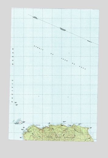
Cape Flattery, WA USGS Topographic Map
Click on map above to begin viewing in our Map Viewer.

This topographic map contains these locations and features:
Feature Name Type Latitude Longitude GNIS ID View Map
Beach CreekStreamN48.3887°W124.6947°1503213View Map
Cape FlatteryCapeN48.3831°W124.7144°1503795View Map
Cape Flattery LighthouseLocaleN48.3920°W124.7200°1531328View Map
Chibahdehl RocksBarN48.3940°W124.6761°1503949View Map
ClassetLocaleN48.3892°W124.6614°1511864View Map
ClassetPopulated PlaceN48.3865°W124.6769°1514742View Map
Classet CreekStreamN48.3887°W124.6639°1503999View Map
Duncan RockBarN48.4081°W124.7422°1504587View Map
Duntze RockIslandN48.4103°W124.7436°1510308View Map
Flattery CreekStreamN48.3831°W124.7250°1504928View Map
Fuca PillarPillarN48.3784°W124.7327°1505064View Map
Hole-in-the-WallBayN48.3851°W124.7275°1505557View Map
Jones RockBarN48.3870°W124.7316°1505865View Map
Kessiso RocksBarN48.3826°W124.7316°1505955View Map
Koitlah PointCapeN48.3881°W124.6361°1506022View Map
Kydikabbit PointCapeN48.3909°W124.6533°1530959View Map
Look-Through RockArchN48.3837°W124.7258°1679046View Map
Middle CreekStreamN48.3887°W124.6669°1506655View Map
MidwayPopulated PlaceN48.3903°W124.6739°1511153View Map
Mushroom RockBarN48.3903°W124.7130°1506906View Map
Sah-da-ped-thlRidgeN48.3892°W124.6680°1514741View Map
Scow CreekStreamN48.3792°W124.6327°1508178View Map
Slant RockBarN48.3915°W124.6941°1508405View Map
Tatoosh IslandIslandN48.3931°W124.7380°1508916View Map
Titacoclos FallsFallsN48.3887°W124.6936°1511566View Map
Warmhouse BeachBeachN48.3887°W124.6639°1510309View Map

Note: Coordinates in the location and feature list above are referenced to NAD83 datum.


Copyright (C) 2008-2025 Ryan Niemi / Sunset Dynamics ... All Rights Reserved