TopoQuest Logo
Do you find TopoQuest useful?
Help keep TopoQuest running and adding new maps/features by donating!
Bitcoin:  19c7KJd3qBynnjoSw5npx9KScwjBe4ifkT
Litecoin:  LXs6TkuXGGXo1vDsWCkWVdjQX94eUKd6ui
Home View Maps Find Maps Find Places Resources & Links


Neah Bay, Washington Topographic Map

USGS Map Title: Neah Bay, WA
USGS Map MRC: 48124C5
DRG (GeoTIFF) Download: o48124c5.tif


Neighboring USGS Topographic Map Quads:


  Cape Flattery, WA  
48124D6
 

  Waadah Island, WA  
48124D5


  Makah Bay, WA  
48124C6
 

  Neah Bay, WA  
48124C5
 

  Sekiu River, WA  
48124C4
 

  Ozette, WA  
48124B6
 

  Umbrella Creek, WA  
48124B5
 

  Hoko Falls, WA  
48124B4


Map MRC Location:

N49°
W125°
N49°
W124°
H8 H7 H6 H5 H4 H3 H2 H1
G8 G7 G6 G5 G4 G3 G2 G1
F8 F7 F6 F5 F4 F3 F2 F1
E8 E7 E6 E5 E4 E3 E2 E1
D8 D7 D6 D5 D4 D3 D2 D1
C8 C7 C6 C5 C4 C3 C2 C1
B8 B7 B6 B5 B4 B3 B2 B1
A8 A7 A6 A5 A4 A3 A2 A1
N48°
W125°
N48°
W124°

Neah Bay, WA USGS 1:24K Topographic Map Preview:
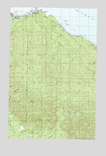
Neah Bay, WA USGS Topographic Map
Click on map above to begin viewing in our Map Viewer.

This topographic map contains these locations and features:
Feature Name Type Latitude Longitude GNIS ID View Map
Agency CreekStreamN48.3734°W124.5905°1502951View Map
Apostolic Faith ChurchChurchN48.3666°W124.6217°2609701View Map
Baada PointCapeN48.3731°W124.5908°1503089View Map
Bullman CreekStreamN48.3492°W124.5319°1503637View Map
Dtokoah PointCapeN48.3717°W124.5841°1530861View Map
Educket CreekStreamN48.3570°W124.6247°1504688View Map
First BeachBeachN48.3715°W124.5863°1510085View Map
Halfway CreekStreamN48.3673°W124.6066°1509992View Map
Klachopis PointCapeN48.3706°W124.5769°1511521View Map
Makah Bureau of Indian Affairs AgencyLocaleN48.3709°W124.5888°1511652View Map
Makah Cultural and Research CenterLocaleN48.3673°W124.6236°1514002View Map
Makah Lutheran ChurchChurchN48.3639°W124.6107°2609702View Map
Makah MarinaLocaleN48.3679°W124.6114°2610270View Map
Makah PeaksSummitN48.2940°W124.6158°1512422View Map
Miller CreekStreamN48.2617°W124.6177°1506703View Map
Neah BayPopulated PlaceN48.3681°W124.6250°1512497View Map
Neah Bay Census Designated PlaceCensusN48.3610°W124.6115°2408908View Map
Neah Bay Elementary SchoolSchoolN48.3637°W124.6220°1515052View Map
Neah Bay Post OfficePost OfficeN48.3655°W124.6071°2781691View Map
Oleho River (historical)StreamN48.3726°W124.5913°1531399View Map
Sail RiverStreamN48.3592°W124.5597°1513197View Map
Sail RockBarN48.3592°W124.5455°1507998View Map
Seal RockBarN48.3628°W124.5486°1508185View Map
Second BeachBeachN48.3706°W124.5805°1510084View Map
Snow CreekStreamN48.3540°W124.5463°1508478View Map
Third BeachBeachN48.3673°W124.5694°1508982View Map
Thirty Cent CreekStreamN48.2573°W124.6147°1508987View Map
Tsoo-Yess PeakSummitN48.2848°W124.5911°1512668View Map
Washburn RanchLocaleN48.2695°W124.6194°1509298View Map

Note: Coordinates in the location and feature list above are referenced to NAD83 datum.


Copyright (C) 2008-2025 Ryan Niemi / Sunset Dynamics ... All Rights Reserved