TopoQuest Logo
Do you find TopoQuest useful?
Help keep TopoQuest running and adding new maps/features by donating!
Bitcoin:  19c7KJd3qBynnjoSw5npx9KScwjBe4ifkT
Litecoin:  LXs6TkuXGGXo1vDsWCkWVdjQX94eUKd6ui
Home View Maps Find Maps Find Places Resources & Links


Spade Ranch, Texas Topographic Map

USGS Map Title: Spade Ranch, TX
USGS Map MRC: 32100B8
DRG (GeoTIFF) Download: o32100b8.tif


Neighboring USGS Topographic Map Quads:


  Westbrook, TX  
32101C1
 

  Lake Colorado City, TX  
32100C8
 

  Colorado City SE, TX  
32100C7
 

  Hyman NE, TX  
32101B1
 

  Spade Ranch, TX  
32100B8
 

  Pecan Crossing, TX  
32100B7
 

  Buffalo Draw, TX  
32101A1
 

  McWhorter Mountain, TX  
32100A8
 

  Dead Indian Mountain, TX  
32100A7


Map MRC Location:

N33°
W101°
N33°
W100°
H8 H7 H6 H5 H4 H3 H2 H1
G8 G7 G6 G5 G4 G3 G2 G1
F8 F7 F6 F5 F4 F3 F2 F1
E8 E7 E6 E5 E4 E3 E2 E1
D8 D7 D6 D5 D4 D3 D2 D1
C8 C7 C6 C5 C4 C3 C2 C1
B8 B7 B6 B5 B4 B3 B2 B1
A8 A7 A6 A5 A4 A3 A2 A1
N32°
W101°
N32°
W100°

Spade Ranch, TX USGS 1:24K Topographic Map Preview:
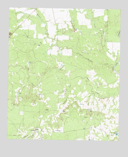
Spade Ranch, TX USGS Topographic Map
Click on map above to begin viewing in our Map Viewer.

This topographic map contains these locations and features:
Feature Name Type Latitude Longitude GNIS ID View Map
Bailey TankReservoirN32.2145°W100.9673°1329933View Map
Beals Creek TankReservoirN32.1971°W100.9777°1330191View Map
Beals MountainSummitN32.2248°W100.9987°1330192View Map
Dockrey TankReservoirN32.2087°W100.9425°1857568View Map
Dockrey Tank DamDamN32.2101°W100.9437°1857567View Map
Geneva CreekStreamN32.1701°W100.9043°1336470View Map
Geneva TankReservoirN32.1540°W100.9083°1336471View Map
Granger CreekStreamN32.1990°W100.8782°1336820View Map
Hollywood TankReservoirN32.1316°W100.8773°1337971View Map
Little Renderbrook TankReservoirN32.1339°W100.9400°1340159View Map
Little Water CreekStreamN32.1354°W100.9618°1340212View Map
Lower Renderbrook TankReservoirN32.1725°W100.9368°1340691View Map
Mason TankReservoirN32.1253°W100.9047°1341054View Map
Mud Spring WindmillLocaleN32.1535°W100.9573°1342215View Map
Red DrawValleyN32.2164°W100.9467°1344908View Map
Redbud TankReservoirN32.1524°W100.9387°1344970View Map
Renderbrook CreekStreamN32.1821°W100.9321°1345036View Map
Renderbrook SpringSpringN32.1336°W100.9686°1345037View Map
Spade RanchLocaleN32.1335°W100.9673°1347620View Map
Spade Ranch Hollywood Tank DamDamN32.1335°W100.8771°1857569View Map
Tank Number FourReservoirN32.1594°W100.9184°1348227View Map
Tank Number ThreeReservoirN32.1670°W100.9395°1348226View Map
Tank Number TwoReservoirN32.1681°W100.9631°1348225View Map
Van Zandt TanksReservoirN32.1931°W100.9425°1349190View Map
Wildcat CreekStreamN32.1798°W100.9776°1350060View Map
Wildcat TankReservoirN32.1691°W100.9883°1350073View Map
Wildcat WindmillLocaleN32.1579°W100.9918°1350079View Map
Wildhorse CreekStreamN32.1965°W100.8804°1350082View Map

Note: Coordinates in the location and feature list above are referenced to NAD83 datum.


Copyright (C) 2008-2025 Ryan Niemi / Sunset Dynamics ... All Rights Reserved