TopoQuest Logo
Do you find TopoQuest useful?
Help keep TopoQuest running and adding new maps/features by donating!
Bitcoin:  19c7KJd3qBynnjoSw5npx9KScwjBe4ifkT
Litecoin:  LXs6TkuXGGXo1vDsWCkWVdjQX94eUKd6ui
Home View Maps Find Maps Find Places Resources & Links


Storm King Mountain, Colorado Topographic Map

USGS Map Title: Storm King Mountain, CO
USGS Map MRC: 39107E4
DRG (GeoTIFF) Download: o39107e4.tif


Neighboring USGS Topographic Map Quads:


  Deep Creek Point, CO  
39107F5
 

  Adams Lake, CO  
39107F4
 

  Carbonate, CO  
39107F3
 

  New Castle, CO  
39107E5
 

  Storm King Mountain, CO  
39107E4
 

  Glenwood Springs, CO  
39107E3
 

  Gibson Gulch, CO  
39107D5
 

  Center Mountain, CO  
39107D4
 

  Cattle Creek, CO  
39107D3


Map MRC Location:

N40°
W108°
N40°
W107°
H8 H7 H6 H5 H4 H3 H2 H1
G8 G7 G6 G5 G4 G3 G2 G1
F8 F7 F6 F5 F4 F3 F2 F1
E8 E7 E6 E5 E4 E3 E2 E1
D8 D7 D6 D5 D4 D3 D2 D1
C8 C7 C6 C5 C4 C3 C2 C1
B8 B7 B6 B5 B4 B3 B2 B1
A8 A7 A6 A5 A4 A3 A2 A1
N39°
W108°
N39°
W107°

Storm King Mountain, CO USGS 1:24K Topographic Map Preview:
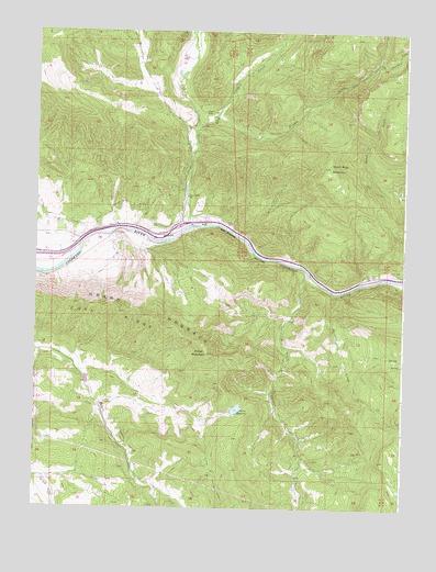
Storm King Mountain, CO USGS Topographic Map
Click on map above to begin viewing in our Map Viewer.

This topographic map contains these locations and features:
Feature Name Type Latitude Longitude GNIS ID View Map
Barton Porter DamDamN39.5266°W107.4306°199440View Map
Bearwallow CreekStreamN39.5989°W107.4467°173952View Map
Canyon CreekStreamN39.5741°W107.4476°173943View Map
Canyon Creek SchoolSchoolN39.5819°W107.4489°174068View Map
ChacraPopulated PlaceN39.5753°W107.4467°174067View Map
Chacra Census Designated PlaceCensusN39.5770°W107.4509°2583222View Map
Coal RidgeRidgeN39.5597°W107.4701°202208View Map
Dalsas MineMineN39.5219°W107.3989°1684108View Map
Dry Possum CreekStreamN39.6169°W107.3856°173974View Map
East Canyon CreekStreamN39.6000°W107.4456°173948View Map
East Canyon Creek MineMineN39.6186°W107.4156°1684109View Map
Horse MountainSummitN39.5405°W107.4420°174070View Map
Mings Chenoweth and Wolverton DitchCanalN39.5789°W107.4662°174065View Map
Okanela LodgeLocaleN39.6039°W107.4442°174063View Map
Paradise CreekStreamN39.5572°W107.3995°174074View Map
Porter ReservoirReservoirN39.5260°W107.4315°199441View Map
Possum CreekStreamN39.6014°W107.4403°173949View Map
Revelation Group MineMineN39.5708°W107.4581°1684107View Map
Roderick DitchCanalN39.5200°W107.4703°174075View Map
South Canyon CreekStreamN39.5619°W107.4081°174795View Map
South Canyon Hot SpringsSpringN39.5519°W107.4126°1794717View Map
South Canyon LandfillLocaleN39.5525°W107.4292°2678159View Map
South Canyon MineMineN39.5308°W107.4189°174071View Map
Spion Kapp DitchCanalN39.5886°W107.4503°174064View Map
Storm King MountainSummitN39.5894°W107.4009°174073View Map
Sykes and Alford DitchCanalN39.5100°W107.4398°202273View Map
Valcan DitchCanalN39.5678°W107.4642°174066View Map

Note: Coordinates in the location and feature list above are referenced to NAD83 datum.


Copyright (C) 2008-2025 Ryan Niemi / Sunset Dynamics ... All Rights Reserved