TopoQuest Logo
Do you find TopoQuest useful?
Help keep TopoQuest running and adding new maps/features by donating!
Bitcoin:  19c7KJd3qBynnjoSw5npx9KScwjBe4ifkT
Litecoin:  LXs6TkuXGGXo1vDsWCkWVdjQX94eUKd6ui
Home View Maps Find Maps Find Places Resources & Links


Cattle Creek, Colorado Topographic Map

USGS Map Title: Cattle Creek, CO
USGS Map MRC: 39107D3
DRG (GeoTIFF) Download: o39107d3.tif


Neighboring USGS Topographic Map Quads:


  Storm King Mountain, CO  
39107E4
 

  Glenwood Springs, CO  
39107E3
 

  Shoshone, CO  
39107E2
 

  Center Mountain, CO  
39107D4
 

  Cattle Creek, CO  
39107D3
 

  Carbondale, CO  
39107D2
 

  Quaker Mesa, CO  
39107C4
 

  Stony Ridge, CO  
39107C3
 

  Mount Sopris, CO  
39107C2


Map MRC Location:

N40°
W108°
N40°
W107°
H8 H7 H6 H5 H4 H3 H2 H1
G8 G7 G6 G5 G4 G3 G2 G1
F8 F7 F6 F5 F4 F3 F2 F1
E8 E7 E6 E5 E4 E3 E2 E1
D8 D7 D6 D5 D4 D3 D2 D1
C8 C7 C6 C5 C4 C3 C2 C1
B8 B7 B6 B5 B4 B3 B2 B1
A8 A7 A6 A5 A4 A3 A2 A1
N39°
W108°
N39°
W107°

Cattle Creek, CO USGS 1:24K Topographic Map Preview:
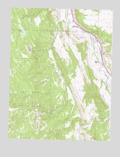
Cattle Creek, CO USGS Topographic Map
Click on map above to begin viewing in our Map Viewer.

This topographic map contains these locations and features:
Feature Name Type Latitude Longitude GNIS ID View Map
Babbish GulchValleyN39.4029°W107.3537°174817View Map
Black Diamond MineMineN39.4586°W107.3448°174821View Map
Carbondale and Rural Fire Protection District Station 8400 Glenwood SpringsBuildingN39.4701°W107.2715°2667040View Map
Cattle CreekStreamN39.4628°W107.2709°174826View Map
Cattle CreekPopulated PlaceN39.4583°W107.2626°174822View Map
Cattle Creek Census Designated PlaceCensusN39.4666°W107.2599°2583221View Map
Crystal River RanchLocaleN39.3986°W107.2517°174827View Map
Dry ParkFlatN39.4275°W107.2901°174814View Map
Foraker MineMineN39.4339°W107.3517°1684123View Map
Four Mile MineMineN39.4000°W107.3159°1684122View Map
Fourmile CreekStreamN39.4858°W107.3048°174811View Map
Fourmile Gaging StationLocaleN39.4008°W107.3245°174819View Map
Freeman CreekStreamN39.4311°W107.3067°174813View Map
Glenwood DitchCanalN39.4778°W107.2784°202276View Map
Hughes DamDamN39.4778°W107.3603°199410View Map
Hughes ReservoirReservoirN39.4780°W107.3606°174815View Map
Kaiser-Sievers DitchCanalN39.4230°W107.2534°202274View Map
KREG-TV (Glenwood Springs)TowerN39.4180°W107.3676°204229View Map
Midland MineMineN39.4005°W107.3203°1684124View Map
Mule GulchValleyN39.4006°W107.3304°174820View Map
Overland MineMineN39.4389°W107.3420°1684125View Map
Pocahontas MineMineN39.4122°W107.3217°1684126View Map
South Branch Edgerton CreekStreamN39.3900°W107.2806°174824View Map
Sunlight MineMineN39.4019°W107.3217°174818View Map

Note: Coordinates in the location and feature list above are referenced to NAD83 datum.


Copyright (C) 2008-2025 Ryan Niemi / Sunset Dynamics ... All Rights Reserved