TopoQuest Logo
Do you find TopoQuest useful?
Help keep TopoQuest running and adding new maps/features by donating!
Bitcoin:  19c7KJd3qBynnjoSw5npx9KScwjBe4ifkT
Litecoin:  LXs6TkuXGGXo1vDsWCkWVdjQX94eUKd6ui
Home View Maps Find Maps Find Places Resources & Links


Superior, Nebraska Topographic Map

USGS Map Title: Superior, NE
USGS Map MRC: 40098A1
DRG (GeoTIFF) Download: o40098a1.tif


Neighboring USGS Topographic Map Quads:


  Mount Clare, NE  
40098B2
 

  Nelson, NE  
40098B1
 

  Oak, NE  
40097B8
 

  Bostwick, NE  
40098A2
 

  Superior, NE  
40098A1
 

  Hardy, NE  
40097A8
 

  Mankato NW, KS  
39098H2
 

  Webber, KS  
39098H1
 

  Scandia NW, KS  
39097H8


Map MRC Location:

N41°
W99°
N41°
W98°
H8 H7 H6 H5 H4 H3 H2 H1
G8 G7 G6 G5 G4 G3 G2 G1
F8 F7 F6 F5 F4 F3 F2 F1
E8 E7 E6 E5 E4 E3 E2 E1
D8 D7 D6 D5 D4 D3 D2 D1
C8 C7 C6 C5 C4 C3 C2 C1
B8 B7 B6 B5 B4 B3 B2 B1
A8 A7 A6 A5 A4 A3 A2 A1
N40°
W99°
N40°
W98°

Superior, NE USGS 1:24K Topographic Map Preview:
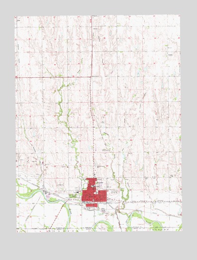
Superior, NE USGS Topographic Map
Click on map above to begin viewing in our Map Viewer.

This topographic map contains these locations and features:
Feature Name Type Latitude Longitude GNIS ID View Map
Abdal (historical)Populated PlaceN40.1222°W98.1234°1882649View Map
Abdal (historical)LocaleN40.1222°W98.1234°1882651View Map
Abdal Grain Company ElevatorLocaleN40.1222°W98.1234°1882652View Map
Abdal Post Office (historical)Post OfficeN40.1222°W98.1234°1882650View Map
Agrex Incorporated ElevatorLocaleN40.0189°W98.0512°1882666View Map
Beaver-Ville SchoolSchoolN40.0900°W98.0673°827267View Map
Blakely CreekStreamN40.0375°W98.0517°827482View Map
Brodstone Memorial HospitalHospitalN40.0264°W98.0660°1882674View Map
CadamsPopulated PlaceN40.1039°W98.0100°835265View Map
Cadams (historical)LocaleN40.1039°W98.0100°1882641View Map
Cadams Post Office (historical)Post OfficeN40.1039°W98.0100°1882642View Map
Centennial Lutheran ChurchChurchN40.0247°W98.0678°1882682View Map
Church of ChristChurchN40.0203°W98.0656°1882685View Map
Church of the NazareneChurchN40.0233°W98.0625°1882687View Map
City of SuperiorCivilN40.0230°W98.0663°2396009View Map
First Baptist ChurchChurchN40.0217°W98.0698°1882681View Map
First Presbyterian ChurchChurchN40.0217°W98.0717°1882680View Map
Grace Community Evangelical Free ChurchChurchN40.0208°W98.0664°1882686View Map
Grummert DamDamN40.1134°W98.0532°1767408View Map
Grummert ReservoirReservoirN40.1146°W98.0529°1767409View Map
Higer DamDamN40.0894°W98.0328°1767220View Map
Higer ReservoirLakeN40.0915°W98.0323°1767221View Map
KRFS-AM (Superior)TowerN40.0250°W98.0775°837367View Map
KRFS-FM (Superior)TowerN40.0250°W98.0775°837435View Map
Ladies Evergreen CemeteryCemeteryN40.0375°W98.0653°830577View Map
Lamppost MallLocaleN40.0195°W98.0717°1882670View Map
Lincoln ParkParkN40.0206°W98.0828°830726View Map
Lincoln Park CampgroundLocaleN40.0206°W98.0828°1882689View Map
Living Faith Fellowship ChurchChurchN40.0195°W98.0717°1882679View Map
Lost CreekStreamN40.0156°W98.0867°830906View Map
North Ward Elementary SchoolSchoolN40.0264°W98.0670°831747View Map
Nuckolls County Historical Society MuseumBuildingN40.0222°W98.0648°1882669View Map
Oak CreekStreamN40.0178°W98.0437°831795View Map
Old Mill Race CanalCanalN40.0145°W98.0756°831855View Map
Olive Hill CongregationChurchN40.0208°W98.0700°1882688View Map
Our Redeemer Lutheran ChurchChurchN40.0211°W98.0689°1882684View Map
Rempe Private AirportAirportN40.0927°W98.0645°2675750View Map
Saint Josephs Catholic ChurchChurchN40.0306°W98.0728°1882678View Map
Saul DamDamN40.0133°W98.0003°1767184View Map
Saul ReservoirReservoirN40.0133°W98.0003°1767185View Map
SmyrnaPopulated PlaceN40.1186°W98.0673°835448View Map
Smyrna (historical)LocaleN40.1186°W98.0673°1882630View Map
Smyrna Post Office (historical)Post OfficeN40.1186°W98.0673°1882629View Map
South Ward Elementary SchoolSchoolN40.0181°W98.0670°833626View Map
SuperiorLocaleN40.0172°W98.0717°1882665View Map
SuperiorPopulated PlaceN40.0208°W98.0700°833952View Map
Superior CanalCanalN40.0256°W98.0848°833953View Map
Superior City ParkParkN40.0222°W98.0648°1882690View Map
Superior Country ClubLocaleN40.0639°W98.0587°1882673View Map
Superior Family Medical CenterHospitalN40.0264°W98.0642°1882676View Map
Superior Good Samaritan CenterHospitalN40.0331°W98.0659°1882675View Map
Superior Municipal AirportAirportN40.0480°W98.0648°837725View Map
Superior Police DepartmentBuildingN40.0208°W98.0698°1882668View Map
Superior Post OfficePost OfficeN40.0201°W98.0697°1882671View Map
Superior Public LibraryBuildingN40.0206°W98.0689°1882672View Map
Superior Rural Fire Protection DistrictBuildingN40.0211°W98.0723°2553243View Map
Superior Secondary SchoolSchoolN40.0231°W98.0787°1882691View Map
Superior Vision ClinicHospitalN40.0197°W98.0712°1882677View Map
Superior Volunteer Fire DepartmentBuildingN40.0212°W98.0722°1882667View Map
Superior Volunteer Rescue SquadBuildingN40.0211°W98.0723°2553681View Map
United Methodist ChurchChurchN40.0206°W98.0681°1882683View Map

Note: Coordinates in the location and feature list above are referenced to NAD83 datum.


Copyright (C) 2008-2024 Ryan Niemi / Sunset Dynamics ... All Rights Reserved