TopoQuest Logo
Do you find TopoQuest useful?
Help keep TopoQuest running and adding new maps/features by donating!
Bitcoin:  19c7KJd3qBynnjoSw5npx9KScwjBe4ifkT
Litecoin:  LXs6TkuXGGXo1vDsWCkWVdjQX94eUKd6ui
Home View Maps Find Maps Find Places Resources & Links


Tin Creek, Montana Topographic Map

USGS Map Title: Tin Creek, MT
USGS Map MRC: 47113H5
DRG (GeoTIFF) Download: o47113h5.tif


Neighboring USGS Topographic Map Quads:


  Quintonkon, MT  
48113A6
 

  Circus Peak, MT  
48113A5
 

  Horseshoe Peak, MT  
48113A4
 

  Connor Creek, MT  
47113H6
 

  Tin Creek, MT  
47113H5
 

  Spotted Bear Mountain, MT  
47113H4
 

  Thunderbolt Mountain, MT  
47113G6
 

  String Creek, MT  
47113G5
 

  Meadow Creek, MT  
47113G4


Map MRC Location:

N48°
W114°
N48°
W113°
H8 H7 H6 H5 H4 H3 H2 H1
G8 G7 G6 G5 G4 G3 G2 G1
F8 F7 F6 F5 F4 F3 F2 F1
E8 E7 E6 E5 E4 E3 E2 E1
D8 D7 D6 D5 D4 D3 D2 D1
C8 C7 C6 C5 C4 C3 C2 C1
B8 B7 B6 B5 B4 B3 B2 B1
A8 A7 A6 A5 A4 A3 A2 A1
N47°
W114°
N47°
W113°

Tin Creek, MT USGS 1:24K Topographic Map Preview:
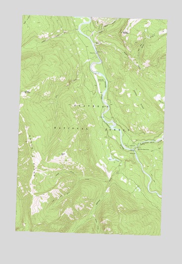
Tin Creek, MT USGS Topographic Map
Click on map above to begin viewing in our Map Viewer.

This topographic map contains these locations and features:
Feature Name Type Latitude Longitude GNIS ID View Map
Addition CreekStreamN47.9177°W113.5220°778872View Map
Beacon MountainSummitN47.9916°W113.5384°779459View Map
Billy R Garrett Memorial BridgeBridgeN47.9449°W113.5529°794234View Map
Bruce CreekStreamN47.9052°W113.5462°780472View Map
Bruce MeadowsFlatN47.9083°W113.5279°794233View Map
Bruce RidgeRidgeN47.9186°W113.6134°780475View Map
Horse RidgeRidgeN47.9527°W113.5237°785062View Map
Little CreekStreamN47.8858°W113.5609°786279View Map
Lower Twin CreekStreamN47.9886°W113.5673°786683View Map
North CreekStreamN47.9752°W113.5287°788080View Map
Red CreekStreamN47.9169°W113.5331°789447View Map
Soldier CreekStreamN47.9922°W113.5762°790837View Map
Soldier MountainSummitN47.9555°W113.6218°790839View Map
South Fork River AccessLocaleN47.9316°W113.5368°794235View Map
Spotted Bear CampgroundLocaleN47.9263°W113.5276°799077View Map
Spotted Bear Ranger StationLocaleN47.9249°W113.5234°791180View Map
Spotted Bear RiverStreamN47.9247°W113.5270°799022View Map
Spotted Bear USFS AirportAirportN47.9669°W113.5625°798823View Map
Stony CreekStreamN47.9063°W113.5709°791551View Map
Stony HillSummitN47.9205°W113.5887°791554View Map
Tin CreekStreamN47.9772°W113.5595°792206View Map
Twin CreekStreamN47.9849°W113.5629°792508View Map

Note: Coordinates in the location and feature list above are referenced to NAD83 datum.


Copyright (C) 2008-2025 Ryan Niemi / Sunset Dynamics ... All Rights Reserved