TopoQuest Logo
Do you find TopoQuest useful?
Help keep TopoQuest running and adding new maps/features by donating!
Bitcoin:  19c7KJd3qBynnjoSw5npx9KScwjBe4ifkT
Litecoin:  LXs6TkuXGGXo1vDsWCkWVdjQX94eUKd6ui
Home View Maps Find Maps Find Places Resources & Links


Tony Peak, Montana Topographic Map

USGS Map Title: Tony Peak, MT
USGS Map MRC: 48115C3
DRG (GeoTIFF) Download: o48115c3.tif


Neighboring USGS Topographic Map Quads:


  Vermiculite Mountain, MT  
48115D4
 

  Alexander Mountain, MT  
48115D3
 

  Cripple Horse Mountain, MT  
48115D2
 

  Swede Mountain, MT  
48115C4
 

  Tony Peak, MT  
48115C3
 

  Richards Mountain, MT  
48115C2
 

  Horse Mountain, MT  
48115B4
 

  Fisher Mountain, MT  
48115B3
 

  Calx Mountain, MT  
48115B2


Map MRC Location:

N49°
W116°
N49°
W115°
H8 H7 H6 H5 H4 H3 H2 H1
G8 G7 G6 G5 G4 G3 G2 G1
F8 F7 F6 F5 F4 F3 F2 F1
E8 E7 E6 E5 E4 E3 E2 E1
D8 D7 D6 D5 D4 D3 D2 D1
C8 C7 C6 C5 C4 C3 C2 C1
B8 B7 B6 B5 B4 B3 B2 B1
A8 A7 A6 A5 A4 A3 A2 A1
N48°
W116°
N48°
W115°

Tony Peak, MT USGS 1:24K Topographic Map Preview:
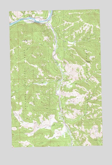
Tony Peak, MT USGS Topographic Map
Click on map above to begin viewing in our Map Viewer.

This topographic map contains these locations and features:
Feature Name Type Latitude Longitude GNIS ID View Map
Alder CreekStreamN48.3072°W115.3063°778924View Map
Big BendBendN48.3666°W115.3299°779761View Map
Big Bend RV ParkLocaleN48.3661°W115.3191°1782374View Map
Blackwell FlatsFlatN48.3666°W115.3260°1782392View Map
Buck CreekStreamN48.3111°W115.3063°780512View Map
Butler CreekStreamN48.3438°W115.3124°780684View Map
Canoe GulchValleyN48.3680°W115.3543°780888View Map
Canoe Gulch Ranger StationLocaleN48.3697°W115.3488°1782395View Map
Cody CreekStreamN48.2727°W115.3029°781469View Map
Doe CreekStreamN48.2702°W115.3024°782434View Map
Fawn CreekStreamN48.2666°W115.2977°783327View Map
Fisher RiverStreamN48.3655°W115.3235°783461View Map
JenningsPopulated PlaceN48.3655°W115.3446°785454View Map
Jennings (historical)LocaleN48.3655°W115.3446°1782422View Map
Jennings Post Office (historical)Post OfficeN48.3655°W115.3446°1782314View Map
Jennings School (historical)SchoolN48.3655°W115.3446°1782421View Map
Kootenai Post (historical)LocaleN48.3666°W115.3343°1782426View Map
Libby DivisionCivilN48.3358°W115.3435°1940659View Map
Peoples CreekStreamN48.3383°W115.3143°788757View Map
Reinshagen GulchValleyN48.3661°W115.3663°789522View Map
RiverviewLocaleN48.3611°W115.3204°1782443View Map
Riverview MountainSummitN48.3269°W115.2710°789613View Map
Scotchville (historical)Populated PlaceN48.3000°W115.3079°1782438View Map
Sportsmans RV ParkLocaleN48.3666°W115.3677°1782373View Map
Sterling GulchValleyN48.2508°W115.2521°791495View Map
Tony PeakSummitN48.3477°W115.3543°792270View Map
Tony Peak Lookout (historical)LocaleN48.3475°W115.3549°794405View Map
Wing CreekStreamN48.2847°W115.3082°793416View Map

Note: Coordinates in the location and feature list above are referenced to NAD83 datum.


Copyright (C) 2008-2025 Ryan Niemi / Sunset Dynamics ... All Rights Reserved