TopoQuest Logo
Do you find TopoQuest useful?
Help keep TopoQuest running and adding new maps/features by donating!
Bitcoin:  19c7KJd3qBynnjoSw5npx9KScwjBe4ifkT
Litecoin:  LXs6TkuXGGXo1vDsWCkWVdjQX94eUKd6ui
Home View Maps Find Maps Find Places Resources & Links


Tripp Canyon, Arizona Topographic Map

USGS Map Title: Tripp Canyon, AZ
USGS Map MRC: 32110G1
DRG (GeoTIFF) Download: o32110g1.tif


Neighboring USGS Topographic Map Quads:


  Jackson Mountain, AZ  
32110H2
 

  Telegraph Wash, AZ  
32110H1
 

  Eden, AZ  
32109H8
 

  Buford Hill, AZ  
32110G2
 

  Tripp Canyon, AZ  
32110G1
 

  Shingle Mill Mountain, AZ  
32109G8
 

  Eureka Ranch, AZ  
32110F2
 

  Blue Jay Peak, AZ  
32110F1
 

  Webb Peak, AZ  
32109F8


Map MRC Location:

N33°
W111°
N33°
W110°
H8 H7 H6 H5 H4 H3 H2 H1
G8 G7 G6 G5 G4 G3 G2 G1
F8 F7 F6 F5 F4 F3 F2 F1
E8 E7 E6 E5 E4 E3 E2 E1
D8 D7 D6 D5 D4 D3 D2 D1
C8 C7 C6 C5 C4 C3 C2 C1
B8 B7 B6 B5 B4 B3 B2 B1
A8 A7 A6 A5 A4 A3 A2 A1
N32°
W111°
N32°
W110°

Tripp Canyon, AZ USGS 1:24K Topographic Map Preview:
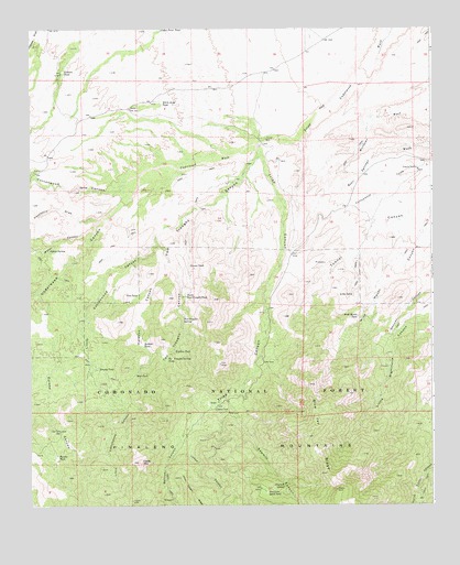
Tripp Canyon, AZ USGS Topographic Map
Click on map above to begin viewing in our Map Viewer.

This topographic map contains these locations and features:
Feature Name Type Latitude Longitude GNIS ID View Map
Bellows CanyonValleyN32.7701°W110.0765°1225View Map
Blue Jay RidgeRidgeN32.7587°W110.0334°1706View Map
Brushy TankReservoirN32.7860°W110.1041°2045View Map
Cedar MountainSummitN32.7615°W110.0915°2631View Map
Cedar Point TankReservoirN32.8749°W110.0845°2635View Map
Cottonwood CanyonValleyN32.8320°W110.1034°3319View Map
Deer TankReservoirN32.7842°W110.0926°3817View Map
Dry Lake Stock TankReservoirN32.7533°W110.0518°4148View Map
Eureka CanyonValleyN32.7942°W110.1184°4508View Map
Eureka TankReservoirN32.7627°W110.1170°4513View Map
Gibbs TankReservoirN32.8051°W110.0249°5003View Map
Grama TankReservoirN32.8130°W110.0759°5208View Map
Hackberry DrawValleyN32.8251°W110.1048°5472View Map
Holdout CanyonValleyN32.8123°W110.0834°5874View Map
Holdout TankReservoirN32.7918°W110.0901°5878View Map
Indian SpringSpringN32.8169°W110.1193°6227View Map
Iron Tank WellWellN32.7698°W110.1162°6267View Map
Johns CanyonValleyN32.7637°W110.0759°6465View Map
Ladrone TankReservoirN32.8636°W110.1146°6826View Map
Little Cottonwood CanyonValleyN32.8181°W110.0870°7097View Map
Little Righthand CanyonValleyN32.7987°W110.0062°7168View Map
Lower Two Troughs TankReservoirN32.8115°W110.0756°22560View Map
North Two Troughs TankReservoirN32.8049°W110.0767°8793View Map
Otto TankReservoirN32.8051°W110.0917°9026View Map
Pipeline TankReservoirN32.7906°W110.0806°9533View Map
Sawmill CanyonValleyN32.7742°W110.0623°10976View Map
Sawmill SpringSpringN32.7547°W110.0464°10983View Map
Sawmill Water Storage TankReservoirN32.7751°W110.0679°22650View Map
Section Twenty-eight TankReservoirN32.7987°W110.1079°22651View Map
Tripp CanyonValleyN32.8440°W110.0529°12729View Map
Two Troughs CanyonValleyN32.8445°W110.0531°13009View Map
Two Troughs SpringSpringN32.7986°W110.0779°13010View Map
Two Troughs Spring TankReservoirN32.7884°W110.0829°12910View Map
Underwood CanyonValleyN32.8365°W110.0912°13035View Map
Underwood WashStreamN32.8445°W110.0542°13036View Map
Water CanyonValleyN32.8217°W110.1070°13377View Map
White Hills TankReservoirN32.8555°W110.0839°13626View Map
Wide Mouth TankReservoirN32.7995°W110.0235°13737View Map

Note: Coordinates in the location and feature list above are referenced to NAD83 datum.


Copyright (C) 2008-2024 Ryan Niemi / Sunset Dynamics ... All Rights Reserved