TopoQuest Logo
Do you find TopoQuest useful?
Help keep TopoQuest running and adding new maps/features by donating!
Bitcoin:  19c7KJd3qBynnjoSw5npx9KScwjBe4ifkT
Litecoin:  LXs6TkuXGGXo1vDsWCkWVdjQX94eUKd6ui
Home View Maps Find Maps Find Places Resources & Links


Vernon, Arizona Topographic Map

USGS Map Title: Vernon, AZ
USGS Map MRC: 34109C6
DRG (GeoTIFF) Download: o34109c6.tif


Neighboring USGS Topographic Map Quads:


  Mesa Redonda, AZ  
34109D7
 

  Concho Lake, AZ  
34109D6
 

  Concho, AZ  
34109D5
 

  Ortega Mountain, AZ  
34109C7
 

  Vernon, AZ  
34109C6
 

  Cerro Hueco, AZ  
34109C5
 

  Sponseller Mountain, AZ  
34109B7
 

  Boundary Butte, AZ  
34109B6
 

  Whiting Knoll, AZ  
34109B5


Map MRC Location:

N35°
W110°
N35°
W109°
H8 H7 H6 H5 H4 H3 H2 H1
G8 G7 G6 G5 G4 G3 G2 G1
F8 F7 F6 F5 F4 F3 F2 F1
E8 E7 E6 E5 E4 E3 E2 E1
D8 D7 D6 D5 D4 D3 D2 D1
C8 C7 C6 C5 C4 C3 C2 C1
B8 B7 B6 B5 B4 B3 B2 B1
A8 A7 A6 A5 A4 A3 A2 A1
N34°
W110°
N34°
W109°

Vernon, AZ USGS 1:24K Topographic Map Preview:
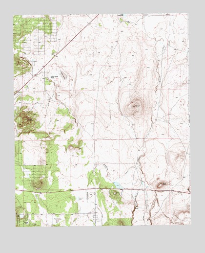
Vernon, AZ USGS Topographic Map
Click on map above to begin viewing in our Map Viewer.

This topographic map contains these locations and features:
Feature Name Type Latitude Longitude GNIS ID View Map
Anderson LakeLakeN34.2665°W109.7056°25647View Map
BannonLocaleN34.2539°W109.7426°25953View Map
Burnt KnollSummitN34.2745°W109.6451°27030View Map
Dutch MountainSummitN34.3134°W109.7398°28699View Map
FloyLocaleN34.3373°W109.7279°29074View Map
Laguna SaladaLakeN34.3391°W109.7146°30840View Map
Laguna Salada SpringSpringN34.3384°W109.7240°30841View Map
Lake HoleLakeN34.2569°W109.7457°30065View Map
Sepulveda CreekStreamN34.2867°W109.6609°34262View Map
Smooth KnollSummitN34.3203°W109.6634°34573View Map
VernonPopulated PlaceN34.2575°W109.6929°35771View Map
Vernon Census Designated PlaceCensusN34.2508°W109.6926°2582891View Map
Vernon Post OfficePost OfficeN34.2707°W109.6927°2783317View Map
Vernon Post Office (historical)Post OfficeN34.2575°W109.6929°2026816View Map
Vernon Public LibraryBuildingN34.2547°W109.6928°2669484View Map
White Mountain Ultralight FlightparkAirportN34.3690°W109.6985°2717348View Map
Whiting WashValleyN34.2764°W109.6601°39186View Map

Note: Coordinates in the location and feature list above are referenced to NAD83 datum.


Copyright (C) 2008-2024 Ryan Niemi / Sunset Dynamics ... All Rights Reserved