TopoQuest Logo
Do you find TopoQuest useful?
Help keep TopoQuest running and adding new maps/features by donating!
Bitcoin:  19c7KJd3qBynnjoSw5npx9KScwjBe4ifkT
Litecoin:  LXs6TkuXGGXo1vDsWCkWVdjQX94eUKd6ui
Home View Maps Find Maps Find Places Resources & Links


Boundary Butte, Arizona Topographic Map

USGS Map Title: Boundary Butte, AZ
USGS Map MRC: 34109B6
DRG (GeoTIFF) Download: o34109b6.tif


Neighboring USGS Topographic Map Quads:


  Ortega Mountain, AZ  
34109C7
 

  Vernon, AZ  
34109C6
 

  Cerro Hueco, AZ  
34109C5
 

  Sponseller Mountain, AZ  
34109B7
 

  Boundary Butte, AZ  
34109B6
 

  Whiting Knoll, AZ  
34109B5
 

  McNary, AZ  
34109A7
 

  Horseshoe Cienega, AZ  
34109A6
 

  Greens Peak, AZ  
34109A5


Map MRC Location:

N35°
W110°
N35°
W109°
H8 H7 H6 H5 H4 H3 H2 H1
G8 G7 G6 G5 G4 G3 G2 G1
F8 F7 F6 F5 F4 F3 F2 F1
E8 E7 E6 E5 E4 E3 E2 E1
D8 D7 D6 D5 D4 D3 D2 D1
C8 C7 C6 C5 C4 C3 C2 C1
B8 B7 B6 B5 B4 B3 B2 B1
A8 A7 A6 A5 A4 A3 A2 A1
N34°
W110°
N34°
W109°

Boundary Butte, AZ USGS 1:24K Topographic Map Preview:
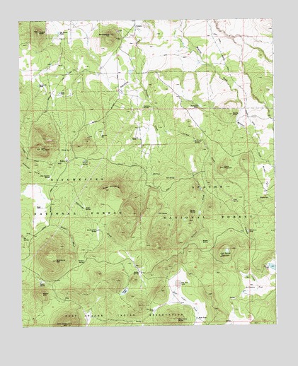
Boundary Butte, AZ USGS Topographic Map
Click on map above to begin viewing in our Map Viewer.

This topographic map contains these locations and features:
Feature Name Type Latitude Longitude GNIS ID View Map
Aniceto Cinder PitBasinN34.2023°W109.7165°44739View Map
Aniceto KnollSummitN34.1989°W109.7193°44744View Map
Aniceto SpringSpringN34.2031°W109.7101°25659View Map
Aniceto TankReservoirN34.2047°W109.7099°44740View Map
Antelope HillsSummitN34.1884°W109.7462°25670View Map
Arab TankReservoirN34.2206°W109.7303°25733View Map
Aspen SpringSpringN34.1734°W109.7187°25824View Map
Bear TankReservoirN34.1488°W109.6627°44746View Map
Bosque SpringSpringN34.1592°W109.6584°26626View Map
Bosque TankReservoirN34.1607°W109.6578°44764View Map
Boundary ButteSummitN34.1278°W109.6745°1877View Map
Boundary Spring TankReservoirN34.1762°W109.6463°39010View Map
Boundary TankReservoirN34.1762°W109.6463°44750View Map
Boundary TanksReservoirN34.1634°W109.6387°26667View Map
Brady ParkFlatN34.1853°W109.6298°26714View Map
Brady SpringSpringN34.1770°W109.6284°26715View Map
Brown WashStreamN34.1656°W109.7312°26793View Map
Buckelew SpringSpringN34.2003°W109.6645°26897View Map
Butler MountainSummitN34.1806°W109.7084°27080View Map
Butler TakReservoirN34.1931°W109.6907°44751View Map
Butte TankReservoirN34.1278°W109.6644°27088View Map
Carlock RanchLocaleN34.2017°W109.6926°27286View Map
Casimero SpringSpringN34.2142°W109.6895°27326View Map
Cerro Gordon MountainSummitN34.1262°W109.7276°27472View Map
Circle TankReservoirN34.2142°W109.6611°44738View Map
Coon MountainSummitN34.1892°W109.6501°27887View Map
Coon SpringSpringN34.1759°W109.6459°27890View Map
Elk TankReservoirN34.1871°W109.6854°28861View Map
Firebox SpringSpringN34.1516°W109.7193°29008View Map
Garris KnollSummitN34.2112°W109.6457°29269View Map
Gillespie FlatFlatN34.1403°W109.6348°29324View Map
Gillespie SpringSpringN34.1973°W109.6962°44756View Map
Gillespie TankReservoirN34.1386°W109.6417°44755View Map
Goodman SpringSpringN34.2020°W109.6990°1853741View Map
Gust ReservoirReservoirN34.1809°W109.6619°44748View Map
Gust SpringSpringN34.1703°W109.6623°44749View Map
Harris LakeLakeN34.1480°W109.6263°29762View Map
Jog TankReservoirN34.2171°W109.7071°44743View Map
Juan Garcia MountainSummitN34.1528°W109.6509°30628View Map
Lee SpringSpringN34.1995°W109.6982°1853740View Map
Lee TankReservoirN34.2006°W109.6954°44745View Map
McKay SpringSpringN34.1931°W109.7265°31674View Map
Mineral DitchCanalN34.2262°W109.6459°31907View Map
Naegle RanchLocaleN34.1734°W109.7398°32252View Map
Naegle TankReservoirN34.1752°W109.7417°39093View Map
Oak SpringSpringN34.1850°W109.6745°32459View Map
Ojo Bonito TankReservoirN34.2451°W109.7304°32485View Map
Pancho SpringReservoirN34.1925°W109.7187°39104View Map
Pancho SpringSpringN34.1923°W109.7198°32655View Map
Pancho TankReservoirN34.1927°W109.7185°44752View Map
Pierce MountainSummitN34.1434°W109.7404°32877View Map
Pierce SpringSpringN34.1424°W109.7415°32879View Map
Pine SpringReservoirN34.1715°W109.6824°39108View Map
Pine SpringSpringN34.1709°W109.6829°32970View Map
Pit SpringSpringN34.1621°W109.7489°33038View Map
Porcupine TankReservoirN34.2149°W109.6620°33109View Map
Porter LakeLakeN34.1392°W109.6998°33113View Map
Porter SpringSpringN34.1470°W109.6923°33116View Map
Private TankReservoirN34.2487°W109.7348°44741View Map
Pulcifer CreekStreamN34.2384°W109.6912°33223View Map
Quakie Patch SpringSpringN34.1639°W109.7129°33258View Map
San Juan FlatFlatN34.1375°W109.6701°34015View Map
San Juan LakeLakeN34.1424°W109.6727°34016View Map
San Juan TanksReservoirN34.1312°W109.6855°34017View Map
Section Six TankReservoirN34.2245°W109.7298°44742View Map
Section Thirty TankReservoirN34.2236°W109.7407°34224View Map
Section Twenty TankReservoirN34.1604°W109.7252°44753View Map
Serviceberry HillSummitN34.2439°W109.7054°34267View Map
Silver SpringSpringN34.1448°W109.6393°44747View Map
Timber KnollSummitN34.2456°W109.7407°35326View Map
Tom Canovis SpringSpringN34.1864°W109.7357°35358View Map
Turkey SpringSpringN34.1714°W109.6645°35572View Map
Vernon CemeteryCemeteryN34.2423°W109.6998°35772View Map
Vernon CreekStreamN34.2145°W109.6840°35773View Map
Vernon Elementary SchoolSchoolN34.2497°W109.6944°2543640View Map
Willow SpringSpringN34.1973°W109.7254°36253View Map
Wishbone MountainSummitN34.1517°W109.7332°36348View Map
Wolf MountainSummitN34.1978°W109.7401°36355View Map

Note: Coordinates in the location and feature list above are referenced to NAD83 datum.


Copyright (C) 2008-2024 Ryan Niemi / Sunset Dynamics ... All Rights Reserved