TopoQuest Logo
Do you find TopoQuest useful?
Help keep TopoQuest running and adding new maps/features by donating!
Bitcoin:  19c7KJd3qBynnjoSw5npx9KScwjBe4ifkT
Litecoin:  LXs6TkuXGGXo1vDsWCkWVdjQX94eUKd6ui
Home View Maps Find Maps Find Places Resources & Links


White Monument, Idaho Topographic Map

USGS Map Title: White Monument, ID
USGS Map MRC: 45116B6
DRG (GeoTIFF) Download: o45116b6.tif


Neighboring USGS Topographic Map Quads:


  Jaynes Ridge, OR  
45116C7
 

  Squirrel Prairie, OR  
45116C6
 

  He Devil, ID  
45116C5
 

  Puderbaugh Ridge, OR  
45116B7
 

  White Monument, ID  
45116B6
 

  Purgatory Saddle, ID  
45116B5
 

  Homestead, OR  
45116A7
 

  Cuprum, ID  
45116A6
 

  Butterfield Gulch, ID  
45116A5


Map MRC Location:

N46°
W117°
N46°
W116°
H8 H7 H6 H5 H4 H3 H2 H1
G8 G7 G6 G5 G4 G3 G2 G1
F8 F7 F6 F5 F4 F3 F2 F1
E8 E7 E6 E5 E4 E3 E2 E1
D8 D7 D6 D5 D4 D3 D2 D1
C8 C7 C6 C5 C4 C3 C2 C1
B8 B7 B6 B5 B4 B3 B2 B1
A8 A7 A6 A5 A4 A3 A2 A1
N45°
W117°
N45°
W116°

White Monument, ID USGS 1:24K Topographic Map Preview:
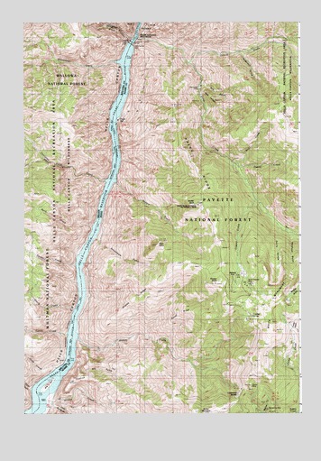
White Monument, ID USGS Topographic Map
Click on map above to begin viewing in our Map Viewer.

This topographic map contains these locations and features:
Feature Name Type Latitude Longitude GNIS ID View Map
Alaska MineMineN45.1327°W116.6479°376494View Map
Allison CreekStreamN45.1274°W116.7443°376555View Map
Anderson GulchValleyN45.2402°W116.6510°376620View Map
Big BarBarN45.1349°W116.7393°377425View Map
Black PointCliffN45.1788°W116.6899°397449View Map
Bluejacket MineMineN45.1257°W116.6388°377960View Map
Buck CreekStreamN45.1846°W116.7190°1138779View Map
Copper CreekStreamN45.1621°W116.6463°396327View Map
Deep CreekStreamN45.2452°W116.6982°380390View Map
Devils HollowValleyN45.1779°W116.6351°380543View Map
Dove CreekStreamN45.1396°W116.7354°1141215View Map
Dove Creek CampgroundLocaleN45.1404°W116.7363°1156916View Map
Doyle CreekStreamN45.1588°W116.7257°1141225View Map
Dry GulchValleyN45.1427°W116.7285°380867View Map
Eagle BarBarN45.2190°W116.7085°380973View Map
Fishers BarBarN45.2396°W116.7060°1142181View Map
Grassy RidgeRidgeN45.1627°W116.6954°382579View Map
Haley RidgeRidgeN45.2046°W116.6735°382808View Map
Hardrock GulchValleyN45.1777°W116.6290°382904View Map
Heady CreekStreamN45.2038°W116.6546°383022View Map
HelenaPopulated PlaceN45.1702°W116.6524°397782View Map
Helena Post Office (historical)Post OfficeN45.1702°W116.6524°2027023View Map
Hells Canyon DamDamN45.2332°W116.7010°398660View Map
Hells Canyon DamDamN45.2415°W116.7010°1153298View Map
Hells Canyon ReservoirReservoirN45.2332°W116.7010°398661View Map
Howell (historical)LocaleN45.2449°W116.7010°1153059View Map
ípsus tím?e CreekStreamN45.1713°W116.7251°1150259View Map
Kinney CreekStreamN45.1493°W116.7271°384244View Map
Kinney PointCliffN45.1663°W116.6640°384247View Map
Kirby CreekStreamN45.1332°W116.7451°1144637View Map
Little Dry GulchValleyN45.1285°W116.7379°376136View Map
Lockwood SaddleGapN45.1313°W116.6521°385026View Map
Lynch CreekStreamN45.1504°W116.7293°1145693View Map
Lynch Creek Forest CampLocaleN45.1513°W116.7288°1156697View Map
Lynes RanchLocaleN45.1310°W116.7407°386309View Map
Oxbow CreekStreamN45.2374°W116.6746°388059View Map
Pine FlatFlatN45.2002°W116.7126°1147707View Map
Red GulchValleyN45.2304°W116.6693°389192View Map
Red LedgeBeachN45.2271°W116.6665°389208View Map
Red Ledge MineMineN45.2296°W116.6699°389210View Map
Red Ledge TrailTrailN45.2099°W116.6668°389211View Map
Sawpit CreekStreamN45.1993°W116.7107°389985View Map
Schoolmam GulchValleyN45.1824°W116.7188°398104View Map
Sheep RockSummitN45.1915°W116.6713°390253View Map
Sheep Rock National Recreation TrailTrailN45.1915°W116.6732°376134View Map
Sheep Rock OverlookLocaleN45.1915°W116.6710°394515View Map
Short CreekStreamN45.2452°W116.7010°1149431View Map
South Peacock MineMineN45.1663°W116.6488°391072View Map
Steamboat CreekStreamN45.2368°W116.7054°1150373View Map
Sucker GulchValleyN45.1518°W116.6279°391579View Map
The FlatironFlatN45.1357°W116.7265°391963View Map
Thirtytwo Point CreekStreamN45.1990°W116.7115°1151073View Map
Towsley SpringSpringN45.1560°W116.6476°392258View Map
Trail CreekStreamN45.2049°W116.6549°392278View Map
Tussel RidgeRidgeN45.1571°W116.6793°392471View Map
Vermillion Bar CampgroundLocaleN45.1457°W116.7326°1156404View Map
White MonumentRidgeN45.1543°W116.6374°393348View Map

Note: Coordinates in the location and feature list above are referenced to NAD83 datum.


Copyright (C) 2008-2025 Ryan Niemi / Sunset Dynamics ... All Rights Reserved