TopoQuest Logo
Do you find TopoQuest useful?
Help keep TopoQuest running and adding new maps/features by donating!
Bitcoin:  19c7KJd3qBynnjoSw5npx9KScwjBe4ifkT
Litecoin:  LXs6TkuXGGXo1vDsWCkWVdjQX94eUKd6ui
Home View Maps Find Maps Find Places Resources & Links


Homestead, Oregon Topographic Map

USGS Map Title: Homestead, OR
USGS Map MRC: 45116A7
DRG (GeoTIFF) Download: o45116a7.tif


Neighboring USGS Topographic Map Quads:


  Gumboot Butte, OR  
45116B8
 

  Puderbaugh Ridge, OR  
45116B7
 

  White Monument, ID  
45116B6
 

  Duck Creek, OR  
45116A8
 

  Homestead, OR  
45116A7
 

  Cuprum, ID  
45116A6
 

  McLain Gulch, OR  
44116H8
 

  Oxbow, OR  
44116H7
 

  Rocky Comfort Flat, ID  
44116H6


Map MRC Location:

N46°
W117°
N46°
W116°
H8 H7 H6 H5 H4 H3 H2 H1
G8 G7 G6 G5 G4 G3 G2 G1
F8 F7 F6 F5 F4 F3 F2 F1
E8 E7 E6 E5 E4 E3 E2 E1
D8 D7 D6 D5 D4 D3 D2 D1
C8 C7 C6 C5 C4 C3 C2 C1
B8 B7 B6 B5 B4 B3 B2 B1
A8 A7 A6 A5 A4 A3 A2 A1
N45°
W117°
N45°
W116°

Homestead, OR USGS 1:24K Topographic Map Preview:
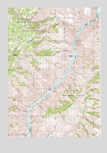
Homestead, OR USGS Topographic Map
Click on map above to begin viewing in our Map Viewer.

This topographic map contains these locations and features:
Feature Name Type Latitude Longitude GNIS ID View Map
Ashby CreekStreamN45.0657°W116.7940°1117065View Map
Ballard CreekStreamN45.0499°W116.8121°1117206View Map
Ballard Landing (historical)LocaleN45.0513°W116.8277°1851677View Map
Bob CreekStreamN45.0018°W116.8440°1138367View Map
Boulder CreekStreamN45.0438°W116.7679°378086View Map
Bull GulchValleyN45.0196°W116.7727°378470View Map
Cattle Rapids (historical)RapidsN45.0100°W116.8464°1118703View Map
Copper CreekStreamN45.0804°W116.7846°1119269View Map
Copperfield-Homestead CemeteryCemeteryN45.0023°W116.8498°1129453View Map
Degits CreekStreamN45.0252°W116.7710°380483View Map
Eckels CreekStreamN45.1157°W116.7526°381243View Map
Elk CreekStreamN45.0135°W116.7771°381358View Map
Hale CreekStreamN45.0443°W116.8204°1152817View Map
Hells Canyon ParkParkN45.0454°W116.7974°376135View Map
Hells Canyon ReservoirReservoirN45.0991°W116.7799°1155574View Map
Herman CreekStreamN45.0390°W116.8252°1121769View Map
Hibble GulchValleyN45.1146°W116.7515°383133View Map
Holbrook CreekStreamN45.0171°W116.8457°1143649View Map
HomesteadPopulated PlaceN45.0238°W116.8507°1121943View Map
Homestead CreekStreamN45.0290°W116.8438°1121944View Map
Homestead Post Office (historical)Post OfficeN45.0238°W116.8507°1165406View Map
Irondyke CreekStreamN45.0232°W116.8485°1144124View Map
Irondyke MineMineN45.0268°W116.8574°1159227View Map
Kerrs RapidsRapidsN45.0331°W116.8359°1122711View Map
Landing Post Office (historical)Post OfficeN45.0513°W116.8277°1164456View Map
Leep CreekStreamN45.1224°W116.7513°1123026View Map
Limepoint CreekStreamN45.0777°W116.7821°384674View Map
McDougal CreekStreamN45.0721°W116.7899°1129452View Map
McGraw CreekStreamN45.1004°W116.7788°1123966View Map
McGraw Creek CabinLocaleN45.1185°W116.8107°1159226View Map
Negro Bill GulchValleyN45.0624°W116.7527°387497View Map
Nelson CreekStreamN45.0904°W116.7849°1124649View Map
Oxbow AirportAirportN45.0046°W116.8492°1131678View Map
Radium (historical)LocaleN45.0707°W116.7904°1958502View Map
South Fork McGraw CreekStreamN45.1096°W116.8004°1133846View Map
Spring CreekStreamN45.1074°W116.7713°1127430View Map
Steen CreekStreamN45.0374°W116.7510°391403View Map
West Fork McGraw CreekStreamN45.1163°W116.8108°1129487View Map
Windy RidgeRidgeN45.0357°W116.7810°393589View Map

Note: Coordinates in the location and feature list above are referenced to NAD83 datum.


Copyright (C) 2008-2025 Ryan Niemi / Sunset Dynamics ... All Rights Reserved