TopoQuest Logo
Do you find TopoQuest useful?
Help keep TopoQuest running and adding new maps/features by donating!
Bitcoin:  19c7KJd3qBynnjoSw5npx9KScwjBe4ifkT
Litecoin:  LXs6TkuXGGXo1vDsWCkWVdjQX94eUKd6ui
Home View Maps Find Maps Find Places Resources & Links


Bastian Bay, Louisiana Topographic Map

USGS Map Title: Bastian Bay, LA
USGS Map MRC: 29089C6
DRG (GeoTIFF) Download: o29089c6.tif


Neighboring USGS Topographic Map Quads:


  Bay Batiste, LA  
29089D7
 

  Port Sulphur, LA  
29089D6


  Bay Ronquille, LA  
29089C7
 

  Bastian Bay, LA  
29089C6
 

  Buras, LA  
29089C5


  Bay Coquette, LA  
29089B5


Map MRC Location:

N30°
W90°
N30°
W89°
H8 H7 H6 H5 H4 H3 H2 H1
G8 G7 G6 G5 G4 G3 G2 G1
F8 F7 F6 F5 F4 F3 F2 F1
E8 E7 E6 E5 E4 E3 E2 E1
D8 D7 D6 D5 D4 D3 D2 D1
C8 C7 C6 C5 C4 C3 C2 C1
B8 B7 B6 B5 B4 B3 B2 B1
A8 A7 A6 A5 A4 A3 A2 A1
N29°
W90°
N29°
W89°

Bastian Bay, LA USGS 1:24K Topographic Map Preview:
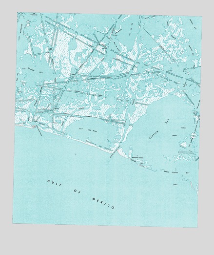
Bastian Bay, LA USGS Topographic Map
Click on map above to begin viewing in our Map Viewer.

This topographic map contains these locations and features:
Feature Name Type Latitude Longitude GNIS ID View Map
Bastian BayBayN29.3088°W89.6503°532327View Map
Bastian IslandIslandN29.2908°W89.6709°532329View Map
Bastian PassChannelN29.2883°W89.6667°532331View Map
Bay Au FerLakeN29.3677°W89.6723°532346View Map
Bay ChalandBayN29.3099°W89.7381°532353View Map
Bay de SuiteLakeN29.3566°W89.6828°532342View Map
Bay Joe WiseLakeN29.3066°W89.6981°532366View Map
Bayou ChalandGutN29.3188°W89.7387°532499View Map
Bayou CookGutN29.3402°W89.6334°532536View Map
Bayou CourantGutN29.3669°W89.6467°532544View Map
Bayou de SuiteGutN29.3647°W89.6812°532407View Map
Bayou HuertesGutN29.3455°W89.6942°532628View Map
Chaland PassChannelN29.3077°W89.7337°533865View Map
Ferrand BayBayN29.3244°W89.6253°534937View Map
Garden BayBayN29.3402°W89.7359°535172View Map
Grand Bayou PassChannelN29.2938°W89.6781°535322View Map
Halfmoon BayLakeN29.3541°W89.6309°535487View Map
Lake RobinsonBayN29.3622°W89.7495°538655View Map
Lanaux IslandIslandN29.2758°W89.6459°536319View Map
Parish Governing Authority District 7CivilN29.3338°W89.6413°1930199View Map
Shell Island BayBayN29.2813°W89.6337°539319View Map

Note: Coordinates in the location and feature list above are referenced to NAD83 datum.


Copyright (C) 2008-2024 Ryan Niemi / Sunset Dynamics ... All Rights Reserved