TopoQuest Logo
Do you find TopoQuest useful?
Help keep TopoQuest running and adding new maps/features by donating!
Bitcoin:  19c7KJd3qBynnjoSw5npx9KScwjBe4ifkT
Litecoin:  LXs6TkuXGGXo1vDsWCkWVdjQX94eUKd6ui
Home View Maps Find Maps Find Places Resources & Links


Gant Mountain, Idaho Topographic Map

USGS Map Title: Gant Mountain, ID
USGS Map MRC: 45114B3
DRG (GeoTIFF) Download: o45114b3.tif


Neighboring USGS Topographic Map Quads:


  Bighorn Crags, ID  
45114C4
 

  Pine Creek Rapids, ID  
45114C3
 

  Pine Creek Ridge, ID  
45114C2
 

  Gant Ridge, ID  
45114B4
 

  Gant Mountain, ID  
45114B3
 

  Jureano Mountain, ID  
45114B2
 

  Blackbird Mountain, ID  
45114A4
 

  Blackbird Creek, ID  
45114A3
 

  Cobalt, ID  
45114A2


Map MRC Location:

N46°
W115°
N46°
W114°
H8 H7 H6 H5 H4 H3 H2 H1
G8 G7 G6 G5 G4 G3 G2 G1
F8 F7 F6 F5 F4 F3 F2 F1
E8 E7 E6 E5 E4 E3 E2 E1
D8 D7 D6 D5 D4 D3 D2 D1
C8 C7 C6 C5 C4 C3 C2 C1
B8 B7 B6 B5 B4 B3 B2 B1
A8 A7 A6 A5 A4 A3 A2 A1
N45°
W115°
N45°
W114°

Gant Mountain, ID USGS 1:24K Topographic Map Preview:
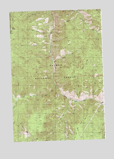
Gant Mountain, ID USGS Topographic Map
Click on map above to begin viewing in our Map Viewer.

This topographic map contains these locations and features:
Feature Name Type Latitude Longitude GNIS ID View Map
Big Deer CreekStreamN45.1763°W114.3154°377502View Map
Big Jureano CreekStreamN45.1591°W114.2540°377558View Map
Birch Creek TrailTrailN45.2374°W114.3343°376191View Map
Blackbird MineMineN45.1255°W114.3501°377794View Map
Bridge CreekStreamN45.2491°W114.2834°378225View Map
Dutchmans HumpSummitN45.2394°W114.2984°380968View Map
Fritzer FlatFlatN45.2019°W114.3170°382095View Map
Fritzer GulchValleyN45.2030°W114.3179°382096View Map
Gant CreekStreamN45.2180°W114.3217°382165View Map
Gant MountainSummitN45.2341°W114.3726°382166View Map
Indian CreekStreamN45.1660°W114.3684°383658View Map
Little Deer CreekStreamN45.1644°W114.2979°384804View Map
Little Deer Creek RidgeRidgeN45.1341°W114.2887°384806View Map
Little Jureano CreekStreamN45.1641°W114.2637°384870View Map
South Fork Big Deer CreekStreamN45.1663°W114.3684°390882View Map
Squaw Camp CreekStreamN45.2288°W114.3212°391277View Map
Sunshine MineMineN45.1296°W114.3626°391673View Map
Trapper FlatFlatN45.1619°W114.2842°392357View Map
Trapper GulchValleyN45.1619°W114.2829°392358View Map
Trapper RidgeRidgeN45.1941°W114.2773°392364View Map

Note: Coordinates in the location and feature list above are referenced to NAD83 datum.


Copyright (C) 2008-2024 Ryan Niemi / Sunset Dynamics ... All Rights Reserved