TopoQuest Logo
Do you find TopoQuest useful?
Help keep TopoQuest running and adding new maps/features by donating!
Bitcoin:  19c7KJd3qBynnjoSw5npx9KScwjBe4ifkT
Litecoin:  LXs6TkuXGGXo1vDsWCkWVdjQX94eUKd6ui
Home View Maps Find Maps Find Places Resources & Links


Carbon, Wyoming Topographic Map

USGS Map Title: Carbon, WY
USGS Map MRC: 41106G4
DRG (GeoTIFF) Download: o41106g4.tif


Neighboring USGS Topographic Map Quads:


  Elmo, WY  
41106H5
 

  Como West, WY  
41106H4
 

  Como East, WY  
41106H3
 

  Hanna, WY  
41106G5
 

  Carbon, WY  
41106G4
 

  Halfway Hill, WY  
41106G3
 

  Rattlesnake Pass, WY  
41106F5
 

  Elk Mountain, WY  
41106F4
 

  T L Ranch, WY  
41106F3


Map MRC Location:

N42°
W107°
N42°
W106°
H8 H7 H6 H5 H4 H3 H2 H1
G8 G7 G6 G5 G4 G3 G2 G1
F8 F7 F6 F5 F4 F3 F2 F1
E8 E7 E6 E5 E4 E3 E2 E1
D8 D7 D6 D5 D4 D3 D2 D1
C8 C7 C6 C5 C4 C3 C2 C1
B8 B7 B6 B5 B4 B3 B2 B1
A8 A7 A6 A5 A4 A3 A2 A1
N41°
W107°
N41°
W106°

Carbon, WY USGS 1:24K Topographic Map Preview:
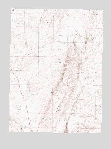
Carbon, WY USGS Topographic Map
Click on map above to begin viewing in our Map Viewer.

This topographic map contains these locations and features:
Feature Name Type Latitude Longitude GNIS ID View Map
Big Spring ReservoirReservoirN41.8736°W106.4381°1585512View Map
Bloody LakeLakeN41.7546°W106.4793°1585664View Map
CarbonPopulated PlaceN41.8486°W106.3770°1597247View Map
Carbon CemeteryCemeteryN41.8518°W106.3786°2774477View Map
Carbon Number One MineMineN41.8480°W106.3781°1726062View Map
Carbon Number Three MineMineN41.8480°W106.3811°1726063View Map
Elk Mountain Strip Mine TwoMineN41.7761°W106.4172°1726064View Map
Fiddlers Green ReservoirReservoirN41.7746°W106.4169°1588442View Map
Irene DamDamN41.7983°W106.3772°1605841View Map
Irene ReservoirReservoirN41.7967°W106.3776°1605842View Map
Jacks SpringSpringN41.8236°W106.4351°1590026View Map
Jackson DrawValleyN41.8216°W106.4334°1590030View Map
Lower Fourmile SpringReservoirN41.8049°W106.3982°1591084View Map
Percy SpringSpringN41.8122°W106.4878°1592671View Map
Rolling SpringsSpringN41.8500°W106.4125°1593626View Map
Sevenmile LakeLakeN41.7524°W106.4340°1594127View Map
Simpson GapGapN41.8364°W106.4559°1594365View Map
Simpson RidgeRidgeN41.7925°W106.4228°1594367View Map
Sixmile ReservoirReservoirN41.7906°W106.4444°1594412View Map
Sixmile SpringSpringN41.7872°W106.4422°1594414View Map
Soda LakesLakeN41.7736°W106.4870°1594552View Map
Threemile SpringReservoirN41.8097°W106.4063°1595551View Map
Upper Fourmile SpringSpringN41.8006°W106.4121°1595861View Map
Upper Rolling Springs ReservoirReservoirN41.8473°W106.4294°1595879View Map
Windy LakeLakeN41.8110°W106.4000°1596536View Map

Note: Coordinates in the location and feature list above are referenced to NAD83 datum.


Copyright (C) 2008-2025 Ryan Niemi / Sunset Dynamics ... All Rights Reserved