TopoQuest Logo
Do you find TopoQuest useful?
Help keep TopoQuest running and adding new maps/features by donating!
Bitcoin:  19c7KJd3qBynnjoSw5npx9KScwjBe4ifkT
Litecoin:  LXs6TkuXGGXo1vDsWCkWVdjQX94eUKd6ui
Home View Maps Find Maps Find Places Resources & Links


Pinto Summit, Nevada Topographic Map

USGS Map Title: Pinto Summit, NV
USGS Map MRC: 39115D8
DRG (GeoTIFF) Download: o39115d8.tif


Neighboring USGS Topographic Map Quads:


  Devon Peak, NV  
39116E1
 

  Eureka, NV  
39115E8
 

  Diamond Peak, NV  
39115E7
 

  Spring Valley Summit, NV  
39116D1
 

  Pinto Summit, NV  
39115D8
 

  Silverado Mountain, NV  
39115D7
 

  Bellevue Peak, NV  
39116C1
 

  Pinto Summit SW, NV  
39115C8
 

  Black Point, NV  
39115C7


Map MRC Location:

N40°
W116°
N40°
W115°
H8 H7 H6 H5 H4 H3 H2 H1
G8 G7 G6 G5 G4 G3 G2 G1
F8 F7 F6 F5 F4 F3 F2 F1
E8 E7 E6 E5 E4 E3 E2 E1
D8 D7 D6 D5 D4 D3 D2 D1
C8 C7 C6 C5 C4 C3 C2 C1
B8 B7 B6 B5 B4 B3 B2 B1
A8 A7 A6 A5 A4 A3 A2 A1
N39°
W116°
N39°
W115°

Pinto Summit, NV USGS 1:24K Topographic Map Preview:
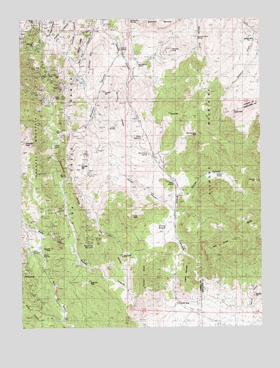
Pinto Summit, NV USGS Topographic Map
Click on map above to begin viewing in our Map Viewer.

This topographic map contains these locations and features:
Feature Name Type Latitude Longitude GNIS ID View Map
American ShaftMineN39.4935°W115.9856°855826View Map
Angelo Belli FlatFlatN39.4897°W115.8837°838460View Map
Atlas ShaftMineN39.4777°W115.9859°855817View Map
Atlas TunnelMineN39.4705°W115.9920°853906View Map
Basalt PeakSummitN39.4622°W115.8889°838628View Map
Beacon PeakSummitN39.4294°W115.9006°838659View Map
Berryman TunnelMineN39.4691°W115.9895°838702View Map
Black Pitch SpringSpringN39.4457°W115.9352°838863View Map
Bullwhacker SpringSpringN39.4989°W115.9430°839190View Map
Burning Moscow MineMineN39.4374°W115.9920°845117View Map
California TunnelMineN39.4722°W115.9814°855816View Map
Carbon RidgeRidgeN39.3960°W115.9359°839315View Map
Charter TunnelMineN39.4833°W115.9876°863213View Map
Cherry SpringSpringN39.4878°W115.9482°839447View Map
Chicago TunnelMineN39.4747°W115.9731°853895View Map
Clarks SpringSpringN39.4630°W115.9845°839555View Map
Colorado TunnelMineN39.4747°W115.9731°853896View Map
Conelly MineMineN39.4833°W115.9876°856569View Map
Conical HillSummitN39.4697°W115.9573°845412View Map
Croesus MineMineN39.4735°W115.9817°854416View Map
Dale CanyonValleyN39.4044°W115.9439°839917View Map
Dead Broke TunnelMineN39.4747°W115.9731°853901View Map
Diamond MineMineN39.4747°W115.9731°853898View Map
Diamond TunnelMineN39.4660°W115.9878°854429View Map
Distinction TunnelMineN39.4705°W115.9920°857585View Map
Dome MountainSummitN39.4613°W115.9226°840089View Map
Dominic TunnelMineN39.4649°W115.9914°853891View Map
Dunderberg MineMineN39.4769°W115.9806°857972View Map
Eldorado MineMineN39.4833°W115.9876°863214View Map
Eldorado TunnelMineN39.4774°W115.9856°840322View Map
Empire MineMineN39.4833°W115.9876°857284View Map
English MountainSummitN39.3941°W115.9134°845455View Map
Eureka County HospitalHospitalN39.4972°W115.9570°851387View Map
Eureka Mining DistrictCivilN39.4833°W115.9870°858630View Map
Eureka Nevada TunnelMineN39.4747°W115.9731°853900View Map
Eureka Secret Canyon MinesMineN39.4116°W115.9731°850886View Map
Eureka TunnelMineN39.4794°W115.9926°854442View Map
Excelsior TunnelMineN39.3799°W115.9931°853892View Map
Fourth of July TunnelMineN39.4647°W115.9909°851261View Map
Fraser TunnelMineN39.4769°W115.9809°855815View Map
Frenchmans TunnelMineN39.4894°W115.9976°853890View Map
Geddes Post Office (historical)Post OfficeN39.4247°W115.9784°864463View Map
Geddes-Bertrand MineMineN39.4213°W115.9817°856251View Map
Gordon TunnelMineN39.4755°W115.9981°851259View Map
Gorman HillSummitN39.4794°W115.9637°845480View Map
Grant MineMineN39.4880°W115.9934°855819View Map
Grey Fox PeakSummitN39.3930°W115.9659°845496View Map
Hamburg MineMineN39.4649°W115.9776°840871View Map
Hamburg RidgeRidgeN39.4341°W115.9731°840872View Map
Hoosac CanyonValleyN39.4233°W115.9226°841052View Map
Hoosac MineMineN39.4366°W115.9639°845186View Map
Hoosac MountainSummitN39.4394°W115.9695°841053View Map
Hornitos ConeSummitN39.4872°W115.9206°845506View Map
Industry MineMineN39.4833°W115.9876°863215View Map
Industry TunnelMineN39.4769°W115.9898°855814View Map
Jackson ShaftMineN39.4966°W115.9856°841351View Map
Lawton ShaftMineN39.4991°W115.9920°841590View Map
Leader MountainSummitN39.4160°W115.8839°841596View Map
Lexington MineMineN39.4833°W115.9876°857285View Map
Long Lost Jewel TunnelsMineN39.4705°W115.9920°853905View Map
Lord Byron TunnelMineN39.4747°W115.9731°853903View Map
Lucky SpringsSpringN39.4564°W115.9519°841877View Map
Macintosh TunnelMineN39.4747°W115.9731°853899View Map
Magnet ShaftMineN39.4810°W115.9895°855818View Map
Magpie HillSummitN39.3880°W115.8789°841900View Map
Maryland WellsWellN39.4138°W115.9231°850947View Map
Mayberry TunnelMineN39.4747°W115.9731°853893View Map
McCoy RidgeRidgeN39.4869°W115.9712°841998View Map
Merritt TunnelMineN39.4844°W115.9687°853889View Map
Metamoras ShaftMineN39.4747°W115.9731°853904View Map
Milk Ranch SpringSpringN39.4817°W115.9390°842110View Map
Mineral HillSummitN39.4905°W115.9851°855823View Map
Murray SpringSpringN39.4366°W115.9773°842360View Map
New Windfall ShaftMineN39.4535°W115.9751°854547View Map
New York CanyonValleyN39.4958°W115.9587°842455View Map
Old Jackson ShaftMineN39.4988°W115.9842°855822View Map
Orange MineMineN39.4747°W115.9731°853902View Map
Oswego MineMineN39.4130°W115.9842°842649View Map
Otto MineMineN39.4833°W115.9876°857283View Map
Oxyoke CanyonValleyN39.4333°W115.9095°842670View Map
Oxyoke SpringSpringN39.4366°W115.8991°842671View Map
Page and Corwin MineMineN39.4127°W115.9656°842683View Map
Phoenix ShaftMineN39.4966°W115.9859°854781View Map
Pinnacle PeakSummitN39.3969°W115.9998°842845View Map
Pinto (historical)Populated PlaceN39.4213°W115.9201°856554View Map
Pinto BasinBasinN39.4144°W115.9281°842847View Map
Pinto CanyonValleyN39.3808°W115.9173°842848View Map
Pinto PeakSummitN39.4205°W115.9431°842852View Map
Pinto Post Office (historical)Post OfficeN39.4213°W115.9201°864684View Map
Pinto SpringSpringN39.4329°W115.9215°842854View Map
Pinto SummitGapN39.4510°W115.9381°842855View Map
Prospect MountainRidgeN39.4533°W115.9981°847462View Map
Prospect PeakSummitN39.4497°W115.9995°842987View Map
Ratto SpringSpringN39.4066°W115.9936°843106View Map
Red RidgeRidgeN39.4074°W115.8970°843159View Map
Rescue CanyonValleyN39.3816°W115.8803°843199View Map
Roberts TunnelMineN39.4930°W115.9995°855820View Map
Rocky CanyonValleyN39.4038°W115.9720°843322View Map
Rogers TunnelMineN39.4972°W115.9942°855821View Map
Round Top MountainSummitN39.4074°W115.9653°843383View Map
Ruby Hill MineMineN39.4910°W115.9931°854766View Map
Schaefer RanchLocaleN39.4216°W115.9209°843531View Map
Secret Valley MineMineN39.4074°W115.9653°857441View Map
Sentinel MountainSummitN39.4338°W115.8778°843570View Map
Seventysix ShaftMineN39.4944°W115.9634°854617View Map
Shadow CanyonValleyN39.4988°W115.9728°843587View Map
Sierra SpringsSpringN39.4005°W115.9895°843686View Map
South GateLocaleN39.3852°W115.9201°843872View Map
Spanish Gulch SpringSpringN39.4921°W115.9081°843908View Map
Spring RidgeRidgeN39.4627°W115.9509°843943View Map
Star of the West MineMineN39.4833°W115.9876°857282View Map
Sterling MineMineN39.4833°W115.9876°863216View Map
Sterling TunnelMineN39.4716°W115.9931°855825View Map
Stockton MineMineN39.4074°W115.9653°857440View Map
SugarloafSummitN39.4033°W115.9473°844061View Map
Surprise PeakSummitN39.4069°W115.9851°844117View Map
Twin Hoosac TunnelMineN39.4466°W115.9598°851262View Map
Uncle Sam TunnelMineN39.4699°W115.9784°851260View Map
Vanderbilt (historical)Populated PlaceN39.4247°W115.9784°858367View Map
Wabash TunnelMineN39.4747°W115.9731°853894View Map
Williams MineMineN39.4747°W115.9731°853897View Map
Windfall CanyonValleyN39.4852°W115.9489°844989View Map
Windfall MineMineN39.4505°W115.9751°844990View Map
Woodpeckers PeakSummitN39.4499°W115.8964°845037View Map

Note: Coordinates in the location and feature list above are referenced to NAD83 datum.


Copyright (C) 2008-2025 Ryan Niemi / Sunset Dynamics ... All Rights Reserved