TopoQuest Logo
Do you find TopoQuest useful?
Help keep TopoQuest running and adding new maps/features by donating!
Bitcoin:  19c7KJd3qBynnjoSw5npx9KScwjBe4ifkT
Litecoin:  LXs6TkuXGGXo1vDsWCkWVdjQX94eUKd6ui
Home View Maps Find Maps Find Places Resources & Links


Wallingford, Vermont Topographic Map

USGS Map Title: Wallingford, VT
USGS Map MRC: 43072D8
DRG (GeoTIFF) Download: o43072d8.tif


Neighboring USGS Topographic Map Quads:


  West Rutland, VT  
43073E1
 

  Rutland, VT  
43072E8
 

  Killington Peak, VT  
43072E7
 

  Middletown Springs, VT  
43073D1
 

  Wallingford, VT  
43072D8
 

  Mount Holly, VT  
43072D7
 

  Dorset, VT  
43073C1
 

  Danby, VT  
43072C8
 

  Weston, VT  
43072C7


Map MRC Location:

N44°
W73°
N44°
W72°
H8 H7 H6 H5 H4 H3 H2 H1
G8 G7 G6 G5 G4 G3 G2 G1
F8 F7 F6 F5 F4 F3 F2 F1
E8 E7 E6 E5 E4 E3 E2 E1
D8 D7 D6 D5 D4 D3 D2 D1
C8 C7 C6 C5 C4 C3 C2 C1
B8 B7 B6 B5 B4 B3 B2 B1
A8 A7 A6 A5 A4 A3 A2 A1
N43°
W73°
N43°
W72°

Wallingford, VT USGS 1:24K Topographic Map Preview:
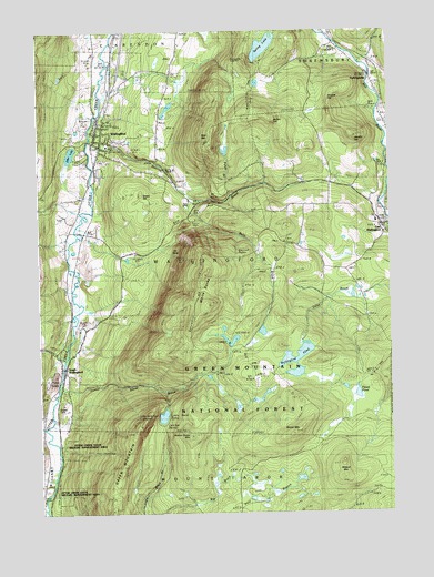
Wallingford, VT USGS Topographic Map
Click on map above to begin viewing in our Map Viewer.

This topographic map contains these locations and features:
Feature Name Type Latitude Longitude GNIS ID View Map
Baker BrookStreamN43.3840°W72.9954°1460542View Map
Bear MountainSummitN43.4703°W72.9387°1460576View Map
Bully BrookStreamN43.4570°W72.9459°1461743View Map
Button HillSummitN43.4773°W72.9168°1460690View Map
CuttingsvillePopulated PlaceN43.4884°W72.8823°1460770View Map
Cuttingsville Post OfficePost OfficeN43.4856°W72.8805°1921834View Map
Doty CemeteryCemeteryN43.4187°W72.9943°1921848View Map
East WallingfordPopulated PlaceN43.4495°W72.8759°1460837View Map
East Wallingford Baptist ChurchChurchN43.4492°W72.8765°1921860View Map
East Wallingford Fire DepartmentBuildingN43.4509°W72.8796°2121489View Map
East Wallingford Post OfficePost OfficeN43.4502°W72.8753°1921861View Map
Elfin LakeLakeN43.4684°W72.9881°1460842View Map
Feller BrookStreamN43.4298°W72.8887°1461644View Map
Fifield PondLakeN43.4056°W72.8867°1460871View Map
First Baptist ChurchChurchN43.4717°W72.9765°1921878View Map
Freeman BrookStreamN43.4742°W72.8776°1460884View Map
Granite HillSummitN43.4834°W72.8951°1460923View Map
Green HillSummitN43.4573°W72.9637°1460931View Map
Green Hill CemeteryCemeteryN43.4664°W72.9779°1921907View Map
Green MountainSummitN43.3978°W72.9643°1460933View Map
Green Mountain TrailTrailN43.3815°W72.9751°1461651View Map
Greenwall ShelterLocaleN43.4412°W72.9284°1461740View Map
Hateful HillSummitN43.4723°W72.8882°1460971View Map
Hill-Roberts CemeteryCemeteryN43.4048°W72.9979°1921920View Map
Homer Stone BrookStreamN43.4084°W72.9934°1460999View Map
Homer Stone MountainSummitN43.3948°W72.9468°1461000View Map
Homer Stone TrailTrailN43.4062°W72.9568°1461735View Map
Ice BedsGlacierN43.4434°W72.9501°1461741View Map
Keewaydin TrailTrailN43.4467°W72.9445°1461742View Map
Laurel Glen CemeteryCemeteryN43.4856°W72.8792°1461059View Map
Little Rock PondLakeN43.4002°W72.9559°1461088View Map
Little Rock Pond ShelterLocaleN43.4015°W72.9568°1461736View Map
Lula Tye ShelterLocaleN43.3978°W72.9557°1461738View Map
Otter Creek CampgroundLocaleN43.3787°W72.9990°1922020View Map
Otter Creek State Wildlife Management AreaParkN43.3754°W72.9870°1461648View Map
Patch BrookStreamN43.4570°W72.9312°1461745View Map
Pelsue-Jarvary CemeteryCemeteryN43.4766°W72.8763°1922031View Map
Roaring BrookStreamN43.4715°W72.9807°1461340View Map
Saint Patrick CemeteryCemeteryN43.4667°W72.9743°1921792View Map
Saint Patricks ChurchChurchN43.4748°W72.9765°1922108View Map
Shrewsbury Volunteer Fire Department Station 1BuildingN43.4925°W72.8809°2121274View Map
South WallingfordPopulated PlaceN43.4128°W72.9926°1461450View Map
South Wallingford Limestone QuarryMineN43.4083°W72.9958°2633846View Map
Spring LakeLakeN43.4960°W72.9189°1461454View Map
Stafford CemeteryCemeteryN43.4131°W72.9892°1922132View Map
Sugar Hill CemeteryCemeteryN43.4457°W72.9127°1922142View Map
Sunnyside ShelterLocaleN43.4923°W72.9257°1461744View Map
Timber Hill EstatesPopulated PlaceN43.4637°W72.9779°1922155View Map
Town of WallingfordCivilN43.4402°W72.9445°1462239View Map
WallingfordPopulated PlaceN43.4717°W72.9773°1461573View Map
Wallingford Census Designated PlaceCensusN43.4748°W72.9675°2378136View Map
Wallingford Congregational ChurchChurchN43.4687°W72.9779°1922182View Map
Wallingford Fire Department Station 2BuildingN43.4102°W72.9931°2121257View Map
Wallingford Main Street Historic DistrictParkN43.4715°W72.9770°1922184View Map
Wallingford Municipal ForestForestN43.4678°W72.9854°1922186View Map
Wallingford PondLakeN43.4147°W72.9083°1461574View Map
Wallingford Post OfficePost OfficeN43.4736°W72.9772°1922187View Map
Wallingford Town HallBuildingN43.4712°W72.9759°1922188View Map
Wallingford Village SchoolSchoolN43.4705°W72.9751°1922183View Map
Wallingford Volunteer Fire Department Station 1BuildingN43.4722°W72.9796°2121266View Map
White RocksSummitN43.4290°W72.9395°1461611View Map
White Rocks National Recreation AreaParkN43.3804°W72.9184°1461650View Map
White Rocks Picnic GroundsLocaleN43.4512°W72.9445°1461739View Map
Wilder MountainSummitN43.3967°W72.9076°1461616View Map
Willard MountainSummitN43.3881°W72.8929°1461618View Map

Note: Coordinates in the location and feature list above are referenced to NAD83 datum.


Copyright (C) 2008-2024 Ryan Niemi / Sunset Dynamics ... All Rights Reserved