TopoQuest Logo
Do you find TopoQuest useful?
Help keep TopoQuest running and adding new maps/features by donating!
Bitcoin:  19c7KJd3qBynnjoSw5npx9KScwjBe4ifkT
Litecoin:  LXs6TkuXGGXo1vDsWCkWVdjQX94eUKd6ui
Home View Maps Find Maps Find Places Resources & Links


Carey, Idaho Topographic Map

USGS Map Title: Carey, ID
USGS Map MRC: 43113C8
DRG (GeoTIFF) Download: o43113c8.tif


Neighboring USGS Topographic Map Quads:


  Little Wood River Reservoir, ID  
43114D1
 

  Lake Hills, ID  
43113D8
 

  Fish Creek Reservoir, ID  
43113D7
 

  Picabo, ID  
43114C1
 

  Carey, ID  
43113C8
 

  Paddelford Flat, ID  
43113C7
 

  Tikura, ID  
43114B1
 

  Pagari Well, ID  
43113B8
 

  Wagon Butte, ID  
43113B7


Map MRC Location:

N44°
W114°
N44°
W113°
H8 H7 H6 H5 H4 H3 H2 H1
G8 G7 G6 G5 G4 G3 G2 G1
F8 F7 F6 F5 F4 F3 F2 F1
E8 E7 E6 E5 E4 E3 E2 E1
D8 D7 D6 D5 D4 D3 D2 D1
C8 C7 C6 C5 C4 C3 C2 C1
B8 B7 B6 B5 B4 B3 B2 B1
A8 A7 A6 A5 A4 A3 A2 A1
N43°
W114°
N43°
W113°

Carey, ID USGS 1:24K Topographic Map Preview:
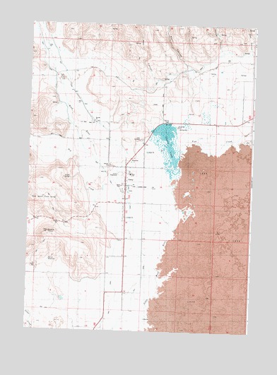
Carey, ID USGS Topographic Map
Click on map above to begin viewing in our Map Viewer.

This topographic map contains these locations and features:
Feature Name Type Latitude Longitude GNIS ID View Map
Blaine County FairgroundsLocaleN43.3141°W113.9489°395119View Map
Box CanyonValleyN43.3518°W113.9300°395131View Map
Bureau of Land Management - Carey Fire StationBuildingN43.3190°W113.9433°2619006View Map
CareyPopulated PlaceN43.3077°W113.9448°396234View Map
Carey AirportAirportN43.3088°W113.9346°400775View Map
Carey CemeteryCemeteryN43.3282°W113.9372°395177View Map
Carey LakeReservoirN43.3121°W113.9192°371894View Map
Carey Lake Migratory Bird Management AreaParkN43.3167°W113.9133°2765229View Map
Carey Lake Wildlife Management AreaReserveN43.3235°W113.9314°401247View Map
Carey Pioneer CemeteryCemeteryN43.3183°W113.9544°2779433View Map
Carey Post OfficePost OfficeN43.3106°W113.9454°2781767View Map
Carey Public SchoolSchoolN43.3138°W113.9436°401451View Map
Case CanyonValleyN43.3641°W113.8775°395181View Map
City of CareyCivilN43.3105°W113.9448°2409982View Map
Dry CreekStreamN43.2874°W113.9492°376075View Map
Fish CreekStreamN43.3299°W113.9189°381745View Map
Harris ReservoirReservoirN43.2786°W113.9879°395450View Map
Hot Springs RanchLocaleN43.3332°W113.9175°395493View Map
Line CreekStreamN43.3241°W113.9748°373599View Map
North Queens Crown SpringsSpringN43.3031°W113.9834°394836View Map
Phillips CanyonValleyN43.3646°W113.8942°394908View Map
Queens CrownSummitN43.2899°W113.9886°394877View Map
Road CanyonValleyN43.3577°W113.9123°395035View Map
Strode SpringSpringN43.3123°W113.9772°396004View Map

Note: Coordinates in the location and feature list above are referenced to NAD83 datum.


Copyright (C) 2008-2024 Ryan Niemi / Sunset Dynamics ... All Rights Reserved