TopoQuest Logo
Do you find TopoQuest useful?
Help keep TopoQuest running and adding new maps/features by donating!
Bitcoin:  19c7KJd3qBynnjoSw5npx9KScwjBe4ifkT
Litecoin:  LXs6TkuXGGXo1vDsWCkWVdjQX94eUKd6ui
Home View Maps Find Maps Find Places Resources & Links


Picabo, Idaho Topographic Map

USGS Map Title: Picabo, ID
USGS Map MRC: 43114C1
DRG (GeoTIFF) Download: o43114c1.tif


Neighboring USGS Topographic Map Quads:


  Seamans Creek, ID  
43114D2
 

  Little Wood River Reservoir, ID  
43114D1
 

  Lake Hills, ID  
43113D8
 

  Gannett, ID  
43114C2
 

  Picabo, ID  
43114C1
 

  Carey, ID  
43113C8
 

  Tapper Lake, ID  
43114B2
 

  Tikura, ID  
43114B1
 

  Pagari Well, ID  
43113B8


Map MRC Location:

N44°
W115°
N44°
W114°
H8 H7 H6 H5 H4 H3 H2 H1
G8 G7 G6 G5 G4 G3 G2 G1
F8 F7 F6 F5 F4 F3 F2 F1
E8 E7 E6 E5 E4 E3 E2 E1
D8 D7 D6 D5 D4 D3 D2 D1
C8 C7 C6 C5 C4 C3 C2 C1
B8 B7 B6 B5 B4 B3 B2 B1
A8 A7 A6 A5 A4 A3 A2 A1
N43°
W115°
N43°
W114°

Picabo, ID USGS 1:24K Topographic Map Preview:
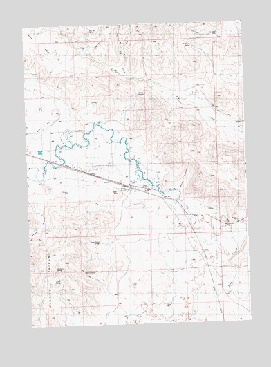
Picabo, ID USGS Topographic Map
Click on map above to begin viewing in our Map Viewer.

This topographic map contains these locations and features:
Feature Name Type Latitude Longitude GNIS ID View Map
Antler SpringSpringN43.2688°W114.1075°395055View Map
Baker CanyonValleyN43.3046°W114.0392°395072View Map
Bradley SummitGapN43.3460°W114.0609°395132View Map
Deer Mountain SpringSpringN43.3722°W114.0871°395577View Map
Deerhorn SpringSpringN43.2735°W114.1098°395295View Map
Dip Vat CreekStreamN43.3521°W114.0639°395304View Map
East Fork Dip Vat CreekStreamN43.3655°W114.0689°401831View Map
East Fork Dry CreekStreamN43.3693°W114.0981°376067View Map
Jasper FlatsFlatN43.3696°W114.1156°395527View Map
Kilpatrick DitchCanalN43.3021°W114.0964°395552View Map
Lawson DitchCanalN43.2949°W114.0161°395615View Map
Leduc (historical)Populated PlaceN43.3291°W114.0659°399110View Map
Leduck CanyonValleyN43.2993°W114.1181°395616View Map
PicaboPopulated PlaceN43.3057°W114.0678°397029View Map
Picabo AirportAirportN43.3080°W114.0618°400897View Map
Picabo Post OfficePost OfficeN43.3082°W114.0667°2767324View Map
Picabo Town SpringSpringN43.2845°W114.0848°394910View Map
Point of RocksLocaleN43.3313°W114.0923°394921View Map
Priest StationLocaleN43.2760°W114.0253°374538View Map
Red Rock SpringSpringN43.3664°W114.0289°394996View Map
Sagehen CanyonValleyN43.3632°W114.0864°395905View Map
Schultz CanyonValleyN43.3721°W114.0031°395923View Map
Silver Creek Access AreaLocaleN43.3241°W114.1084°401193View Map
Tikura WellWellN43.2577°W114.0478°399310View Map
Tipton SpringSpringN43.2724°W114.0937°399314View Map
West Fork Dip Vat CreekStreamN43.3655°W114.0695°399633View Map
West Fork Dry CreekStreamN43.3693°W114.0981°376068View Map

Note: Coordinates in the location and feature list above are referenced to NAD83 datum.


Copyright (C) 2008-2025 Ryan Niemi / Sunset Dynamics ... All Rights Reserved