TopoQuest Logo
Do you find TopoQuest useful?
Help keep TopoQuest running and adding new maps/features by donating!
Bitcoin:  19c7KJd3qBynnjoSw5npx9KScwjBe4ifkT
Litecoin:  LXs6TkuXGGXo1vDsWCkWVdjQX94eUKd6ui
Home View Maps Find Maps Find Places Resources & Links


Carrville, California Topographic Map

USGS Map Title: Carrville, CA
USGS Map MRC: 41122A6
DRG (GeoTIFF) Download: o41122a6.tif


Neighboring USGS Topographic Map Quads:


  Billys Peak, CA  
41122B7
 

  Tangle Blue Lake, CA  
41122B6
 

  Mumbo Basin, CA  
41122B5
 

  Ycatapom Peak, CA  
41122A7
 

  Carrville, CA  
41122A6
 

  Whisky Bill Peak, CA  
41122A5
 

  Covington Mill, CA  
40122H7
 

  Trinity Center, CA  
40122H6
 

  Damnation Peak, CA  
40122H5


Map MRC Location:

N42°
W123°
N42°
W122°
H8 H7 H6 H5 H4 H3 H2 H1
G8 G7 G6 G5 G4 G3 G2 G1
F8 F7 F6 F5 F4 F3 F2 F1
E8 E7 E6 E5 E4 E3 E2 E1
D8 D7 D6 D5 D4 D3 D2 D1
C8 C7 C6 C5 C4 C3 C2 C1
B8 B7 B6 B5 B4 B3 B2 B1
A8 A7 A6 A5 A4 A3 A2 A1
N41°
W123°
N41°
W122°

Carrville, CA USGS 1:24K Topographic Map Preview:
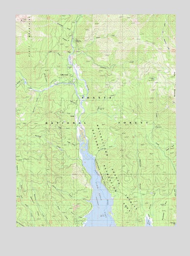
Carrville, CA USGS Topographic Map
Click on map above to begin viewing in our Map Viewer.

This topographic map contains these locations and features:
Feature Name Type Latitude Longitude GNIS ID View Map
Alder GulchValleyN41.0985°W122.7125°256168View Map
Billys Peak LookoutLocaleN41.1215°W122.7464°276907View Map
Bonanza KingSummitN41.0949°W122.6300°1655838View Map
Bonanza King MineMineN41.0743°W122.6270°219625View Map
Brush CreekStreamN41.0046°W122.7011°257528View Map
Buckeye CreekStreamN41.0401°W122.7009°257602View Map
Carr GulchValleyN41.0657°W122.7061°257998View Map
CarrvillePopulated PlaceN41.0649°W122.7042°1655871View Map
Chinquapin GulchValleyN41.1085°W122.7072°258328View Map
Coffee CreekStreamN41.0754°W122.6992°258510View Map
Coffee CreekPopulated PlaceN41.0890°W122.7089°1665333View Map
Coffee Creek Census Designated PlaceCensusN41.0803°W122.7136°2582977View Map
Coffee Creek Elementary SchoolSchoolN41.0857°W122.7117°1683023View Map
Coffee Creek StationLocaleN41.0888°W122.7081°1655306View Map
Coffee Creek Volunteer Fire DepartmentBuildingN41.0856°W122.7063°2622293View Map
Copper CreekStreamN41.0618°W122.6995°258699View Map
Deadhorse CreekStreamN41.0304°W122.7497°259125View Map
Enright GulchValleyN41.0488°W122.7020°259944View Map
Flume CreekStreamN41.0057°W122.7003°260219View Map
Hatchet CreekStreamN41.0143°W122.6939°261149View Map
Kadas MineMineN41.0218°W122.6536°277043View Map
Lick CreekStreamN41.0176°W122.7459°262440View Map
Little Boulder CreekStreamN41.0863°W122.7436°262551View Map
Menzel CreekStreamN41.0407°W122.6336°275404View Map
Menzel GulchValleyN41.0454°W122.6345°263456View Map
Minnehaha CreekStreamN41.1238°W122.6995°263684View Map
Morrison GulchValleyN41.0788°W122.7328°263847View Map
North Fork Scorpion CreekStreamN41.1015°W122.6970°264208View Map
Oneeyed FlatFlatN41.0921°W122.7072°264359View Map
Plummer HillSummitN41.0135°W122.6331°1656225View Map
Porter SpringSpringN41.0593°W122.6428°264967View Map
Powerhouse GulchValleyN41.0726°W122.7156°231018View Map
Rancheria RidgeRidgeN41.0110°W122.7359°1665409View Map
Scorpion CreekStreamN41.1015°W122.7070°265930View Map
Scorpion LakeLakeN41.0866°W122.6429°265932View Map
Snow GulchValleyN41.0432°W122.6872°267317View Map
Snowslide GulchValleyN41.1157°W122.7064°267342View Map
Spring GulchValleyN41.0849°W122.7267°235260View Map
Squirrel CreekStreamN41.0093°W122.6470°267644View Map
Squirrel FlatFlatN41.0060°W122.6478°1665433View Map
Squirrel GulchValleyN41.0113°W122.6528°267649View Map
Stringtown (historical)Populated PlaceN41.0413°W122.7022°1665439View Map
Trinity River CampgroundLocaleN41.1126°W122.7072°268413View Map
Usher GulchValleyN41.0590°W122.7047°268651View Map

Note: Coordinates in the location and feature list above are referenced to NAD83 datum.


Copyright (C) 2008-2024 Ryan Niemi / Sunset Dynamics ... All Rights Reserved