TopoQuest Logo
Do you find TopoQuest useful?
Help keep TopoQuest running and adding new maps/features by donating!
Bitcoin:  19c7KJd3qBynnjoSw5npx9KScwjBe4ifkT
Litecoin:  LXs6TkuXGGXo1vDsWCkWVdjQX94eUKd6ui
Home View Maps Find Maps Find Places Resources & Links


Carter Dome, New Hampshire Topographic Map

USGS Map Title: Carter Dome, NH
USGS Map MRC: 44071C2
DRG (GeoTIFF) Download: o44071c2.tif


Neighboring USGS Topographic Map Quads:


  Berlin, NH  
44071D2
 

  Shelburne, NH  
44071D1


  Carter Dome, NH  
44071C2
 

  Wild River, NH  
44071C1
 

  Stairs Mountain, NH  
44071B3
 

  Jackson, NH  
44071B2
 

  Chatham, NH  
44071B1


Map MRC Location:

N45°
W72°
N45°
W71°
H8 H7 H6 H5 H4 H3 H2 H1
G8 G7 G6 G5 G4 G3 G2 G1
F8 F7 F6 F5 F4 F3 F2 F1
E8 E7 E6 E5 E4 E3 E2 E1
D8 D7 D6 D5 D4 D3 D2 D1
C8 C7 C6 C5 C4 C3 C2 C1
B8 B7 B6 B5 B4 B3 B2 B1
A8 A7 A6 A5 A4 A3 A2 A1
N44°
W72°
N44°
W71°

Carter Dome, NH USGS 1:24K Topographic Map Preview:
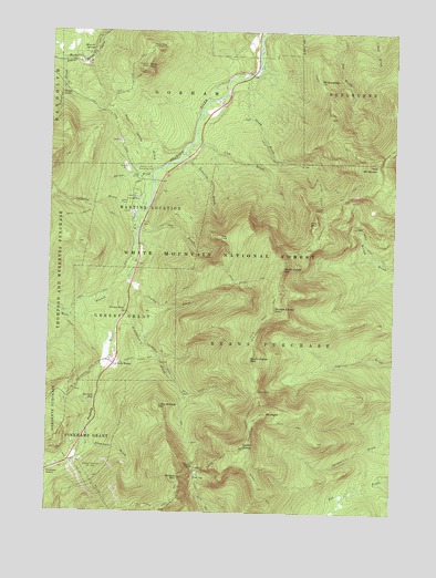
Carter Dome, NH USGS Topographic Map
Click on map above to begin viewing in our Map Viewer.

This topographic map contains these locations and features:
Feature Name Type Latitude Longitude GNIS ID View Map
Aqueduct PathTrailN44.2895°W71.2151°871401View Map
Barnes BrookStreamN44.3370°W71.2126°871445View Map
Barnes Field Camping AreaLocaleN44.3390°W71.2181°873024View Map
Bear Spring BrookStreamN44.3384°W71.2117°871467View Map
Black Angel TrailTrailN44.2740°W71.1367°871513View Map
Carter DomeSummitN44.2673°W71.1790°871629View Map
Carter Dome TrailTrailN44.2751°W71.1759°871630View Map
Carter Moriah TrailTrailN44.3078°W71.1667°871633View Map
Carter NotchGapN44.2617°W71.1954°871634View Map
Carter Notch HutLocaleN44.2592°W71.1954°1916186View Map
Clay BrookStreamN44.3459°W71.1954°871690View Map
Cowboy BrookStreamN44.3084°W71.2198°871732View Map
Crew Cut TrailTrailN44.2659°W71.2456°871744View Map
Culhane BrookStreamN44.3356°W71.2123°871752View Map
Daniel Webster TrailTrailN44.3267°W71.2387°871759View Map
Dolly Copp CampgroundLocaleN44.3326°W71.2184°871790View Map
Emerald PoolLakeN44.2798°W71.2320°871864View Map
Garnet PoolLakeN44.3031°W71.2212°871370View Map
Glen HousePopulated PlaceN44.2884°W71.2254°871941View Map
Great Gulf TrailTrailN44.3056°W71.2340°871961View Map
Greens GrantCivilN44.2987°W71.2215°871974View Map
Imp BrookStreamN44.3301°W71.2129°872069View Map
Imp FaceSummitN44.3217°W71.1876°872070View Map
Imp MountainSummitN44.3259°W71.1523°872071View Map
Imp ShelterLocaleN44.3295°W71.1506°872072View Map
Imp Shelter Cut OffTrailN44.3334°W71.1506°872073View Map
Imp TrailTrailN44.3256°W71.1937°872074View Map
Little Wildcat MountainSummitN44.2773°W71.2092°872199View Map
Martins LocationCivilN44.3269°W71.2139°872260View Map
Middle Carter MountainSummitN44.3031°W71.1673°872288View Map
Mount HightSummitN44.2759°W71.1698°872039View Map
Mount MoriahSummitN44.3403°W71.1315°872330View Map
Mount SurpriseSummitN44.3623°W71.1517°872765View Map
Nineteen BrookStreamN44.3031°W71.2212°872380View Map
Nineteenmile Brook TrailTrailN44.2815°W71.2015°873025View Map
North Carter MountainSummitN44.3131°W71.1645°872392View Map
North Carter TrailTrailN44.3103°W71.1773°872393View Map
Peabody Field Picnic AreaLocaleN44.3251°W71.2170°873067View Map
Pine Link TrailTrailN44.3456°W71.2384°872505View Map
Pine MountainSummitN44.3659°W71.2148°872506View Map
Pine Mountain TrailTrailN44.3656°W71.2206°872507View Map
Pinkhams GrantCivilN44.2604°W71.2451°872509View Map
Rainbow TrailTrailN44.2545°W71.1723°872537View Map
Restricted Ledge TrailTrailN44.3615°W71.2195°872566View Map
RMC Brook PathTrailN44.3709°W71.2259°1916338View Map
RMC Straight PathTrailN44.3681°W71.2287°1916339View Map
South Carter MountainSummitN44.2898°W71.1762°872698View Map
Stony BrookStreamN44.3640°W71.1740°872749View Map
Stony Brook TrailTrailN44.3415°W71.1662°872751View Map
Thompson BrookStreamN44.2695°W71.2351°872801View Map
Townline BrookStreamN44.3484°W71.1962°872826View Map
Townline BrookStreamN44.3670°W71.2451°872827View Map
Triple FallsFallsN44.3587°W71.2454°872831View Map
Vals LedgeBenchN44.2740°W71.2345°873023View Map
WEDB-TV (Berlin)TowerN44.3712°W71.2142°873360View Map
West Branch Peabody RiverStreamN44.3112°W71.2206°872893View Map
Wildcat MountainSummitN44.2590°W71.2015°872940View Map
Wildcat Mountain Ski AreaLocaleN44.2601°W71.2348°873279View Map
Wildcat RidgeRidgeN44.2551°W71.2017°872941View Map
Wildcat Ridge TrailTrailN44.2509°W71.2079°872942View Map
Wildcat River TrailTrailN44.2531°W71.1915°872943View Map
Zeta PassGapN44.2812°W71.1731°872978View Map

Note: Coordinates in the location and feature list above are referenced to NAD83 datum.


Copyright (C) 2008-2024 Ryan Niemi / Sunset Dynamics ... All Rights Reserved