TopoQuest Logo
Do you find TopoQuest useful?
Help keep TopoQuest running and adding new maps/features by donating!
Bitcoin:  19c7KJd3qBynnjoSw5npx9KScwjBe4ifkT
Litecoin:  LXs6TkuXGGXo1vDsWCkWVdjQX94eUKd6ui
Home View Maps Find Maps Find Places Resources & Links


Stairs Mountain, New Hampshire Topographic Map

USGS Map Title: Stairs Mountain, NH
USGS Map MRC: 44071B3
DRG (GeoTIFF) Download: o44071b3.tif


Neighboring USGS Topographic Map Quads:


  Carter Dome, NH  
44071C2
 

  Crawford Notch, NH  
44071B4
 

  Stairs Mountain, NH  
44071B3
 

  Jackson, NH  
44071B2
 

  Mount Carrigain, NH  
44071A4
 

  Bartlett, NH  
44071A3
 

  North Conway West, NH  
44071A2


Map MRC Location:

N45°
W72°
N45°
W71°
H8 H7 H6 H5 H4 H3 H2 H1
G8 G7 G6 G5 G4 G3 G2 G1
F8 F7 F6 F5 F4 F3 F2 F1
E8 E7 E6 E5 E4 E3 E2 E1
D8 D7 D6 D5 D4 D3 D2 D1
C8 C7 C6 C5 C4 C3 C2 C1
B8 B7 B6 B5 B4 B3 B2 B1
A8 A7 A6 A5 A4 A3 A2 A1
N44°
W72°
N44°
W71°

Stairs Mountain, NH USGS 1:24K Topographic Map Preview:
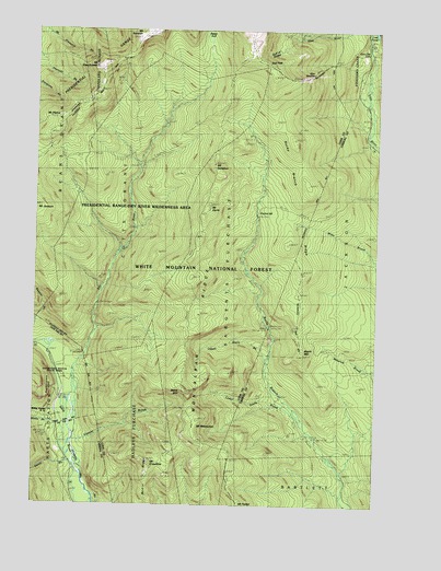
Stairs Mountain, NH USGS Topographic Map
Click on map above to begin viewing in our Map Viewer.

This topographic map contains these locations and features:
Feature Name Type Latitude Longitude GNIS ID View Map
Bemis BrookStreamN44.1381°W71.3623°871485View Map
Branch RidgeRidgeN44.1940°W71.2817°871575View Map
Crawford NotchValleyN44.1590°W71.3617°871738View Map
Crawford PathTrailN44.2445°W71.3392°871740View Map
Cutts GrantCivilN44.2049°W71.3358°873196View Map
Davis BrookStreamN44.1365°W71.3609°871765View Map
Davis PathTrailN44.1853°W71.3204°871769View Map
Desolation PondLakeN44.2417°W71.3342°871780View Map
Dry RiverStreamN44.1381°W71.3620°871803View Map
Dry River CampgroundLocaleN44.1592°W71.3609°873038View Map
Dry River Camping AreaLocaleN44.1556°W71.3623°1915937View Map
Dry River TrailTrailN44.1928°W71.3398°871804View Map
Edmands PathTrailN44.2417°W71.3598°871850View Map
Engine HillSummitN44.2015°W71.2806°871865View Map
Frankenstein CliffCliffN44.1559°W71.3670°871911View Map
Giant StairsSlopeN44.1528°W71.3170°871934View Map
Glen BoulderPillarN44.2378°W71.2751°871938View Map
Glen Boulder TrailTrailN44.2465°W71.2951°871939View Map
Glen Ellis FallsFallsN44.2440°W71.2515°871940View Map
Glen Ellis Falls Picnic AreaLocaleN44.2465°W71.2537°873042View Map
Glen Ellis Falls Scenic AreaLocaleN44.2459°W71.2537°1916258View Map
Gulf of SlidesValleyN44.2462°W71.2820°871985View Map
Gulf PeakSummitN44.2415°W71.2904°871986View Map
Hadleys PurchaseCivilN44.1261°W71.3324°872009View Map
Isolation ShelterLocaleN44.2251°W71.3070°872084View Map
Isolation TrailTrailN44.2148°W71.2895°872085View Map
Lost PondLakeN44.2497°W71.2508°873017View Map
Lower Stairs BrookStreamN44.1478°W71.2776°872230View Map
Maple MountainSummitN44.1645°W71.2767°872253View Map
Miles Brook TrailTrailN44.1890°W71.2526°872297View Map
Mizpah Spring HutLocaleN44.2192°W71.3701°872309View Map
Montalban RidgeRidgeN44.2320°W71.3042°872334View Map
Mount Clinton TrailTrailN44.2051°W71.3573°872339View Map
Mount CrawfordSummitN44.1365°W71.3326°871741View Map
Mount DavisSummitN44.2042°W71.3106°871771View Map
Mount EisenhowerSummitN44.2403°W71.3504°871851View Map
Mount Eisenhower TrailTrailN44.2309°W71.3384°873041View Map
Mount FranklinSummitN44.2495°W71.3306°871913View Map
Mount IsolationSummitN44.2148°W71.3092°872086View Map
Mount JacksonSummitN44.2031°W71.3742°872093View Map
Mount Parker TrailTrailN44.1290°W71.3017°872348View Map
Mount PierceSummitN44.2265°W71.3659°872495View Map
Mount Pleasant TrailTrailN44.2248°W71.3406°872353View Map
Mount ResolutionSummitN44.1462°W71.3156°872565View Map
Oakes GulfValleyN44.2431°W71.3106°872423View Map
Oakes Gulf TrailTrailN44.2417°W71.3123°872424View Map
Otis BrookStreamN44.1328°W71.2606°873043View Map
Presidential RangeRidgeN44.2420°W71.3462°872524View Map
Presidential Range-Dry River WildernessReserveN44.1776°W71.3221°873019View Map
Resolution ShelterLocaleN44.1503°W71.3209°872564View Map
Rocky Branch Number One WMNF ShelterLocaleN44.1537°W71.2856°873044View Map
Rocky Branch RidgeRidgeN44.2095°W71.2751°872580View Map
Rocky Branch TrailTrailN44.2045°W71.2634°872581View Map
Sargents PurchaseCivilN44.2194°W71.3001°872626View Map
Shelter Number OneLocaleN44.1537°W71.2865°872651View Map
Shelter Number OneLocaleN44.1678°W71.3548°872652View Map
Shelter Number TwoLocaleN44.2012°W71.2934°872653View Map
Shelter Number TwoLocaleN44.2145°W71.3367°872654View Map
Sleeper BrookStreamN44.1412°W71.3606°872672View Map
Stairs Brook TrailTrailN44.1815°W71.3073°872725View Map
Stairs Col TrailTrailN44.1503°W71.2587°872726View Map
Stairs MountainSummitN44.1551°W71.3184°872727View Map
Town of Hart's LocationCivilN44.1370°W71.3725°872015View Map
Upper Stairs BrookStreamN44.1623°W71.2895°872852View Map
Willey House Post OfficePost OfficeN44.1478°W71.3698°872951View Map

Note: Coordinates in the location and feature list above are referenced to NAD83 datum.


Copyright (C) 2008-2024 Ryan Niemi / Sunset Dynamics ... All Rights Reserved