TopoQuest Logo
Do you find TopoQuest useful?
Help keep TopoQuest running and adding new maps/features by donating!
Bitcoin:  19c7KJd3qBynnjoSw5npx9KScwjBe4ifkT
Litecoin:  LXs6TkuXGGXo1vDsWCkWVdjQX94eUKd6ui
Home View Maps Find Maps Find Places Resources & Links


Castalia, Ohio Topographic Map

USGS Map Title: Castalia, OH
USGS Map MRC: 41082D7
DRG (GeoTIFF) Download: o41082d7.tif


Neighboring USGS Topographic Map Quads:


  Port Clinton, OH  
41082E8
 

  Gypsum, OH  
41082E7
 

  Kelleys Island, OH  
41082E6
 

  Vickery, OH  
41082D8
 

  Castalia, OH  
41082D7
 

  Sandusky, OH  
41082D6
 

  Clyde, OH  
41082C8
 

  Bellevue, OH  
41082C7
 

  Kimball, OH  
41082C6


Map MRC Location:

N42°
W83°
N42°
W82°
H8 H7 H6 H5 H4 H3 H2 H1
G8 G7 G6 G5 G4 G3 G2 G1
F8 F7 F6 F5 F4 F3 F2 F1
E8 E7 E6 E5 E4 E3 E2 E1
D8 D7 D6 D5 D4 D3 D2 D1
C8 C7 C6 C5 C4 C3 C2 C1
B8 B7 B6 B5 B4 B3 B2 B1
A8 A7 A6 A5 A4 A3 A2 A1
N41°
W83°
N41°
W82°

Castalia, OH USGS 1:24K Topographic Map Preview:
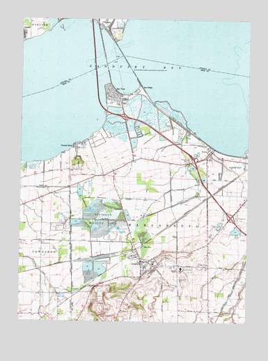
Castalia, OH USGS Topographic Map
Click on map above to begin viewing in our Map Viewer.

This topographic map contains these locations and features:
Feature Name Type Latitude Longitude GNIS ID View Map
Anchor Mobile Home ParkPopulated PlaceN41.4419°W82.7617°2514331View Map
Bay BridgeLocaleN41.4726°W82.8110°1064392View Map
Bay ViewPopulated PlaceN41.4687°W82.8269°1048490View Map
Bay View Fire DepartmentBuildingN41.4651°W82.8202°2549710View Map
Bay View Post Office (historical)Post OfficeN41.4681°W82.8263°1984061View Map
Bay View Village Police DepartmentBuildingN41.4731°W82.8255°2732998View Map
Baywater EstatesPopulated PlaceN41.4411°W82.7553°2514332View Map
Blue HoleLakeN41.4054°W82.8047°1065926View Map
CastaliaPopulated PlaceN41.4001°W82.8085°1056773View Map
Castalia CemeteryCemeteryN41.3962°W82.8013°1806254View Map
Castalia Post OfficePost OfficeN41.4000°W82.8083°1984069View Map
Castalia Quarry ReserveParkN41.3834°W82.8305°1806255View Map
Castalia Trout ClubLocaleN41.4087°W82.8057°1080056View Map
Castalia Village Police DepartmentBuildingN41.3998°W82.8073°2733032View Map
Cold CreekStreamN41.4467°W82.7685°1039237View Map
Crystal RockPopulated PlaceN41.4464°W82.8446°1039521View Map
Crystal Rock Census Designated PlaceCensusN41.4478°W82.8419°2628878View Map
DanburyPopulated PlaceN41.4992°W82.8302°1064505View Map
Danbury Post OfficePost OfficeN41.4987°W82.8305°2041294View Map
Edison BridgeBridgeN41.4812°W82.8357°1040081View Map
Grace Lutheran ChurchChurchN41.3987°W82.8088°1065629View Map
Margaretta Elementary SchoolSchoolN41.3974°W82.7861°1081069View Map
Margaretta High SchoolSchoolN41.3991°W82.8013°1049925View Map
Margaretta Township Fire DepartmentBuildingN41.3997°W82.8078°2549703View Map
Martin PointCapeN41.4737°W82.8274°1065758View Map
Mather FieldAirportN41.4049°W82.7701°1082553View Map
Moore Dairy FarmsLocaleN41.4406°W82.8019°2706145View Map
Oak Lawn CemeteryCemeteryN41.4414°W82.7832°1057887View Map
Ohio State Highway Patrol - Sandusky Patrol PostBuildingN41.4436°W82.7736°2733109View Map
Resthaven Wildlife AreaParkN41.4176°W82.8313°1057953View Map
Sandusky BayBayN41.4789°W82.8413°1066186View Map
Sandusky Fire Department Station 7BuildingN41.4416°W82.7546°2549005View Map
Teemes (historical)Populated PlaceN41.4145°W82.8630°1056120View Map
Teemes Post Office (historical)Post OfficeN41.4139°W82.8624°2057004View Map
Township of MargarettaCivilN41.4243°W82.8242°1086066View Map
Trinity Lutheran ChurchChurchN41.4426°W82.7721°1066243View Map
VenicePopulated PlaceN41.4459°W82.7705°1049272View Map
Venice Heights Elementary SchoolSchoolN41.4409°W82.7664°1049926View Map
Venice Post Office (historical)Post OfficeN41.4459°W82.7707°1985329View Map
Village of Bay ViewCivilN41.4684°W82.8250°2398051View Map
Village of CastaliaCivilN41.4010°W82.8081°2397573View Map
Wayside TempleChurchN41.3962°W82.7880°1047636View Map
Westview EstatesPopulated PlaceN41.4400°W82.7578°2514330View Map
WGGN-FM (Castalia)TowerN41.3967°W82.7919°1085326View Map
WGGN-TV (Sandusky)TowerN41.3967°W82.7919°1085444View Map

Note: Coordinates in the location and feature list above are referenced to NAD83 datum.


Copyright (C) 2008-2024 Ryan Niemi / Sunset Dynamics ... All Rights Reserved